Blue Rock Gap
Blue Rock Gap lies between the Wolgan and Capertee valleys, reached here through an exploration of pagodas, dense regrowth, vast views and hidden sandstone architecture.
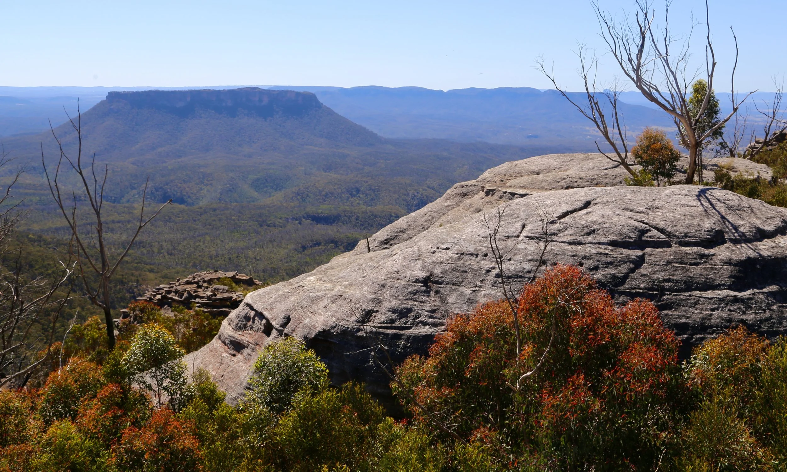
Rounded pagodas east of Blue Rock Gap, with Pantoneys Crown behind.
-
Date: October 2025
Trip context: Day 2 of a three-day walk. Camp had been reached on foot the previous day along the Wolgan–Capertee Divide; this was a day-pack exploration from camp.
Distance: 6.0 km
Elevation gain: 210 m
Grade: 5 — off-track travel, dense regrowth, steep terrain, exposed sandstone and confident navigation required.
Location: Wolgan–Capertee Divide, Gardens of Stone National Park, NSW
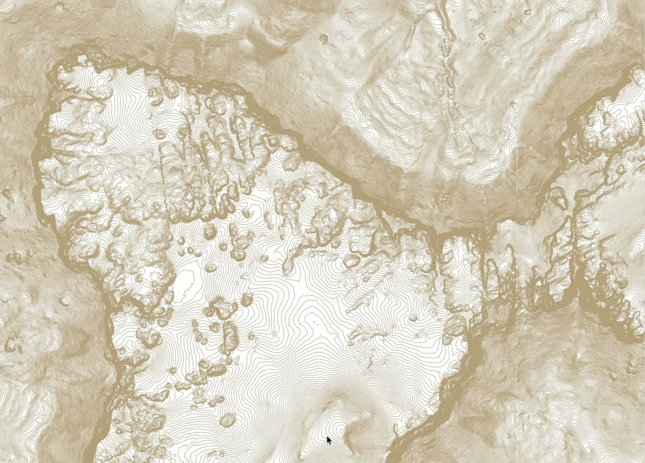
Map: NSW Topographic Map 1:25,000, Ben Bullen
Conditions: Dry spring conditions. Extensive post-fire regrowth made sections slow and difficult, with dense young eucalypts growing beneath standing dead trees. Exposed sandstone was generally dry and straightforward.
Notable features: Blue Rock Gap, broad pagoda formations, views into both the Capertee and Wolgan valleys, cliff-line cave with rock windows, narrow slot descent, Pantoneys Crown views.
Photography: Sandstone Symphony, unless otherwise noted.
The previous day had been spent walking the sandstone skyline of the Wolgan–Capertee Divide, eventually reaching a campsite near Ngamperi. By late afternoon the packs were down and the difficult decisions of the day had narrowed to where to place the camp chairs and whether a glass of wine or second cup of tea went best with the changing light.
The campsite sat close to the cliff edge, looking north-west across the upper reaches of the Capertee Valley towards Baal Bone Point and Pantoneys Crown. Closer at hand, a wall of pagodas stretched towards Point Cameron, catching and glowing in the afternoon light.
Sunset that evening was extraordinary.
It was not a campsite that encouraged early departures.
There was no camp to move and no overnight pack to carry. Our plan was to take day packs and explore farther along the divide, reaching Blue Rock Gap and, if time allowed, pushing on towards Mt Stewart.
But there was also a sleep-in, breakfast, fresh coffee and the same enormous view we had been watching the evening before. We lingered over all of it.
By the time we finally left camp, the morning had almost disappeared.
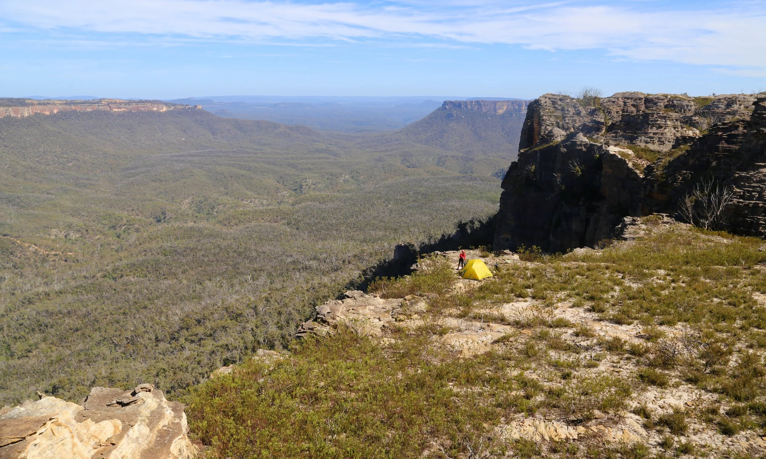
Late morning at camp above the upper Capertee Valley, near Point Cameron on the Wolgan–Capertee Divide.
Beyond camp, the first section was straightforward. The open sandstone of the Pondage — a flat, desolate, almost lunar place — provided a brief spell of easy walking.
It was a false promise. Beyond it, the character of the country changed abruptly.
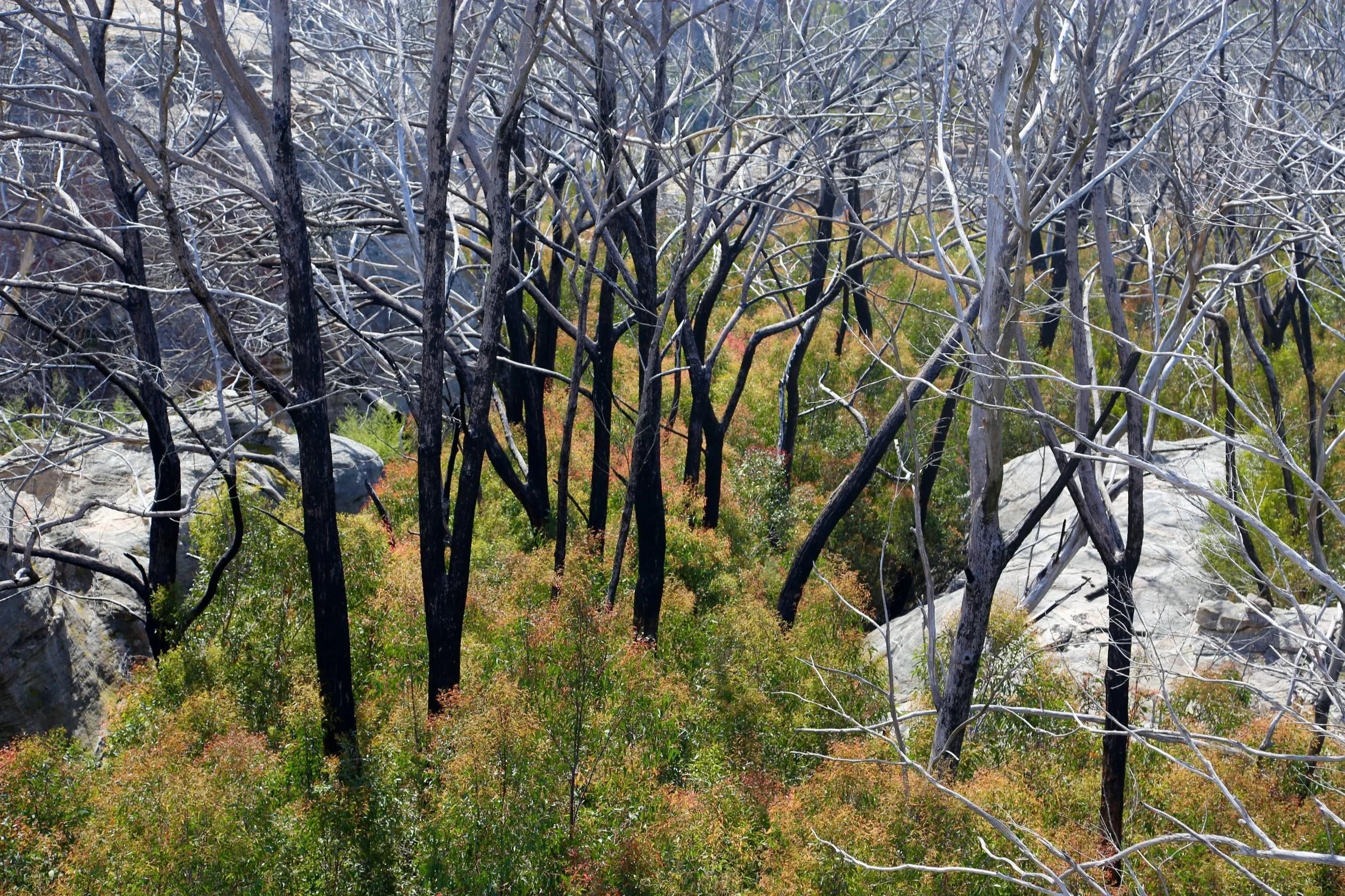
The eucalypt forest here had been devastated in the fires of 2019–20. Countless mature trees stood dead across the landscape. Beneath them, regeneration had arrived with extraordinary force: dense stands of young eucalypts, already thick-stemmed, strong and tightly packed, growing through and around the skeletal remains of the old forest.
For walkers, the result was formidable.
The pagodas were a tempting alternative.
Unlike the sharper towers found elsewhere along the divide, many pagodas here were low-slung, broad and elongated, with surprisingly extensive areas of relatively level sandstone across their tops. Whenever the rock ran in approximately the right direction, we climbed onto it and followed it for as long as possible.
For a while the sandstone became less scenery than transport infrastructure.
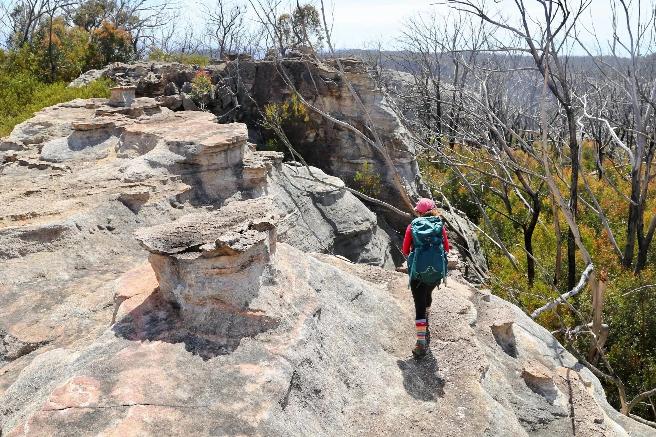
It was not a perfect system. The pagodas rarely pointed precisely where we wanted to go. Some ended abruptly above steep walls; others deposited us back into the saplings. Aerial photography helped identify possibilities, but from ground level the country remained a puzzle assembled one rock platform at a time.
Gradually we drifted north of our intended line. It turned out to be a useful mistake.
Rounding the side of one pagoda, we stepped onto a broad apron of sandstone. Ahead, a long sandstone formation projected out towards the valley before the country fell suddenly away, and the view opened up.
Beyond the cliff was an enormous sweep north along the western side of the divide, with successive sandstone walls fading into the vast Capertee Valley.
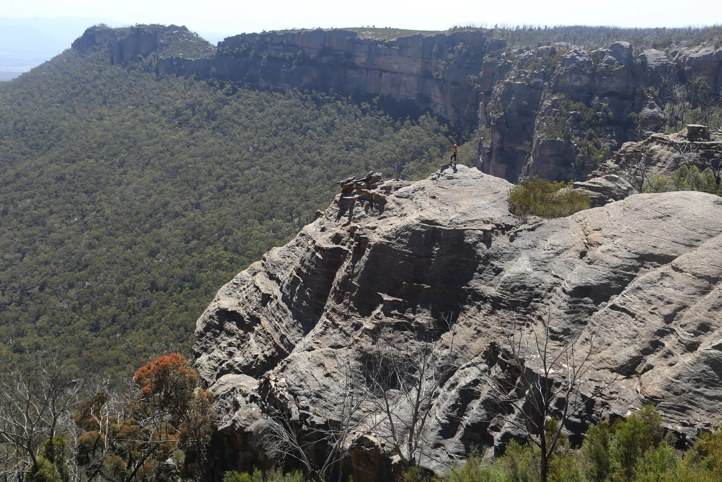
A long sandstone projection above the western side of the divide.
Mt Stewart could be seen in the distance — the direction in which we were supposedly heading. But this unintended lookout, and the sheer scale of the country it revealed, demanded more than a quick photograph.
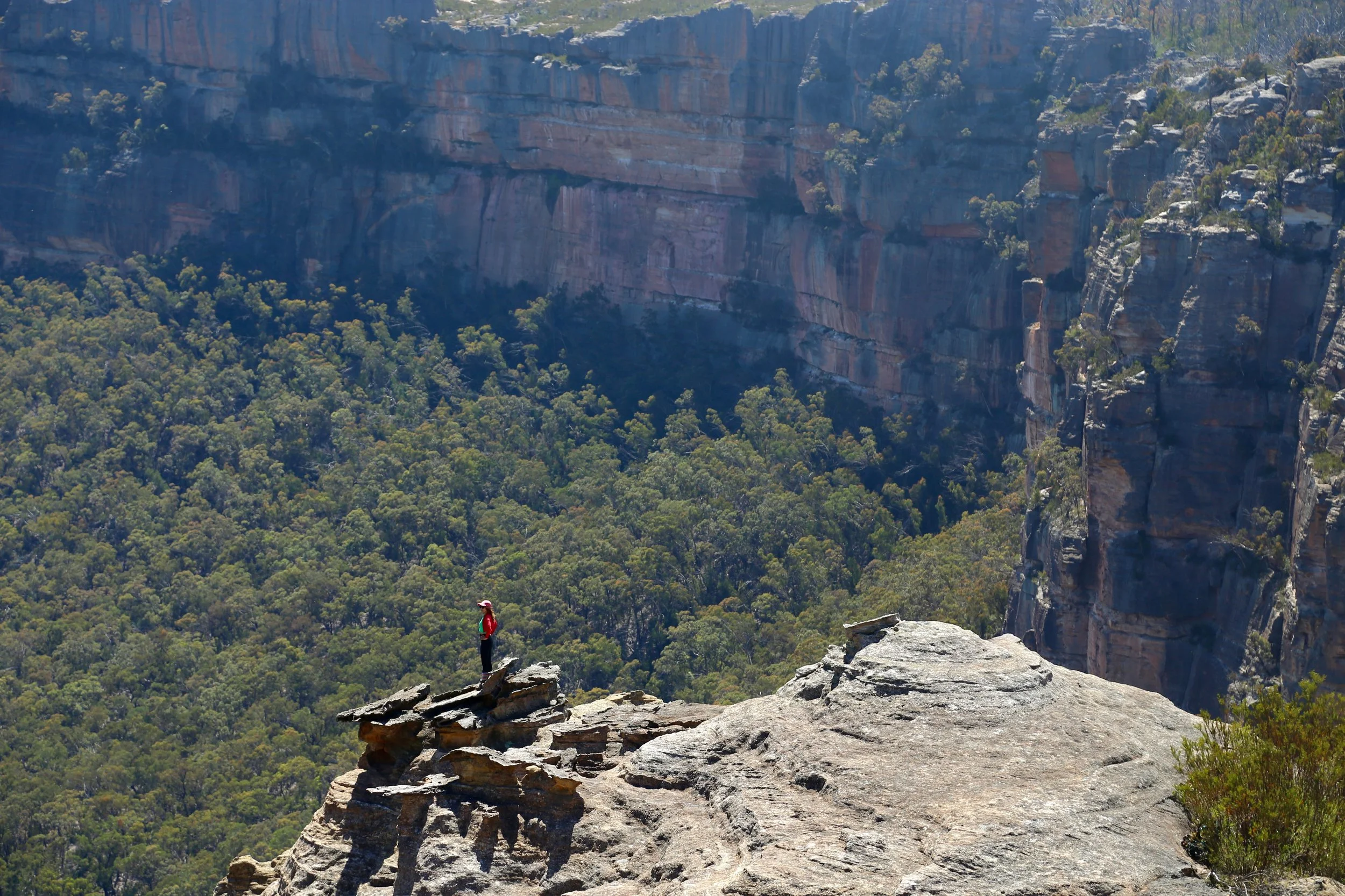
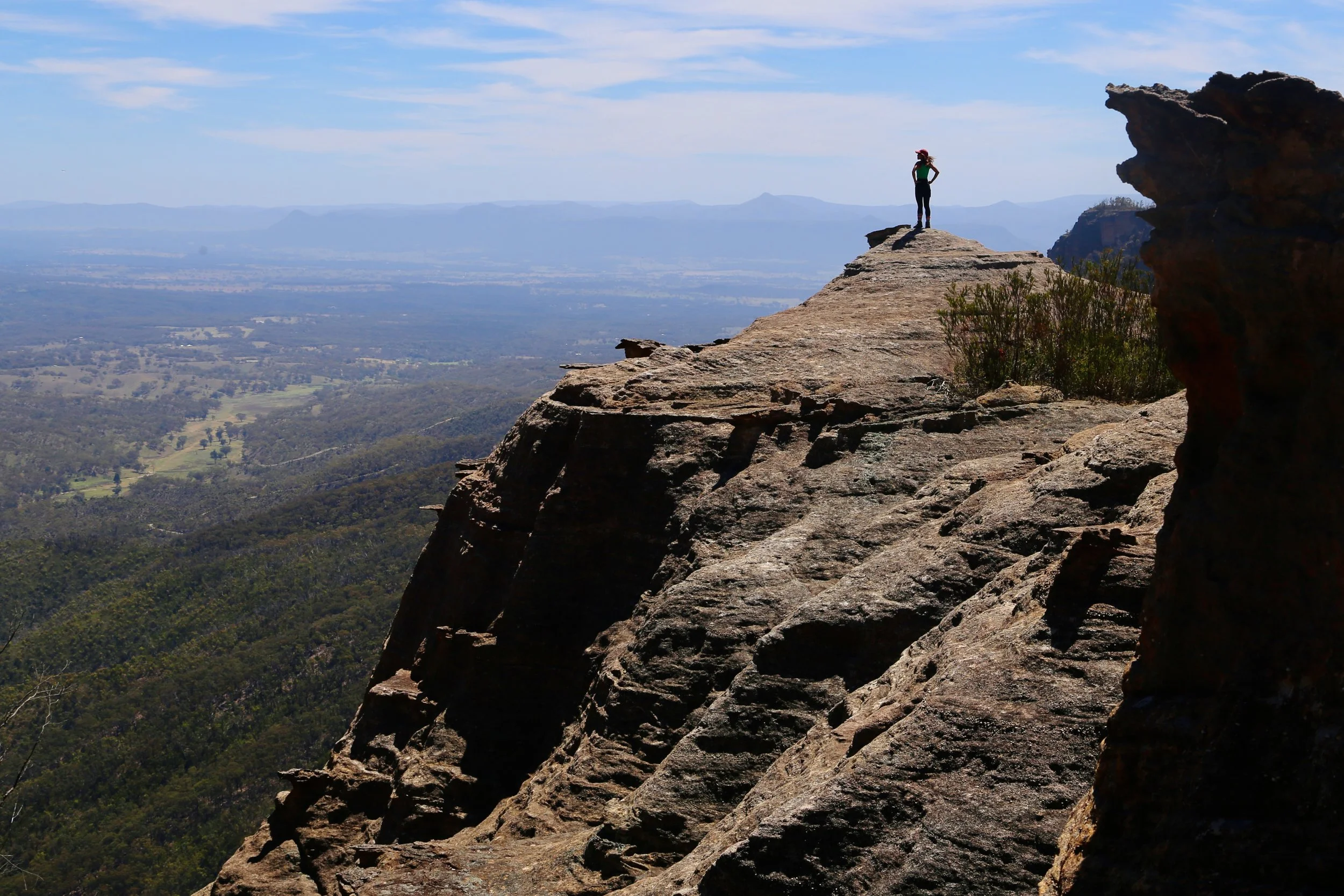
The late start was now gathering momentum.
Eventually we retreated from the northern cliff line and continued east, once again alternating between easy sandstone and descents into dense, stiff regrowth.
At one point the divide narrowed to a high sandstone spine, with the Capertee opening to the north and the Wolgan to the south — two enormous landscapes falling away on either side.
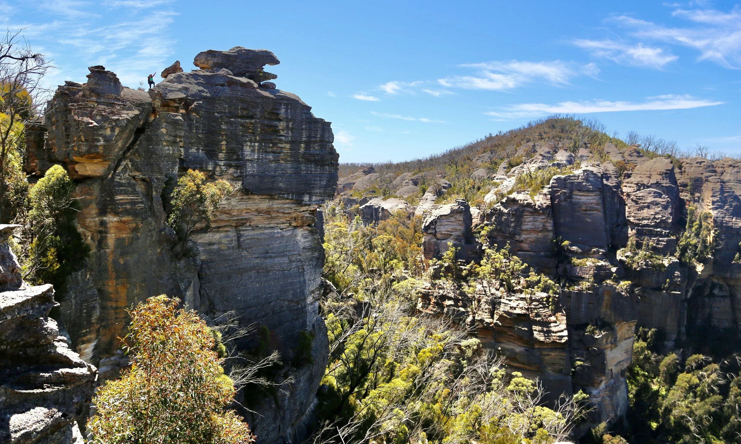
Looking across Blue Rock Gap
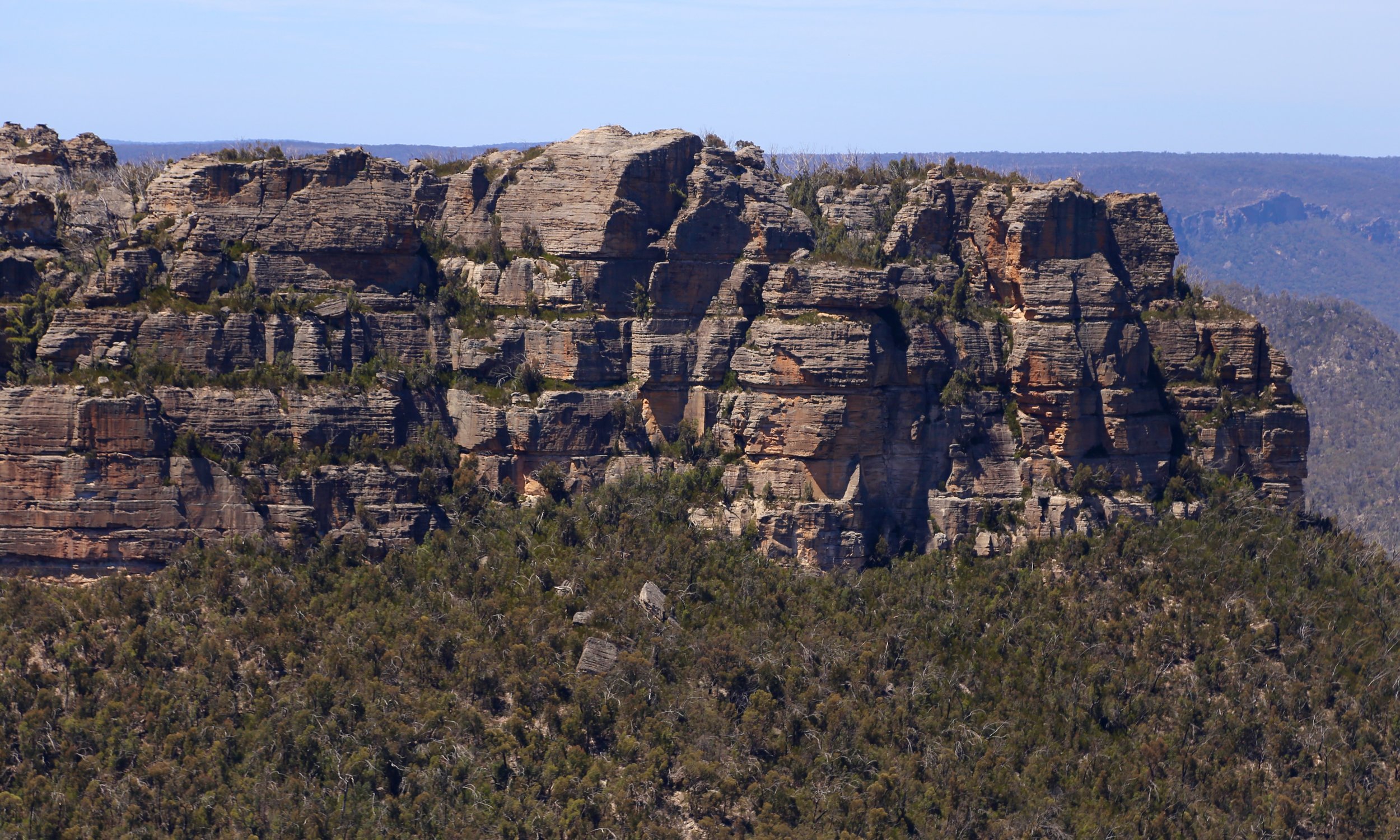
Looking east across the upper reaches of the Wolgan Valley.
Not all the distractions were on a grand scale. Small yellow pagoda daisies (Leucochrysum graminifolium) grew in cracks and shallow pockets in the sandstone.
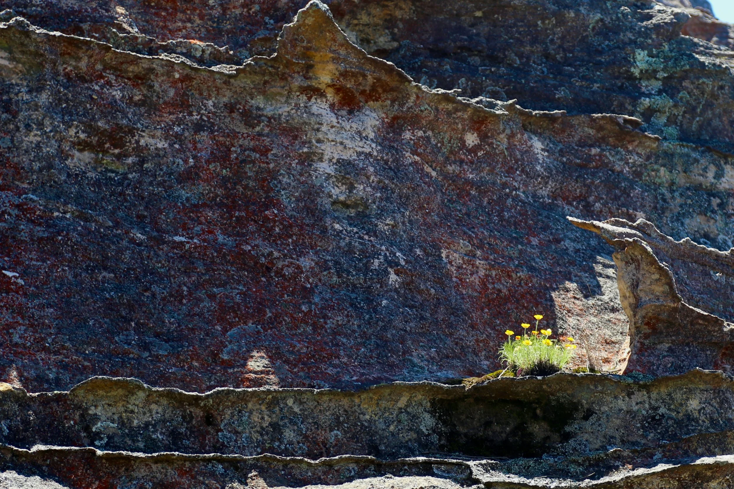
Pagoda Daisy (Leucochrysum graminifolium)
Closer to Blue Rock Gap we reached another unexpected feature.
Set into the upper cliff was a small cave-like opening. A natural sandstone ramp led towards the back of it, but gaining entry required pulling ourselves onto another ledge. Dropping our packs — and any remaining elegance or dignity — we wriggled through a low gap on our stomachs.
Beyond that constriction, the space opened abruptly.
The outer wall of the cliff had been perforated into a series of windows overlooking Blue Rock Gap. The effect was architectural — sandstone openings framing the landscape far below — but there was very little room for carelessness. From the low entrance, the cave dropped away sharply, and a slip in the wrong direction could have sent us through one of those openings high above the gap.
Beautiful, intriguing and just frightening enough to sharpen the senses.
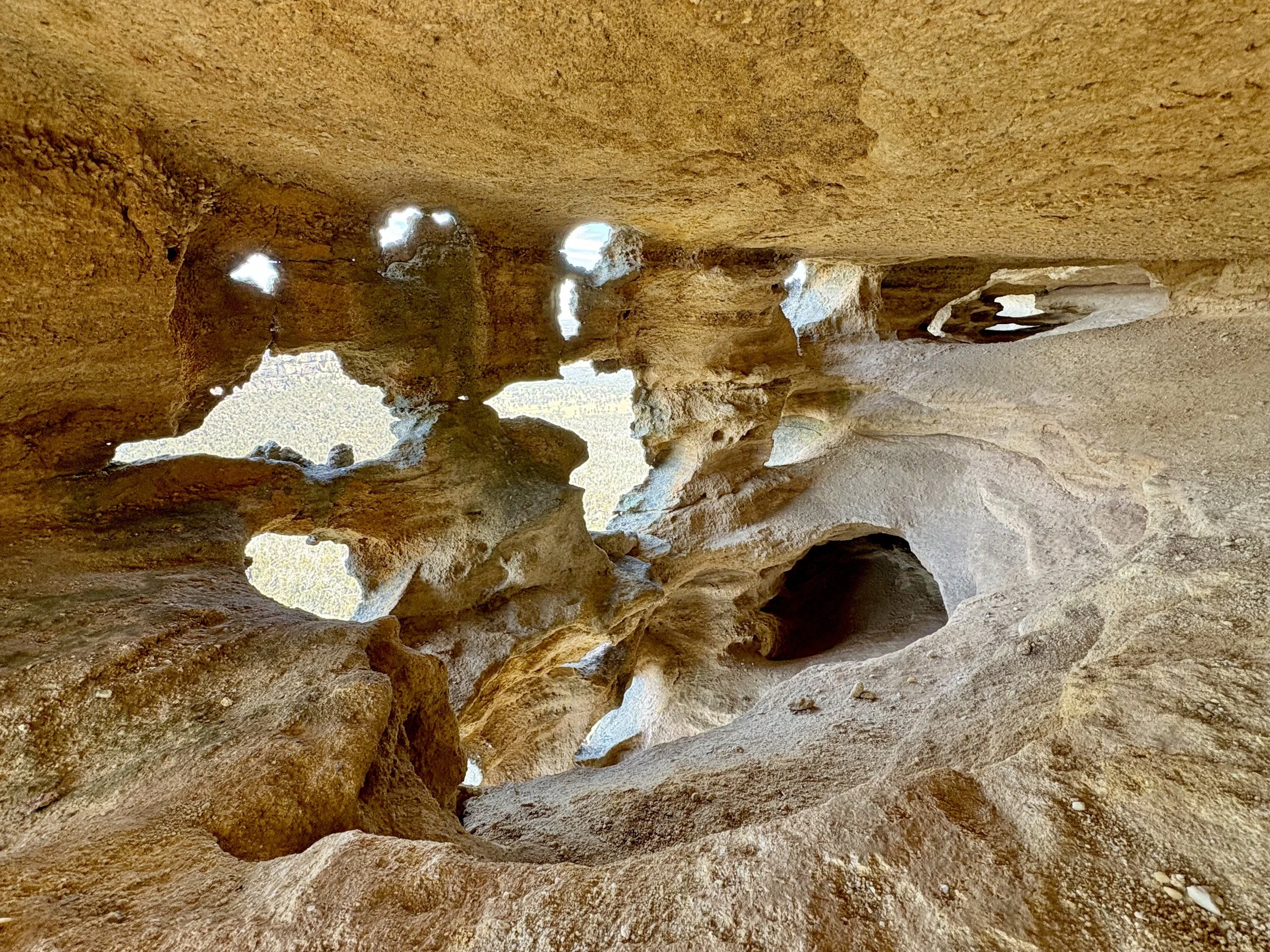
Windows in the cliff, high above Blue Rock Gap.
From there the route changed character again.
Between two sandstone walls we found a narrow slot descending towards Blue Rock Gap. At the top it was barely a metre wide. Ferns and other vegetation filled the lower reaches, while the walls rose closely on either side.
After spending much of the morning trying to stay on top of the sandstone to escape the vegetation, we were suddenly travelling down through the middle of it.
It was steep, narrow and fun.
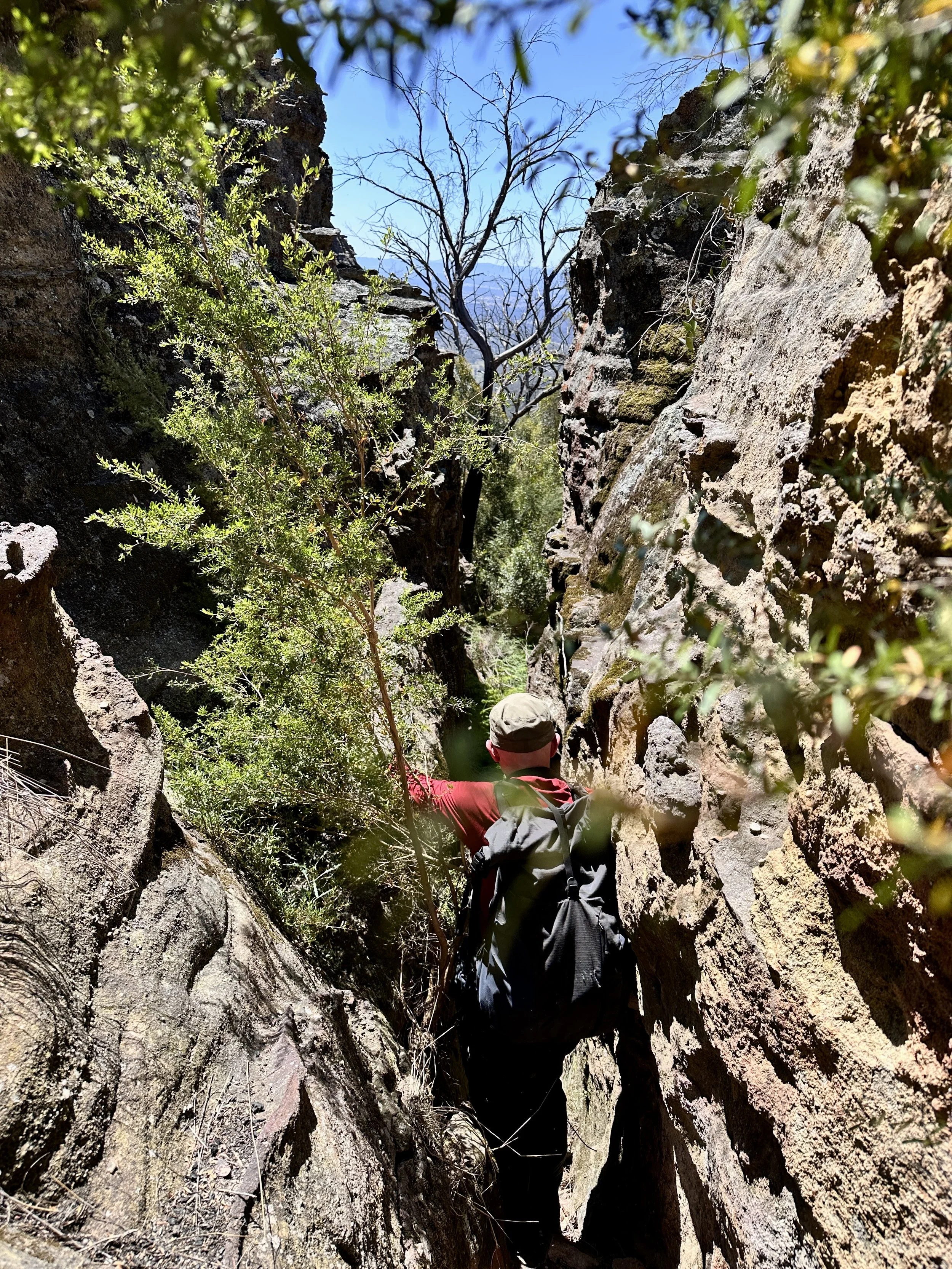
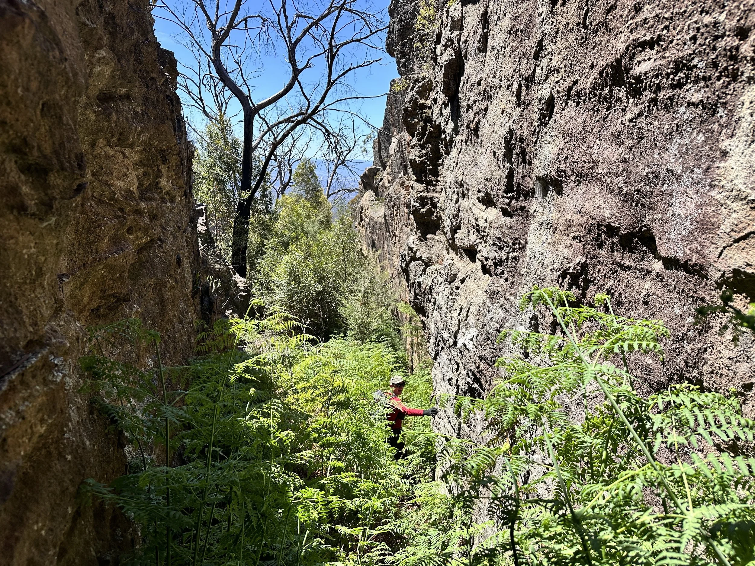
Blue Rock Gap itself was quite different from the exposed country above. It forms a broad saddle in the Wolgan–Capertee Divide, separating drainage towards the Wolgan on one side from the Capertee on the other. Large sandstone walls and pagodas rise around it, while the floor of the gap is forested.
Earlier accounts describe beautiful forest through this saddle. The effects of the 2019–20 fires were still evident when we passed through, although here they felt noticeably less confronting than the devastated forest and almost impenetrable regrowth encountered earlier in the day.
For the first time in several hours, the landscape felt less like a succession of rock platforms and more like a mountain pass.
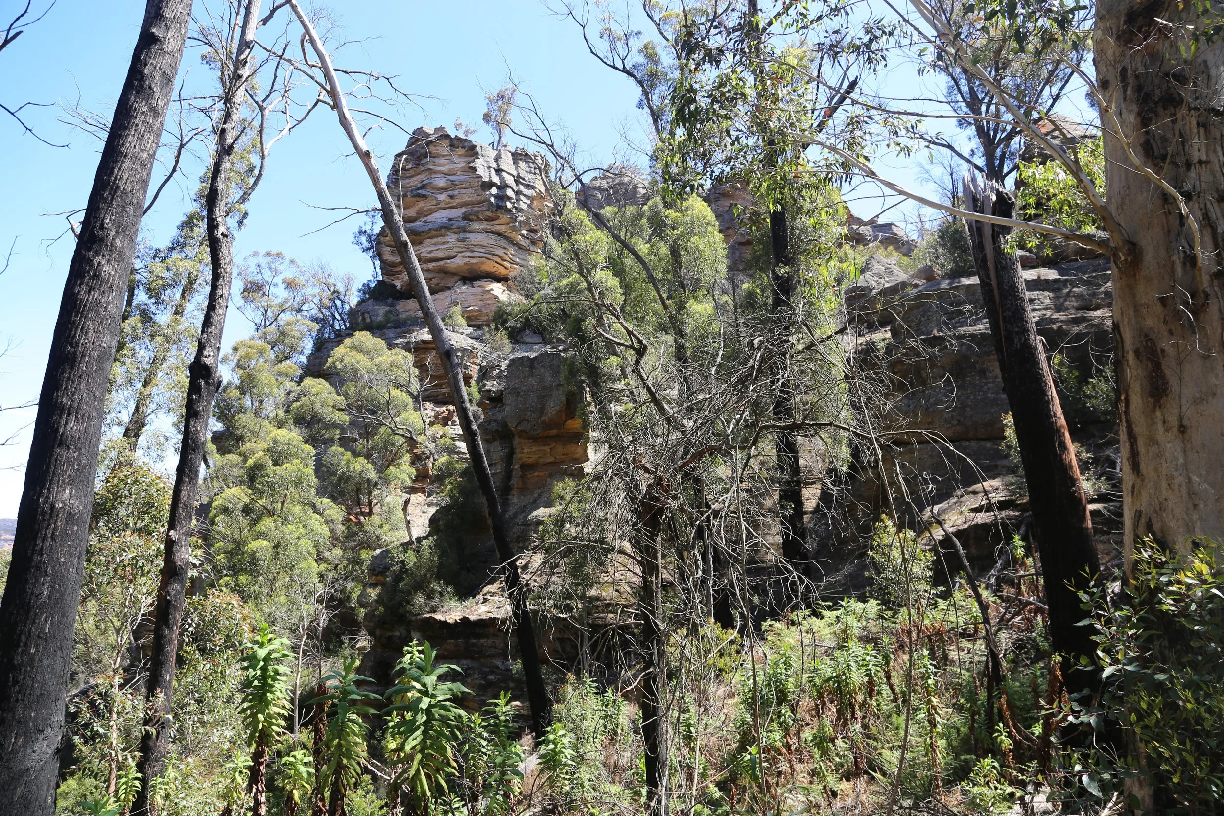
Blue Rock Gap, the broad saddle between the Capertee and Wolgan catchments.
Below the cliffs, however, the sandstone quickly reclaimed attention. We followed the base of the walls through the gap before finding another narrow weakness that allowed us to climb out on the eastern side.
Looking back, the cliff cave we had found earlier could now be seen from below and across the gap. The small openings in its face were the external windows of the cave we had wriggled into not long before.
Seen from here, parts of the sandstone carried a distinct bluish cast. Coincidence, given the name Blue Rock Gap?
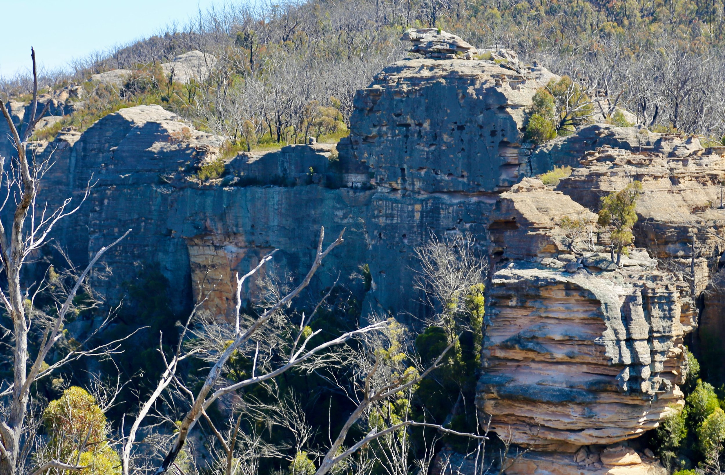
Beyond the gap, we climbed onto a pair of beautifully rounded pagodas, and the country opened once more.
Pantoneys Crown stood prominently across the Capertee landscape, while farther ahead lay the continuation of the divide towards Mt Stewart.
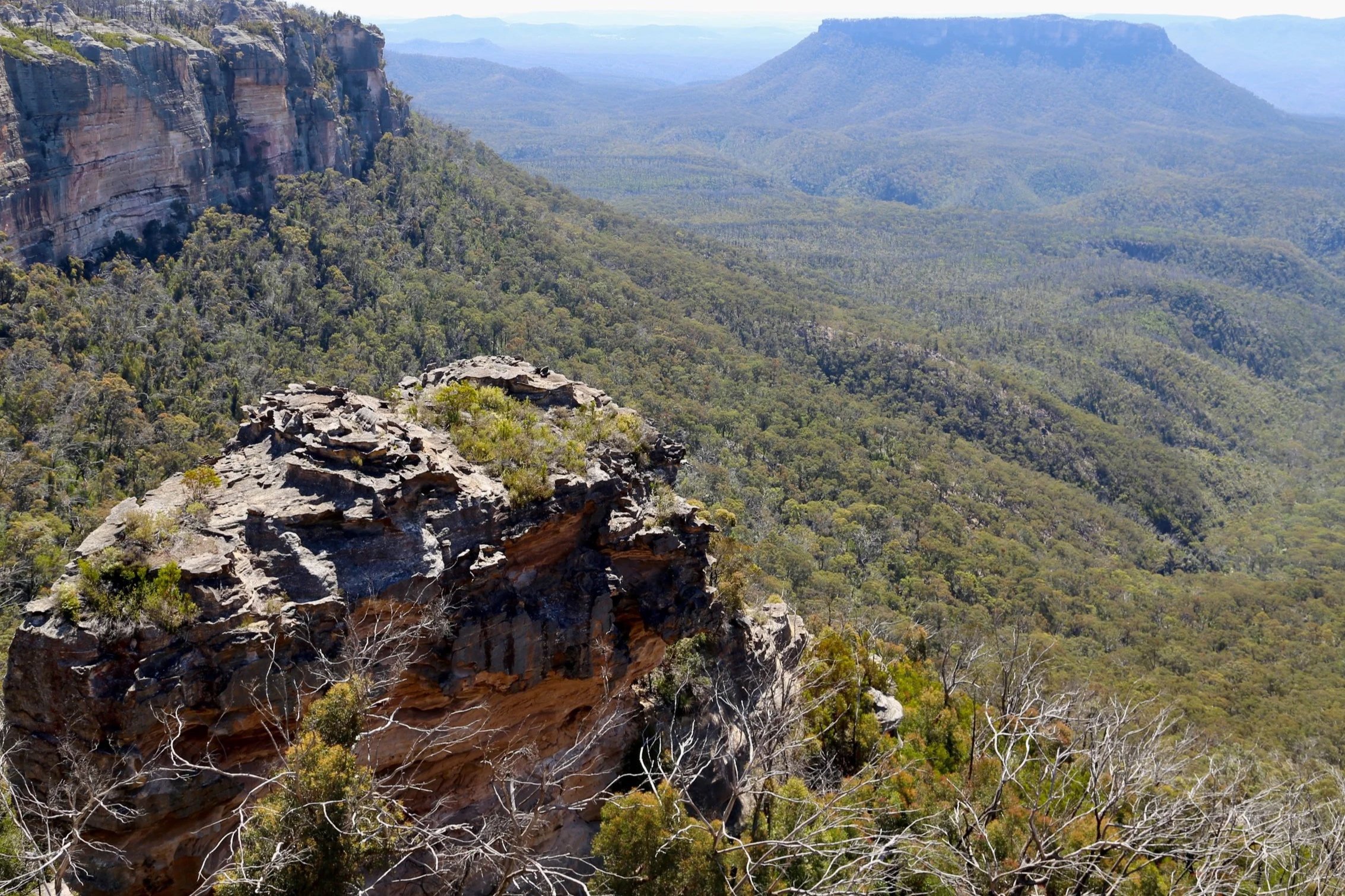
The upper reaches of Capertee Valley, with Pantoneys Crown beyond.
Mt Stewart had been the morning’s ambition, but the slow start, dense regrowth and a succession of worthwhile diversions had put it beyond reach.
It was time to turn back.
With no pressure to push farther, the return through Blue Rock Gap was quicker, with more time to explore the cliffs and recesses along their base.
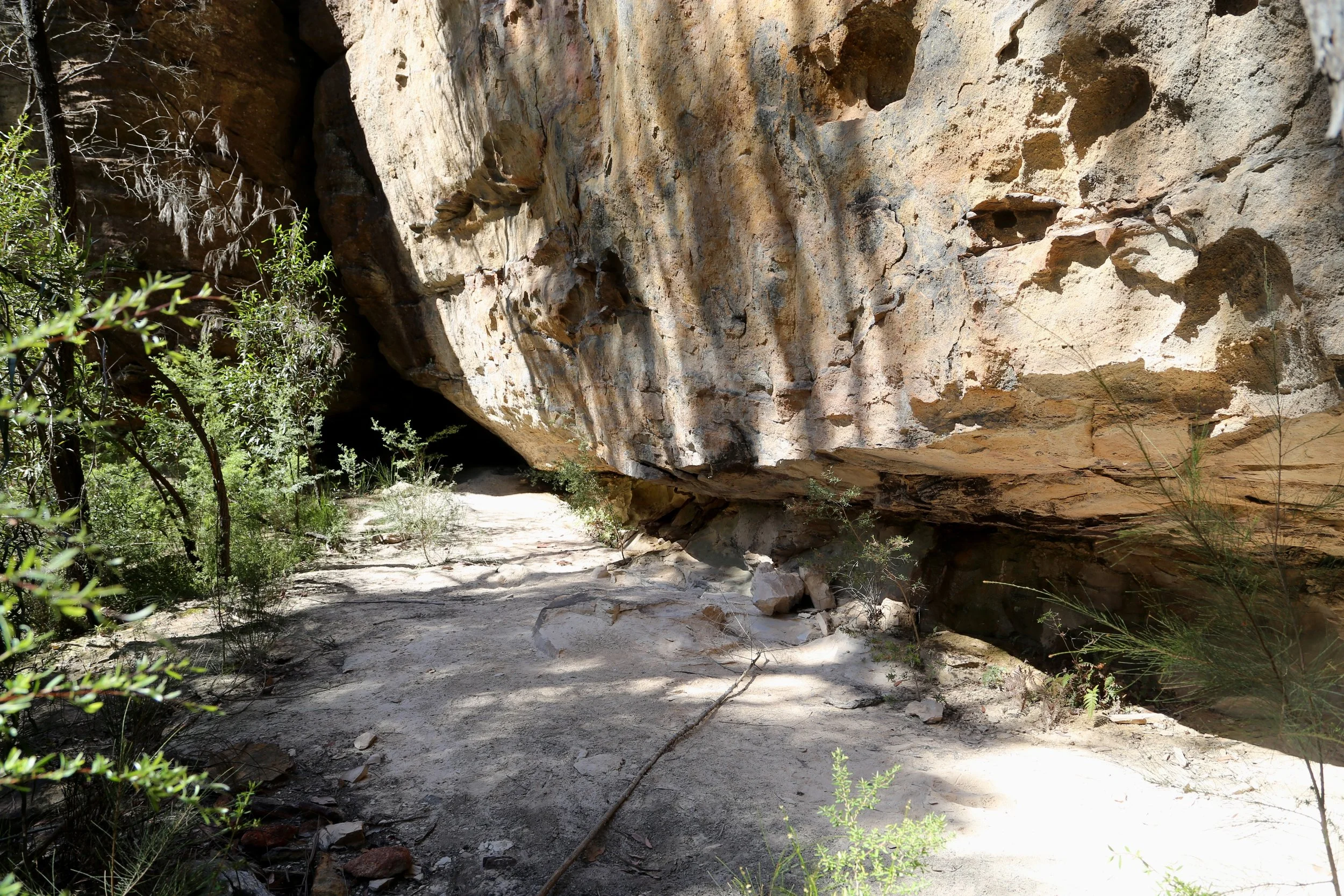
Under the sandstone walls on the return through Blue Rock Gap.
Back on the western side of the gap, we chose a line over Mt Davidson rather than retracing our earlier route. This proved less elegant than it sounds.
The ascent was steep and the regrowth particularly dense — a sustained bush bash through tightly packed young eucalypts that made the earlier pagoda-hopping seem positively civilised.
Mt Davidson itself is a rounded, scrub-covered hill with no real view, just the remains of a dismantled trig station to confirm the summit. Now that we have climbed Mt Davidson, it is comforting to know that we don’t need to do it again.
Once down the other side, the country became easier. Light scrub and low, platy pagodas carried us back towards camp as the afternoon softened.
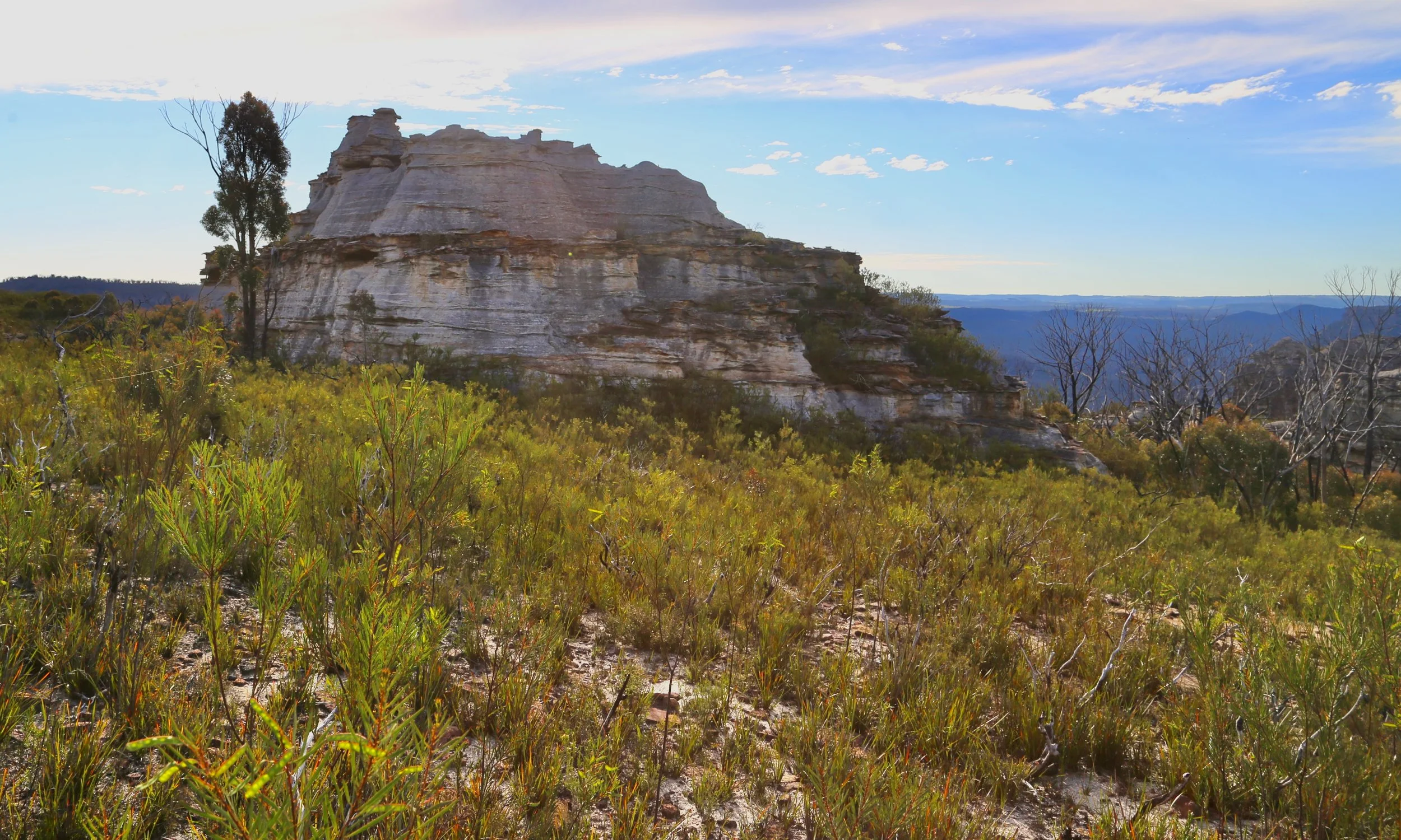
Low, platy pagodas in the softer light of late afternoon.
We arrived shortly before sunset.
And once again, the campsite justified every minute spent lingering there. The cliffs and pagodas towards Point Cameron caught the last light, the Capertee Valley fell away beneath us, and another remarkable sunset unfolded across the western horizon.
The day ended where it had begun: at camp, watching the light.
Time for tea. Mt Stewart could wait.
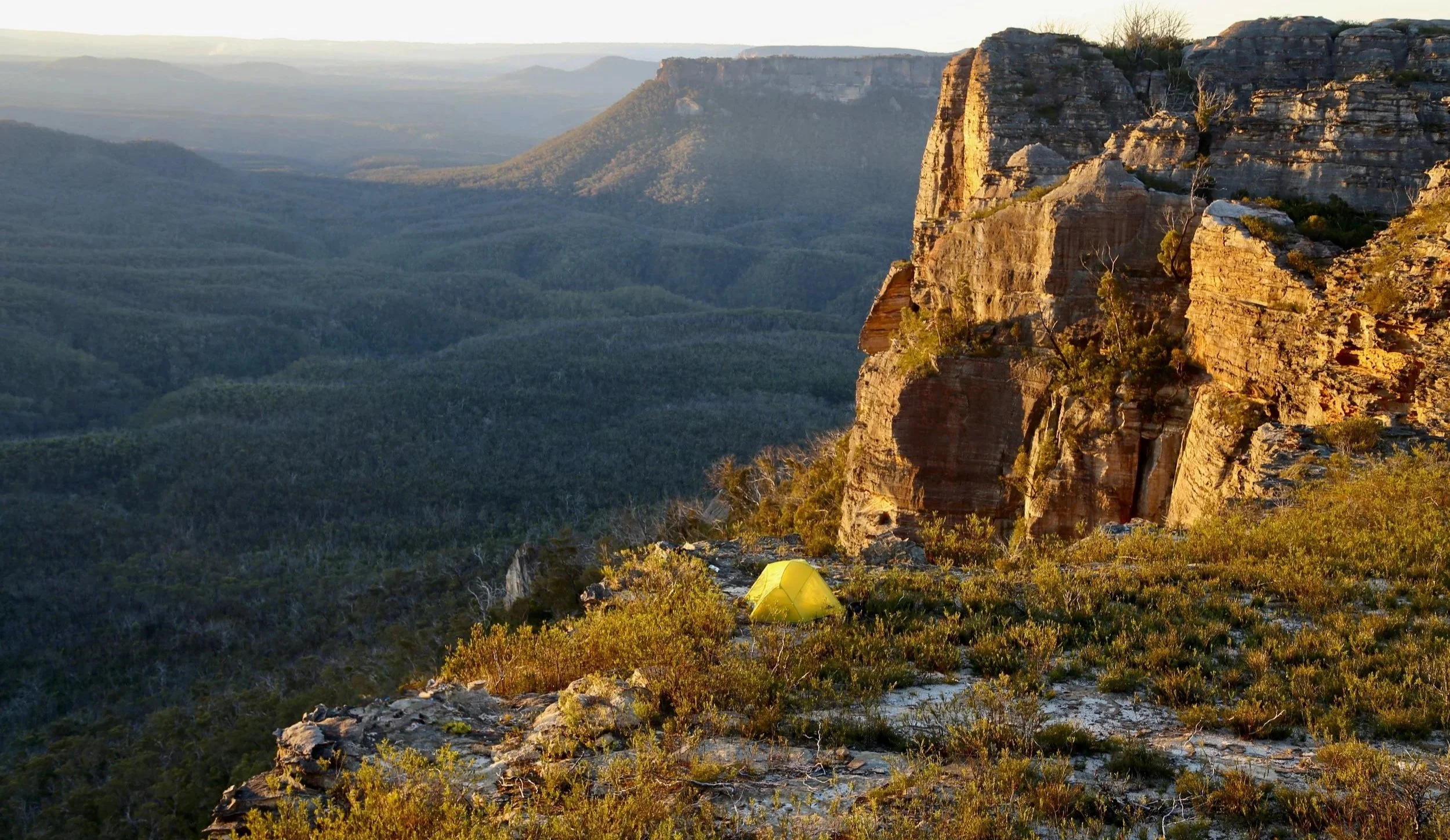
Back at camp as the last light reached the pagodas towards Point Cameron.