What the cliffs hold - Pittwater
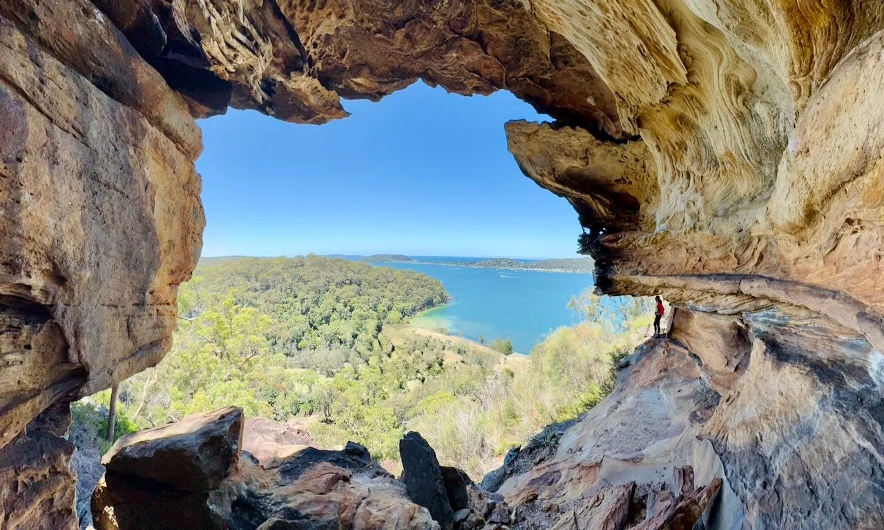
Cave with a view. Human shown for scale.
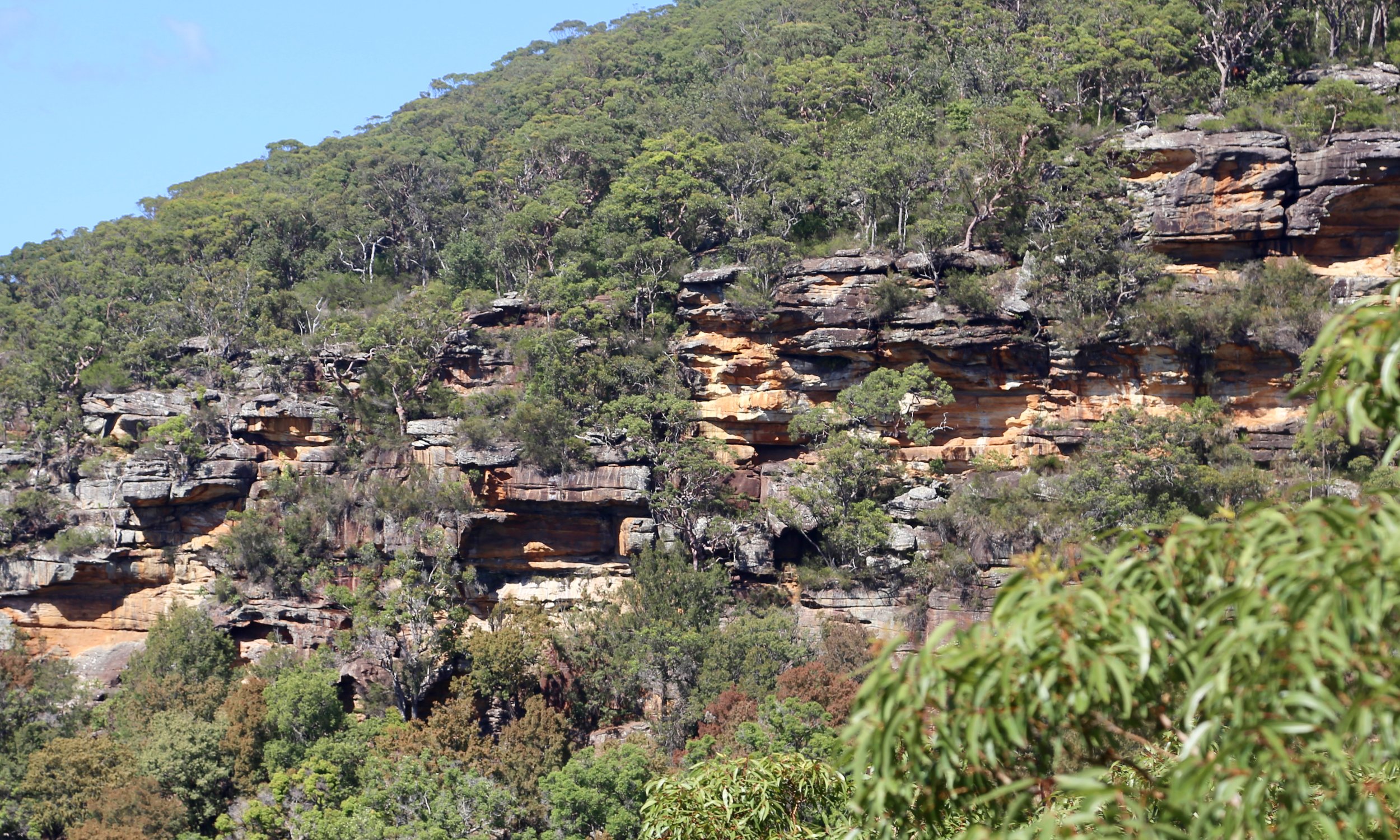
From the water, the cliffs give little away.
For a long time, we’ve looked across Pittwater to its highest cliffs on the wooded Ku-ring-gai shore, and wondered what they hold. On a warm January day, we take a boat across Pittwater to the National Park’s eastern shore.
The clear water over golden sand is too good to ignore. A swim first, then the day starts properly.

The climb begins straight from the beach — steep, pushing up through forest and scrub toward the base of the cliffs. For now, the bush hides any way through the cliffline, but there’s only one way to find out.
As we ascend, dozens of red angophoras stand along the cliffline, their smooth trunks twisting in different directions. In the mid-morning light, they pick up a soft glow against the rock. By afternoon, the light will be much harsher.


A break appears — a narrow split in the cliff. Terraces covered in dry leaf litter, loose underfoot. Careful steps upward, using small ledges and roots where possible, until the angle eases and the first views open.


Below, the bays come back into view — deep green water edged by sandstone, stretching toward the distant headland of Barrenjoey and the Tasman Sea beyond.
A short traverse leads to a rock outcrop noticed from below. Flat, exposed, and well positioned above the water. It juts out into space. A good place to stop for a while.


From here, the plan changes.
The intention had been to traverse along the top, but the mid-level draws attention instead — a line of ledges and overhangs hinted at from below. A short descent brings us onto it.
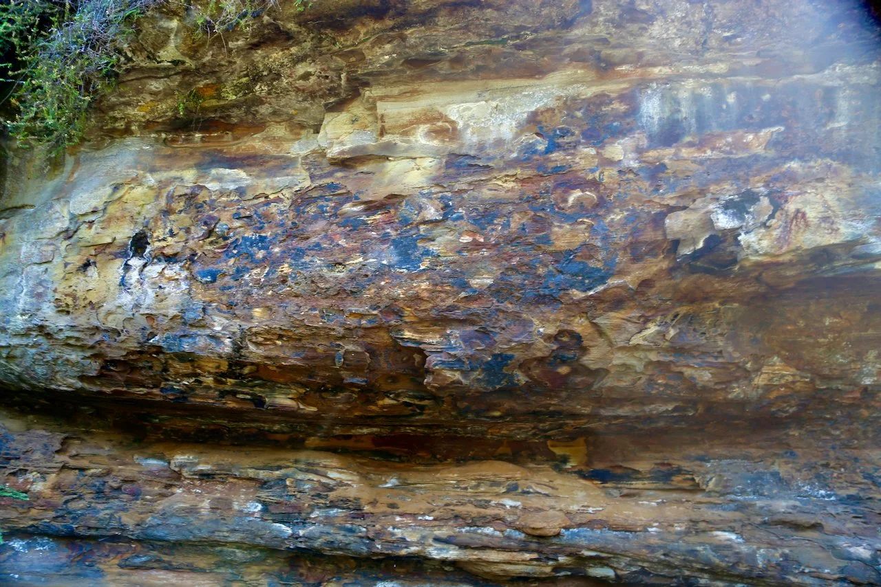
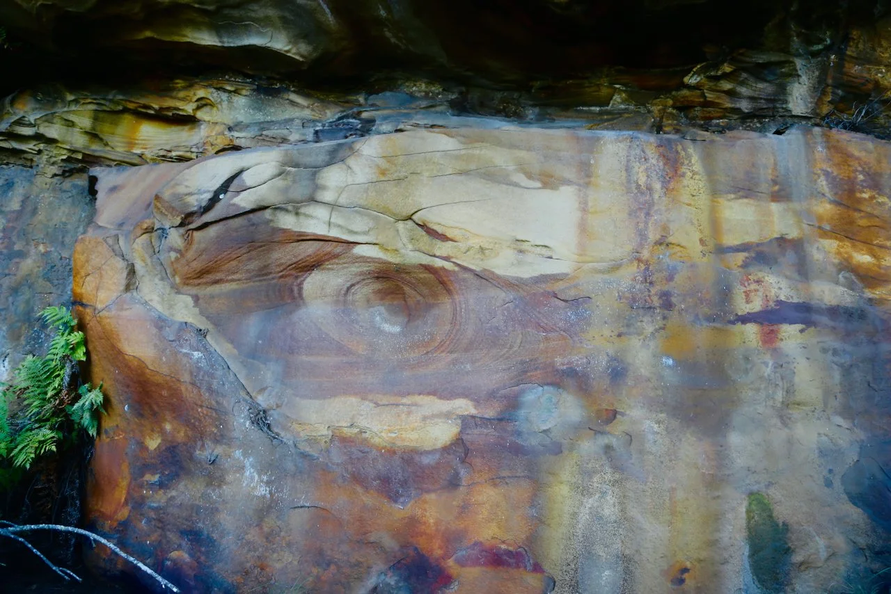
Under the overhangs, the sandstone deepens in colour — warm yellows and golds, protected from weathering. The first large chamber appears: a broad, rounded overhang with a smooth, curved swirling. The surface looks almost worked, though entirely natural.
Rock orchids cling to narrow pockets along the edges.

The line continues for a time before breaking — a drop of around four metres. Without a handline, it’s enough to stop further progress. A return to the upper line follows and we continue our traverse across the top of the cliff to the highest point, and biggest views, of the day.

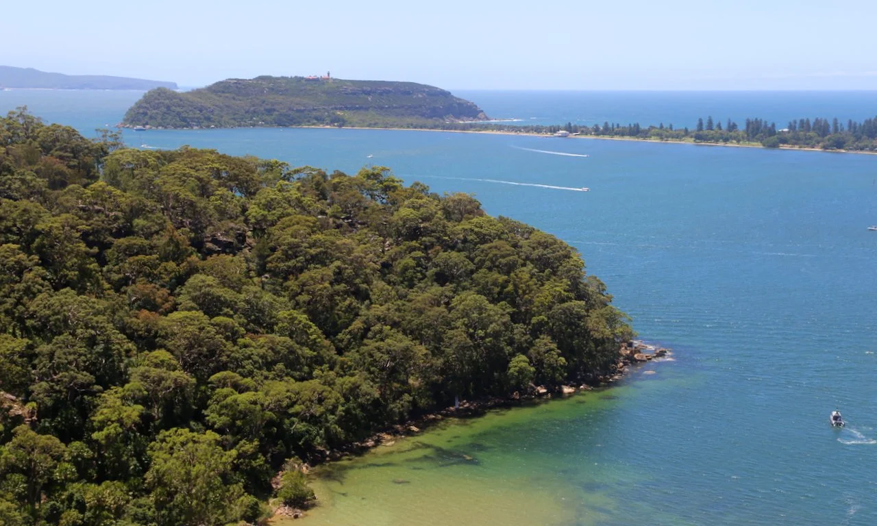
Moving inland, the cliff begins to ease and pull away from the water. The views widen briefly, then soften as Pittwater falls out of sight.
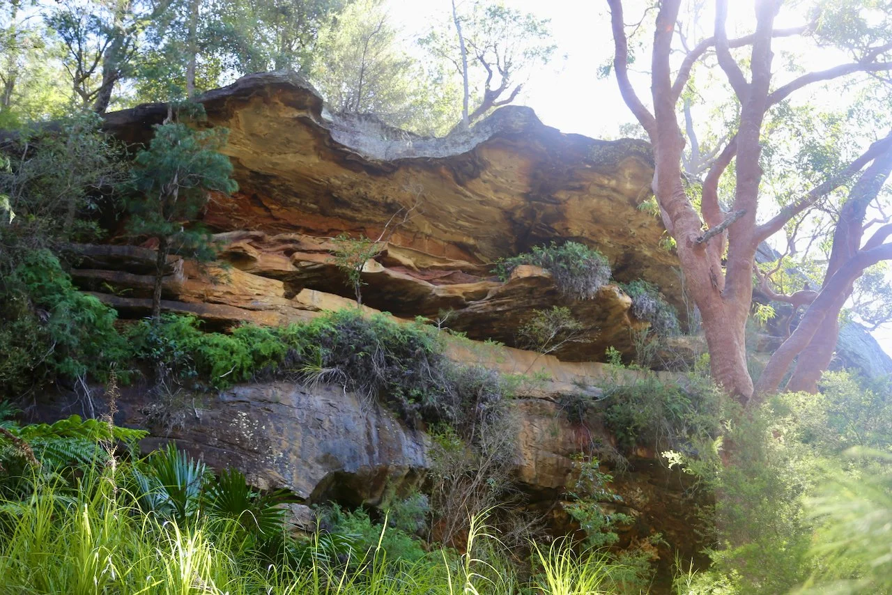
Although lower, the cliff still holds recesses beneath it — hints of more to see.
A possible break shows on our LiDAR-derived contour map, and this time it goes. The descent leads to the base of the cliff.
A long, shallow cave runs along the wall — sheltered and quiet, with fine detail in the rock. The sand underfoot is smooth and undisturbed.


Set into the wall is an ochre hand stencil. Small, but clear.
These places hold a much longer presence.

Hand stencil
Further along, the sound of water.
A small waterfall drops over a series of sandstone ledges — no more than ten metres high, and flowing lightly. The catchment is limited, but in the heat of the day, it’s enough.
A short break here.


The return follows the base of the cliffs toward the water.
Caves continue along the wall, varying in depth and shape.
One stands out — a sheltered space with a floor of deep red sand, partly enclosed and framed by a few cabbage tree palms. The colours are stronger here, the air cooler.

Above, sections of the mid-level come back into view — ledges and openings suggesting more chambers, but still out of reach without rope.
The line continues below the towering walls.
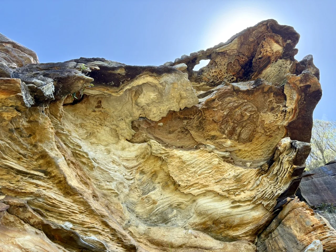
Just as the cliffs begin to taper, one final chamber appears — larger than the others, and more complete.
The swirling curves inward, lined with fine tafoni. Colour shifts across the surface — yellows through to reds and darker tones toward the back.

One last overhang
A week later, going through the photos at home, something else appears.
Small details.
Easy to miss.
Not seen at the time.
See if you can find them.

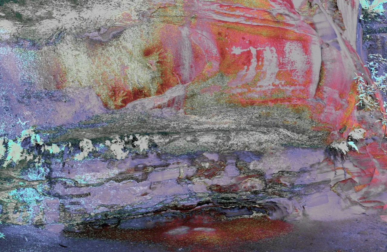
Enhanced to reveal additional detail