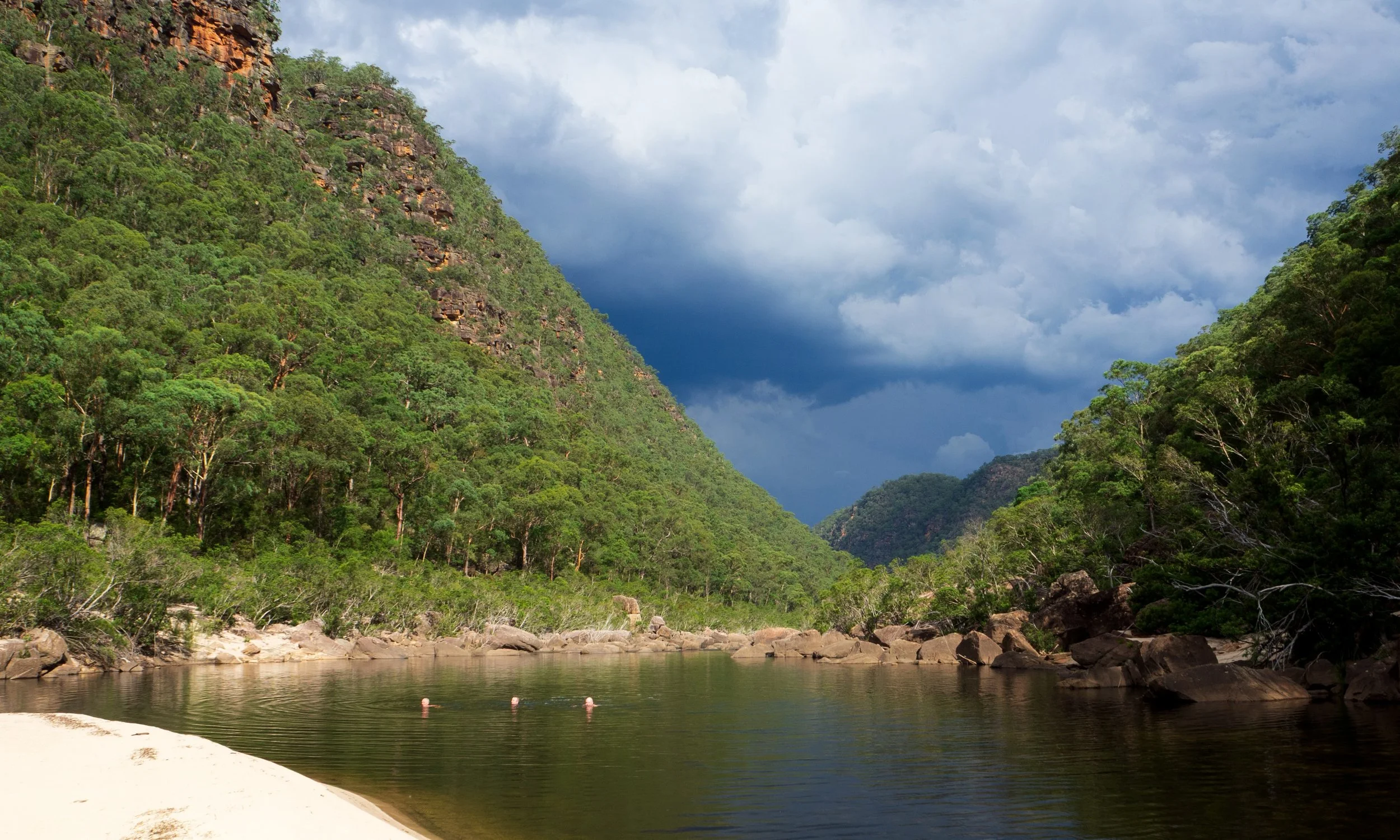
The Colo–Wollangambe Junction
Looking across to where the Wollangambe meets the Colo
Three days in the Wollemi, descending to the Colo River and following it to its junction with the Wollangambe River. Steep passes, long stretches of water through deep gorge country — and swims in clear water, cool against the February heat.
-
Date walked: February 2026
Kilometres: 24.6 km
Elevation gain: 1,240 m
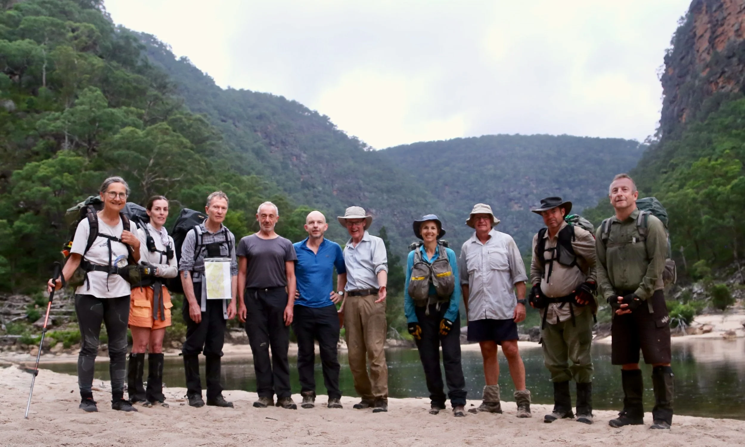
Party: Yuri (leader), Anna, Anton, Ivan, Karen, Kevin, Paula, Rodney, Ross, Stephen
Grade: 5
Location: Wollemi National Park
Maps: NSW Topographic 1:25:000, COLO HEIGHTS
All photos Copyright and by Sandstone Symphony unless otherwise noted.
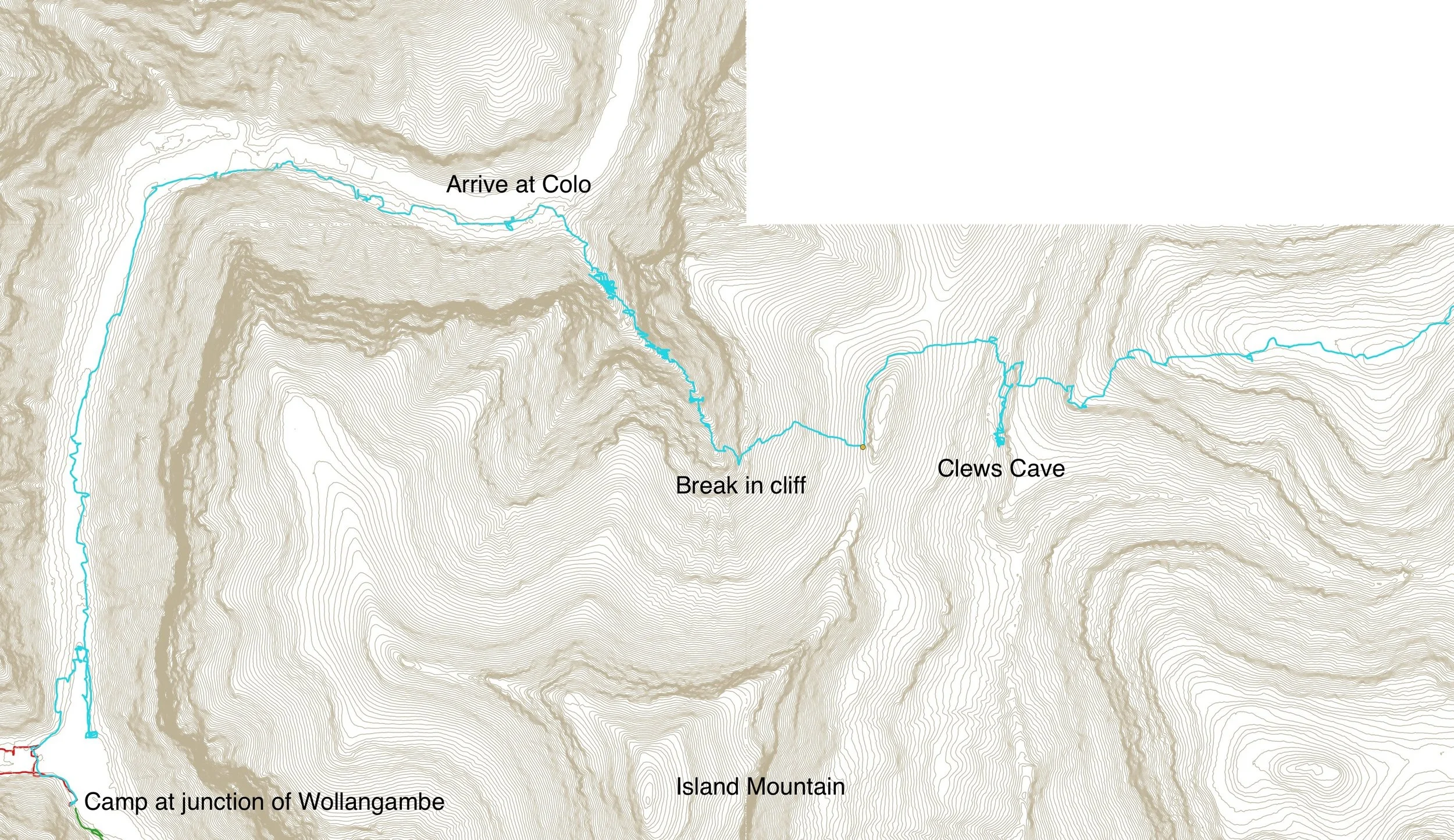
Day 1 — Into the Colo
The heat settled in early on the ridges and did not lift. The bush was still holding last night’s storm in its leaves.
This is February in the Wollemi. A three-day pack walk led by Yuri Bolotin. Somewhere far below, the Wollangambe and the Colo Rivers cut through cliffs and forest toward a junction that would come to define the days ahead.
The walk began along the Drip Rock Trail, an easy line at first, following the ridge toward Clews Cave. Lt. Col. Hugh Powell Gough Clews (1890-1980) — known as “The Major” — stayed in the cave in the 1930s while undertaking survey of the area. The cave itself was — as expected — underwhelming.
The real objective lay ahead.
Yuri found the break in the cliff line readily — a way through — and from there the descent began. Steep and increasingly enclosed as the gully drew down toward the Colo River. This is Bucks Pass 24 - Clews Shortcut as described in book “Colo River passes and routes” by Brian Corlis.
The descent through the cliffline — the damp already finding its way onto the lens.
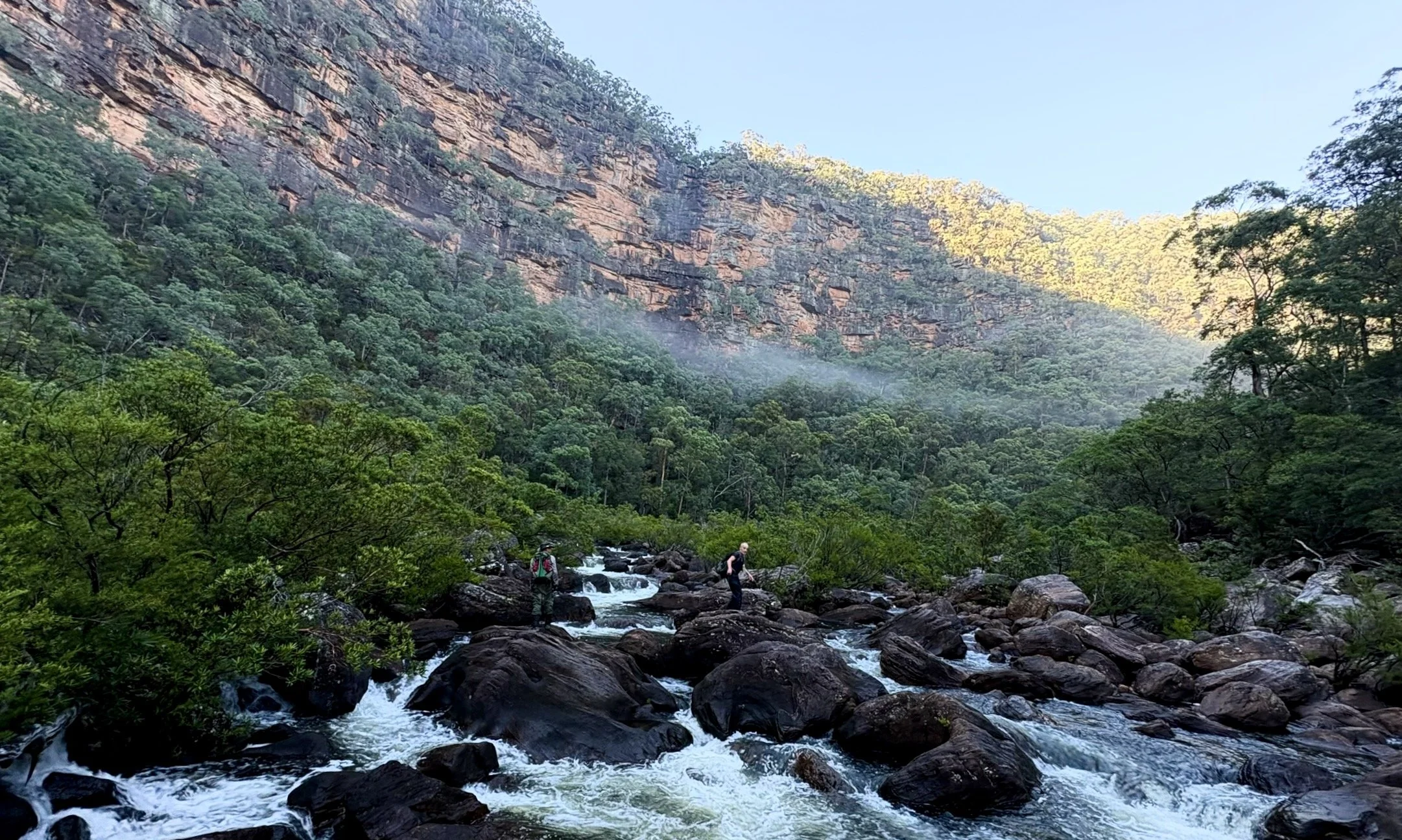
At the river, the scale of the place opened up. Steep walls, deep water, and the slow current pulling downstream toward the junction. Large fish drifted in the still sections — carp, as it turned out. Wilderness has its small disappointments.
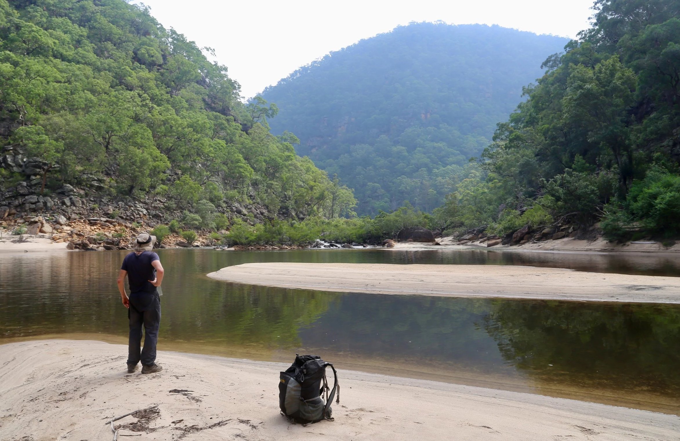
Downstream, the two rivers met. The Wollangambe feeding into the Colo; and the day ended with a knee deep crossing at their fast flowing confluence.
Camp was set on a broad sandy bank on “Gambe Beach”.
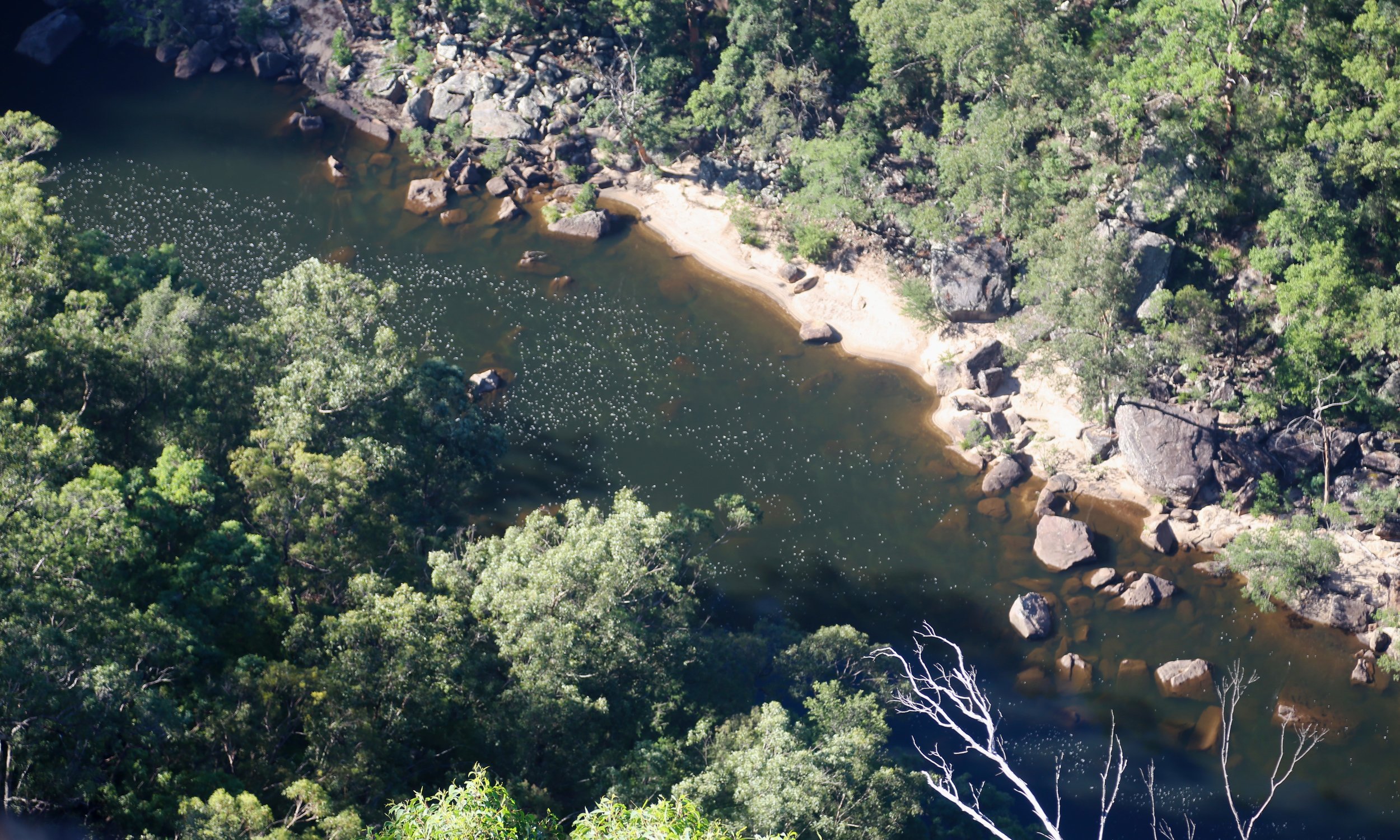
A vast, still pool lay at the meeting of rivers — cliffs rising on all sides, the water holding everything together. That night a storm moved through, steady rain falling onto sand and water, the cliffs briefly alive with echo and lightning. A good first test for a brand new tent.
“Gambe Beach” - our camp for two nights at the junction of the Colo and Wollangambe
Day 2 — Up the Wollangambe
To get ahead of the heat, the day began early.
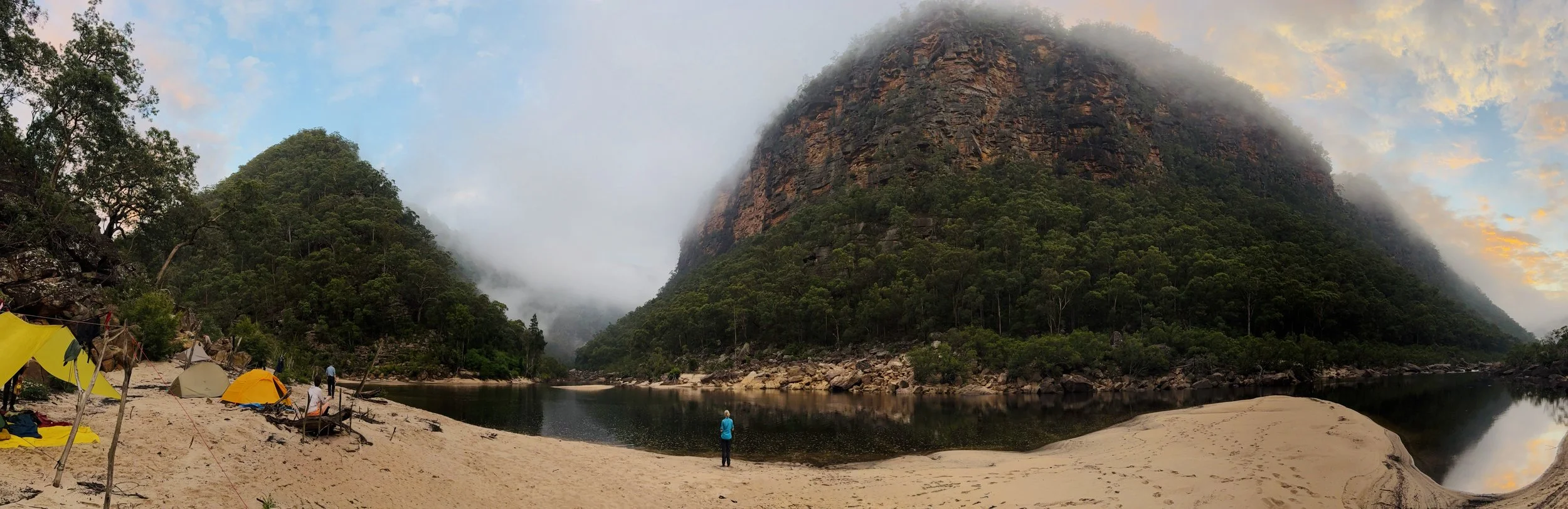
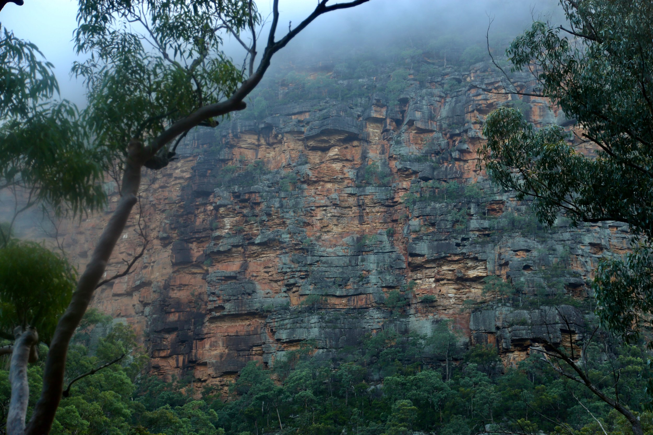
Cloud from the night’s storm still lingered in the valley, wrapping around the cliffs and lifting slowly with the morning light.
Yuri and Rodney at first light as cloud lingers in the valley.
The Wollangambe was running strong over broad boulder beds. Progress along its edge was slow — rock-hopping, pushing through vegetation still dripping from the night’s rain. The air was heavy — humid, enclosing, clinging to skin and gear. At times, it felt more like Sumatra than the Wollemi. Within minutes, everything was soaked again. Keeping a camera lens dry proved difficult. Everything was damp, and often dirty, and it showed in some of the images.
Then the river began to turn.
A long, sweeping curve — and the cliffs rose around it in a vast amphitheatre. Above the trees, a ring of mist traced the arc of the valley, suspended below the cliffline.
A bend in the river, and suddenly the landscape opens — a perfect arc of cliff, suspended in still air and mist.
A crossing was found, followed immediately by a steep climb toward the ridge above. Morning tea was taken on an exposed outcrop, the river laid out below in full scale.
Clifftop morning tea stop above the river
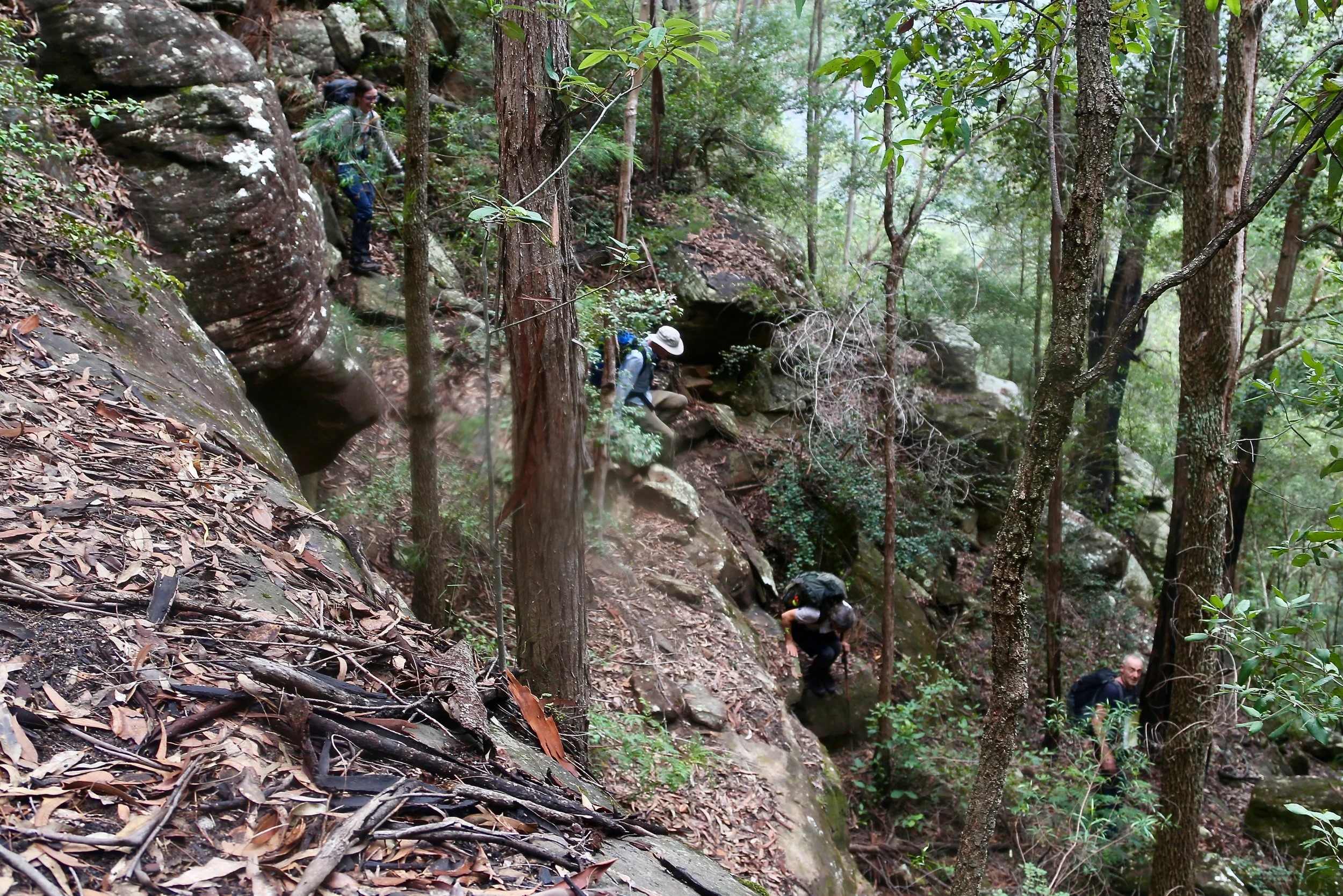
From here, the ridge became dense, resistant bush. Slow progress. Heat building again. With fatigue already present by late morning, the decision to leave the ridge early came easily, dropping toward the gully below rather than forcing the ridge further.
The descent was not straightforward. Cliff lines, ledges, route-finding decisions stacking one upon another — expertly navigated by Yuri and Rodney — while the temperature continued to rise.
Day 2 — The Creek
The creek was reached at a perfect point — a wide rock platform awash with clean, flowing water. Immediate cool relief after the dry heat of the ridge.
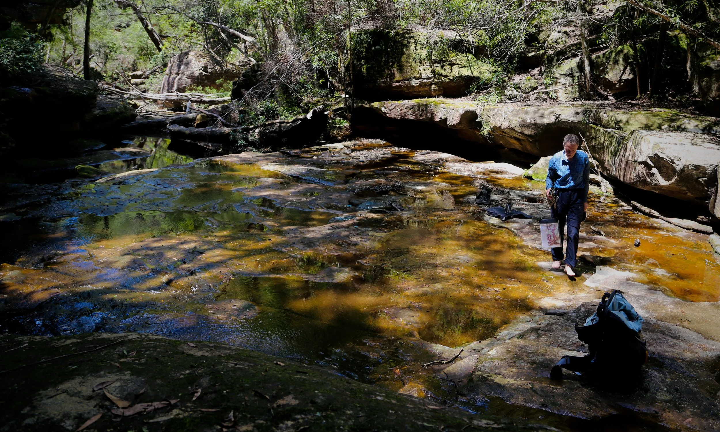
After the heat of the ridge — water, shade, and a place to stop without thinking twice.
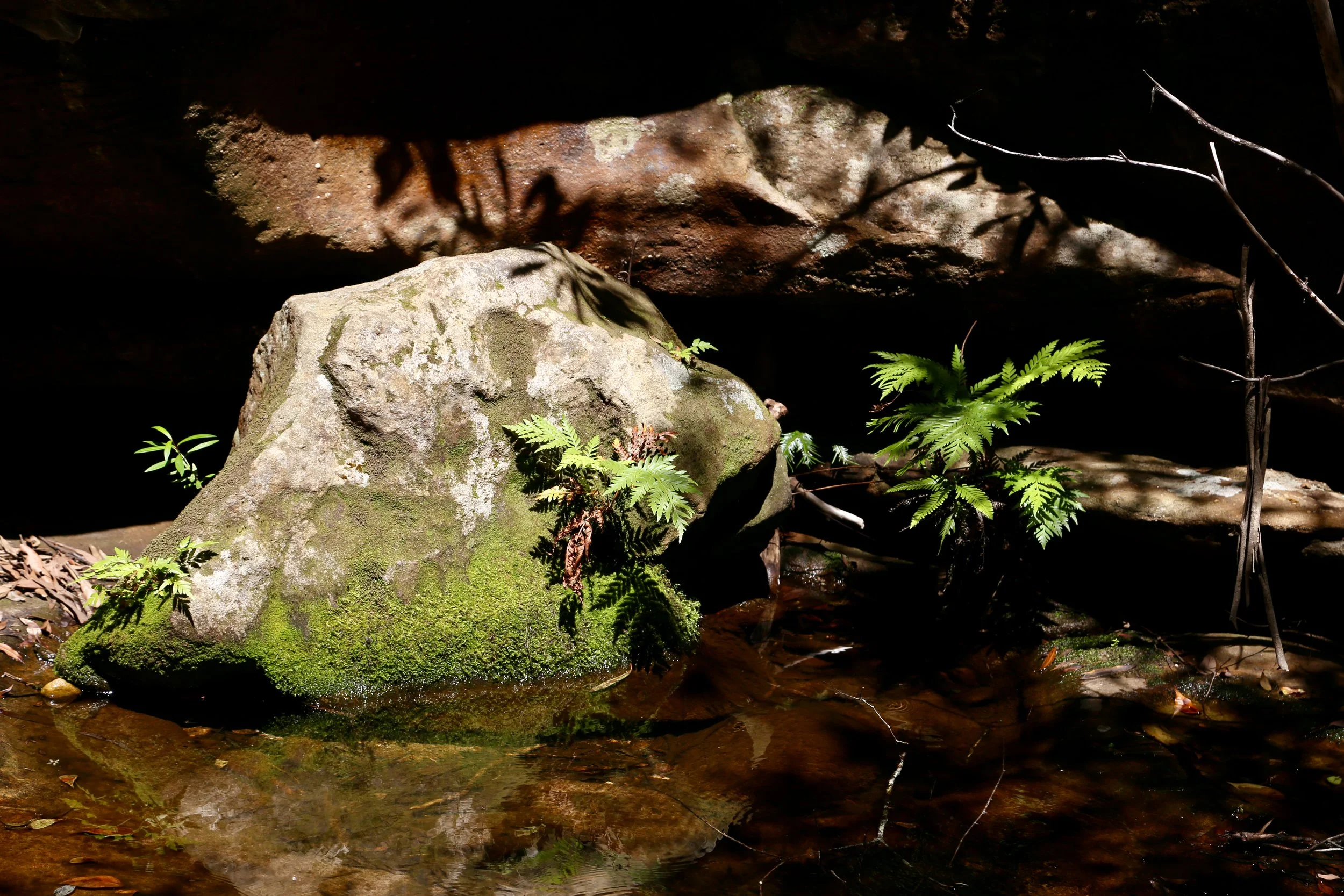
An oasis — shaded rock, clear water, and a place that invited a longer pause.
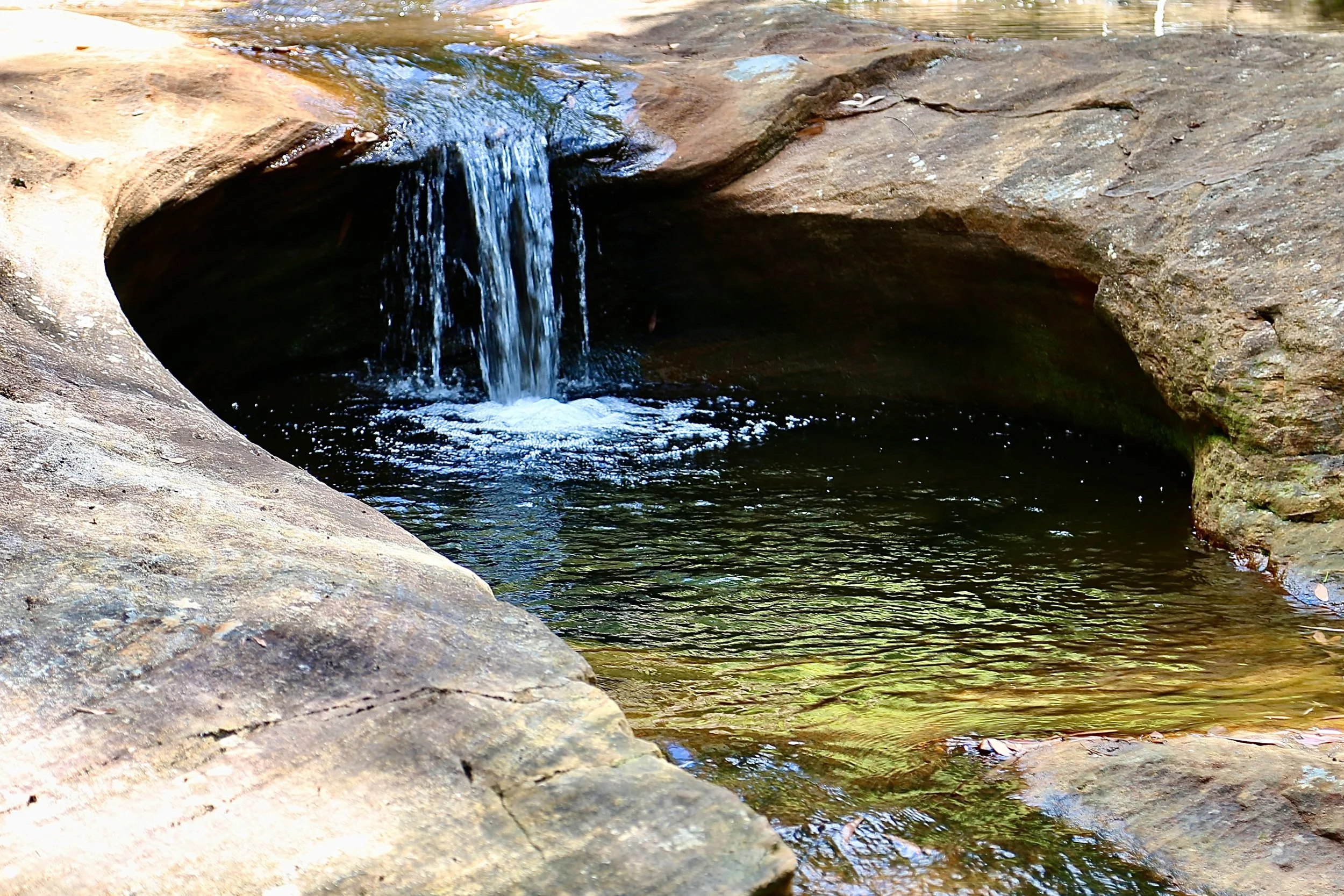
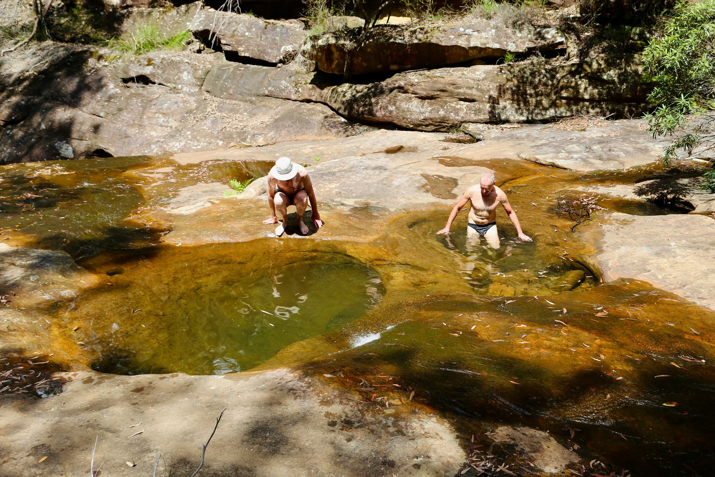
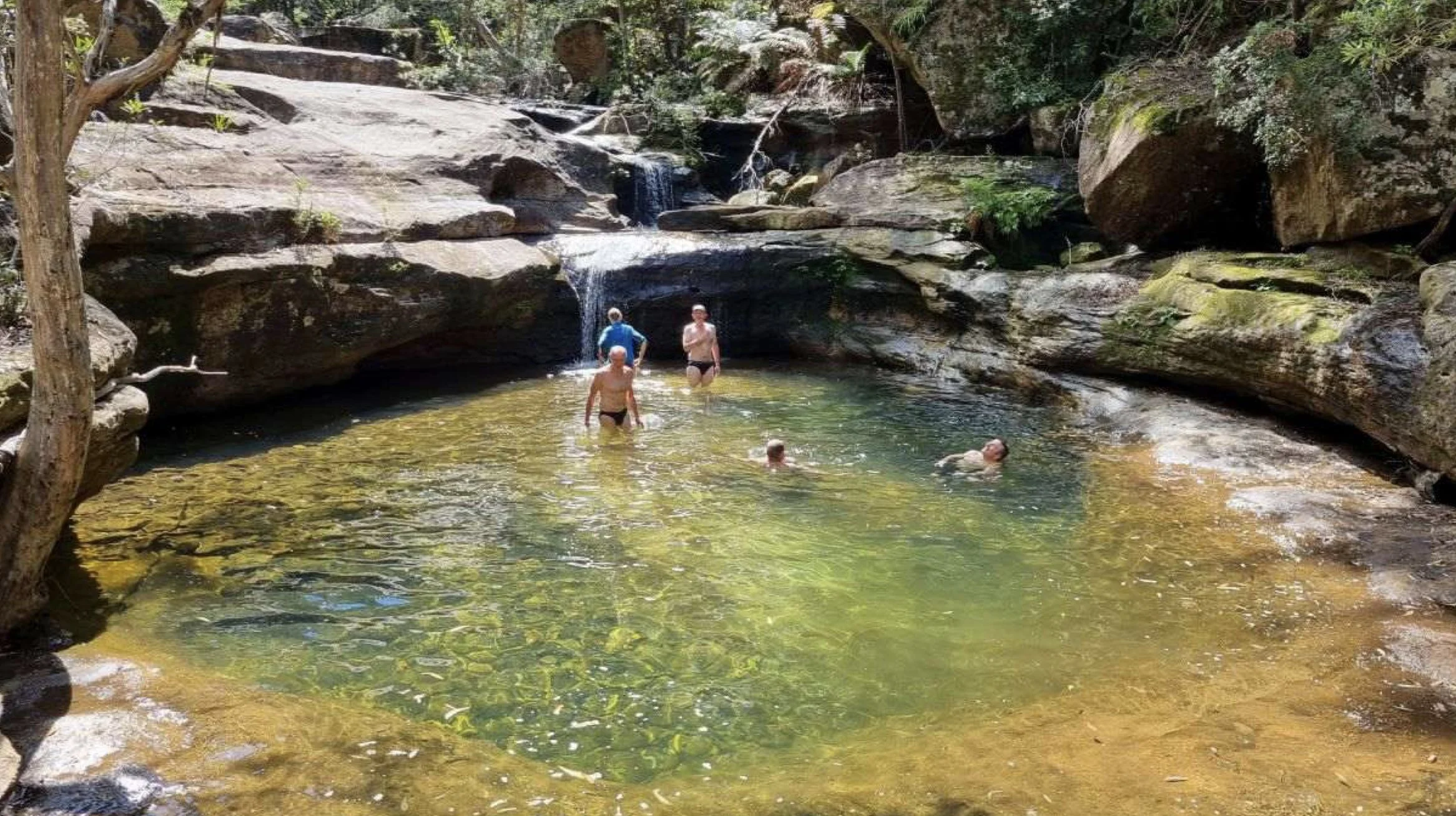
Moving downstream, the creek unfolded as a sequence of discoveries. Boulder-choked sections softened by ferns. Clear, bowl-shaped waterholes — natural baths that required no hesitation. Packs dropped, boots off — straight into the water. Fully submerged, fully relieved — in some cases, fully clothed.
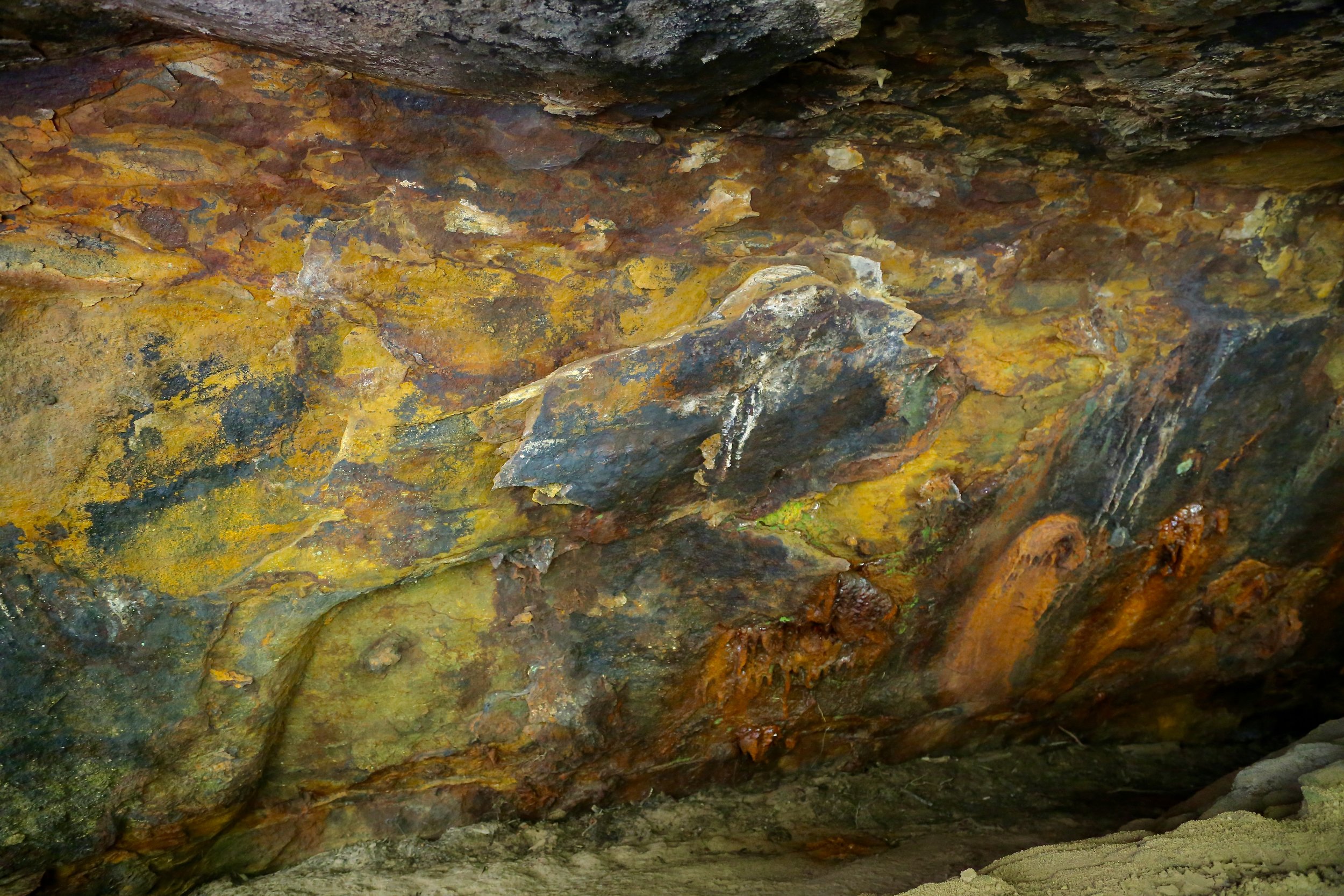
Further down, a cave revealed itself — walls layered with deep, unexpected colour. Then another pool, larger, fed by a small waterfall. More time lost to a swim.

A recent landslide broke the continuity of the valley, and beyond it, the creek continued until it returned to the Wollangambe, not far above its junction with the Colo.
Back at camp, the water beckoned again — this time with a long, slow swim around the deep pool below the junction. Above, distant storm cloud and late light shifted across the cliffs as the day gave way to evening.
Yuri, Steve and Anton in deep water under storm clouds - a swim back at camp. Photo: Paula Kelly
Day 3 — The Climb Out
The final day began at 6:30am.
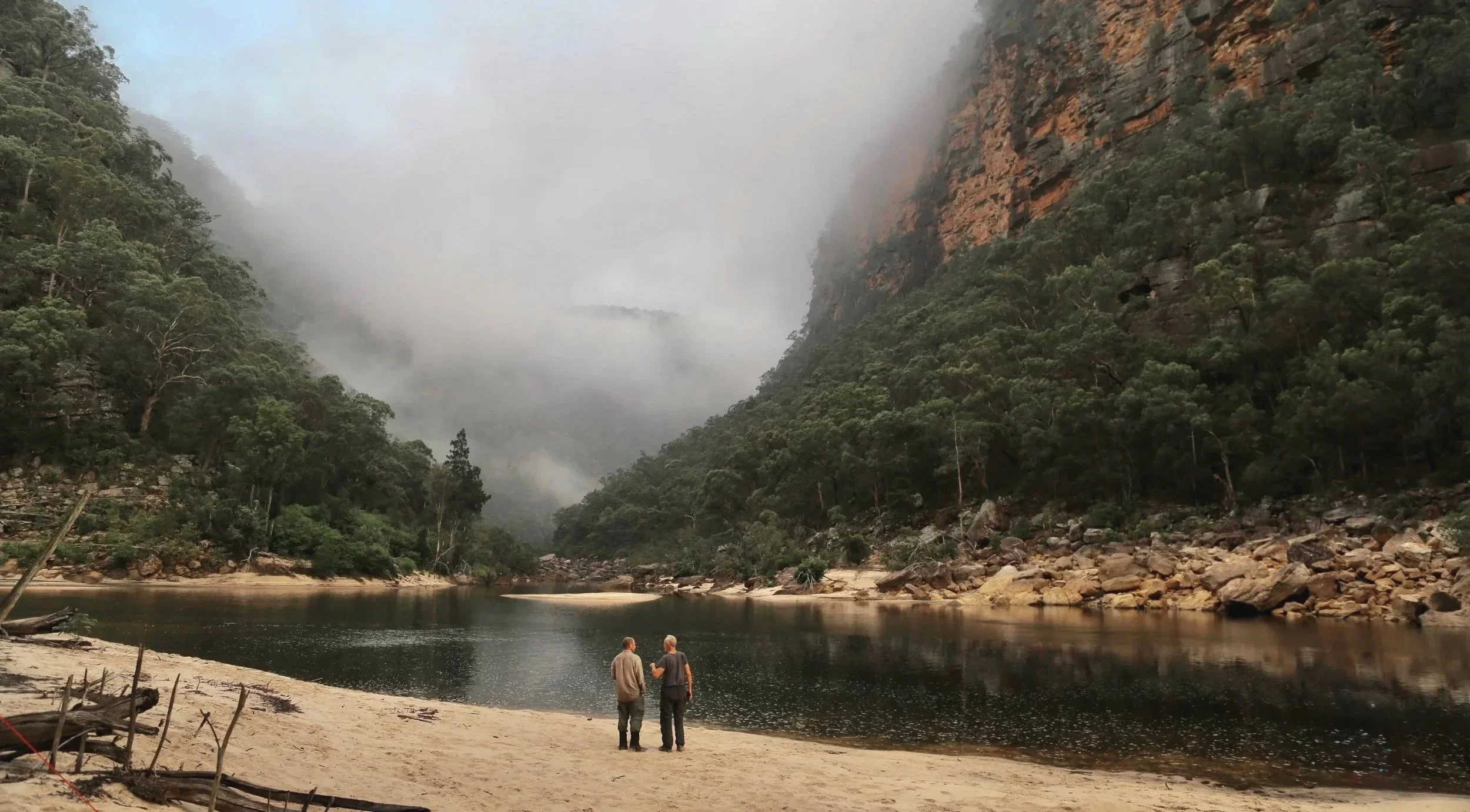
The climb out would define the day, the heat already building. Rather than crossing at the junction, the party tracked downstream in search of a better line. The river here was broad and deep — long, still pools rather than broken water.
Eventually, a possible crossing presented itself. Waist-deep. Clear, with a strong silent flow.
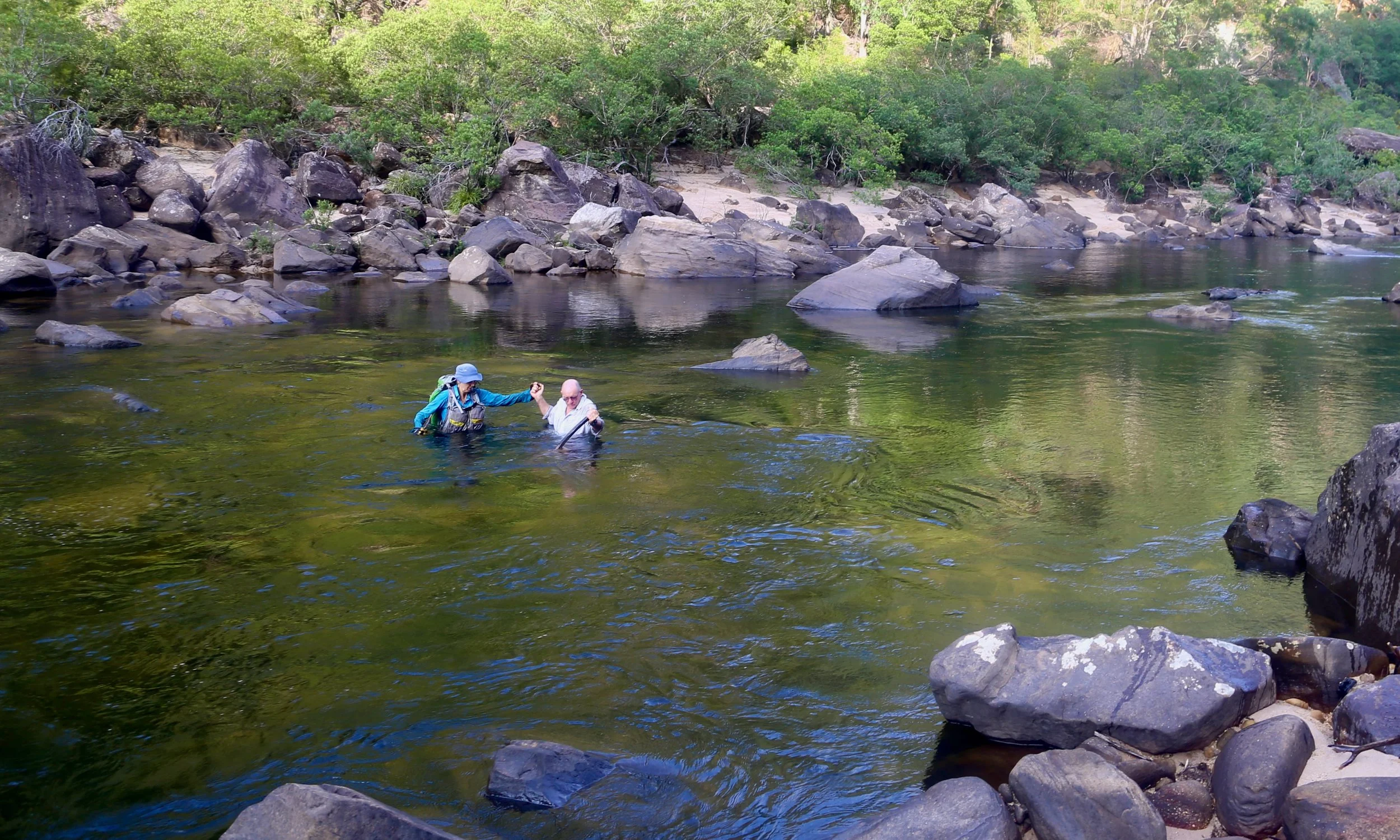
Crossing the Colo
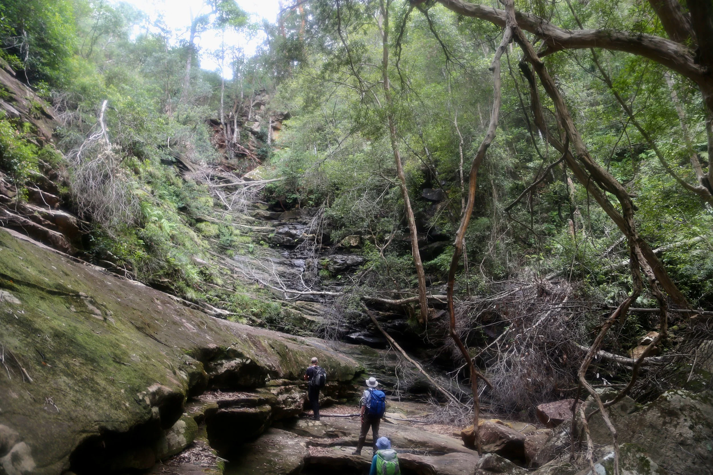
On the eastern bank, the river was followed until the gully that would take the route upward revealed itself. The ascent began on “Bucks Pass 29”, Cascade Pass as described by Brian Corlis in ”Colo River Passes and Routes”.
It was a beautiful gully — though not one easily noticed at the time. The rocky ground was slippery and uneven, and the focus was on staying upright. A 40-metre waterfall blocked the way. It may not have flowed on the day, but its multiple terraces had lost none of their slipperiness. Packs were hauled separately before careful movement for each person.
The waterfall was not flowing, but its terraces were treacherously slippery; handlines were set and packs hauled up.
The boulder terrain continued after the waterfall, but in time the gully widened and gradients softened. The gentler slopes above the creek provided faster progress. The gully provided consistent shade, and relatively easy travel in oppressive heat. After a short lunch stop, the ascent continued to the spur near the road.


Topographic map
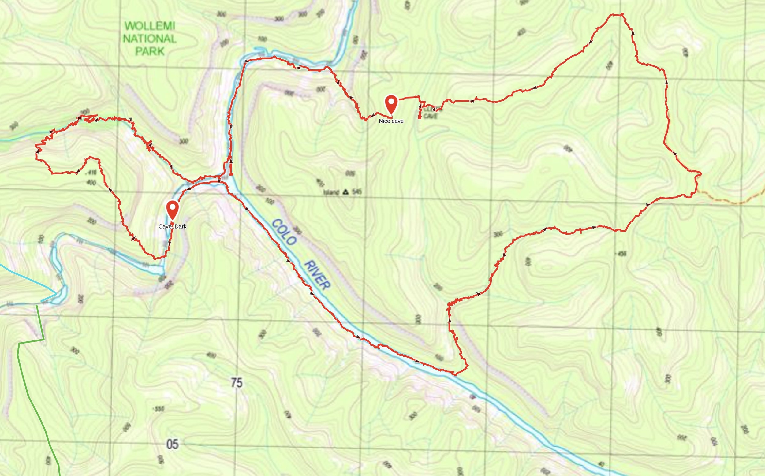
Trace recorded and prepared by Sandstone Symphony. Map source: NSW Spatial Services, 9031-3N COLO HEIGHTS, 1:25,000 Topographic Map 2025. © State of New South Wales.
3D aerial map
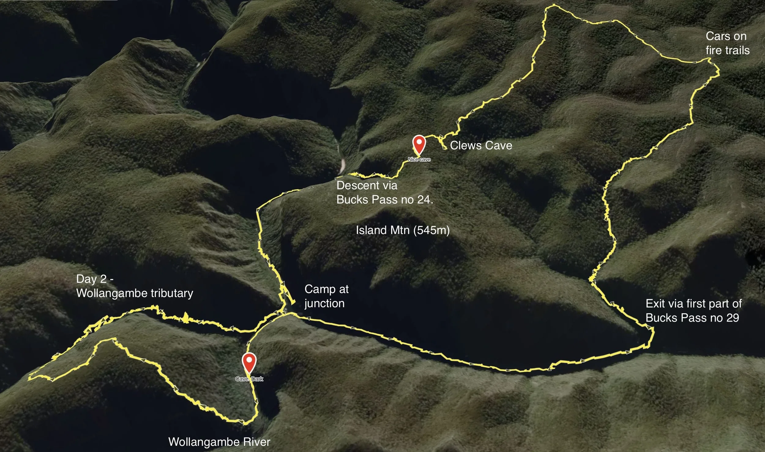
Trace recorded and location labels by Sandstone Symphony. Map data and imagery provided by Gaia GPS (TrailBehind, Inc.)
References and further reading
Corlis, Brian. (2005). Colo River passes and routes / by Brian Corlis. Glenmore Park, N.S.W. : B. Corlis
Keats, M., Yuri Bolotin, & Fox, B. (2025). Wollemi National Park: Wollemi wilderness adventures (Book 1). Design Portfolio Pty Ltd. https://www.bushexplorers.com.au/catalog/wol6
Noel R Gough, “The Major” https://khuts.org/images/stories/docs/major_clews_biography_ngough.pdf