Beneath Fortress Falls
Fortress Creek Falls—known for its dramatic panoramas and cliff-edge pools—has captured the attention of social media. Yet beyond the familiar Insta views, the waterfall guards its secrets.
What lies at the base of its 80-metre drop? It’s one of those rare hikes where anticipation builds with every step, and the destination remains hidden until the landscape finally reveals itself on the final scramble…
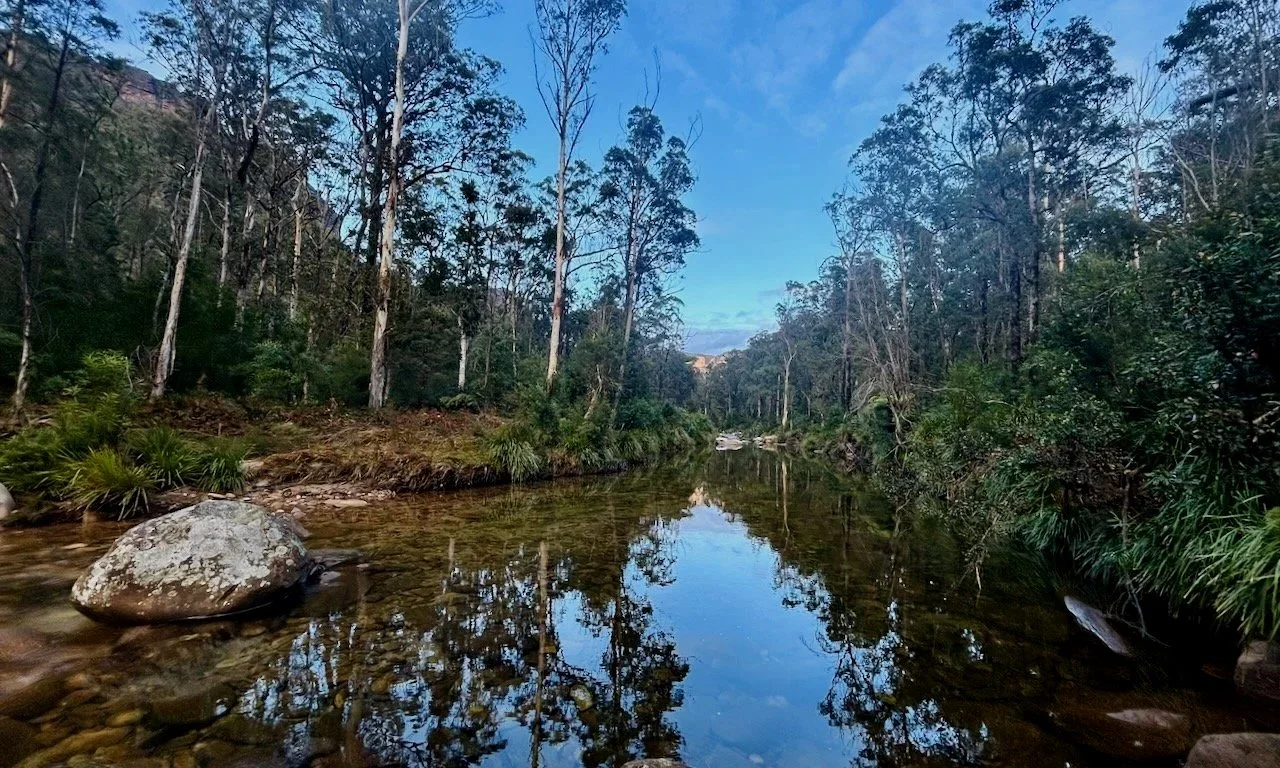
One we prepared earlier - the well-known pools at the top of Fortress Creek Falls.
-
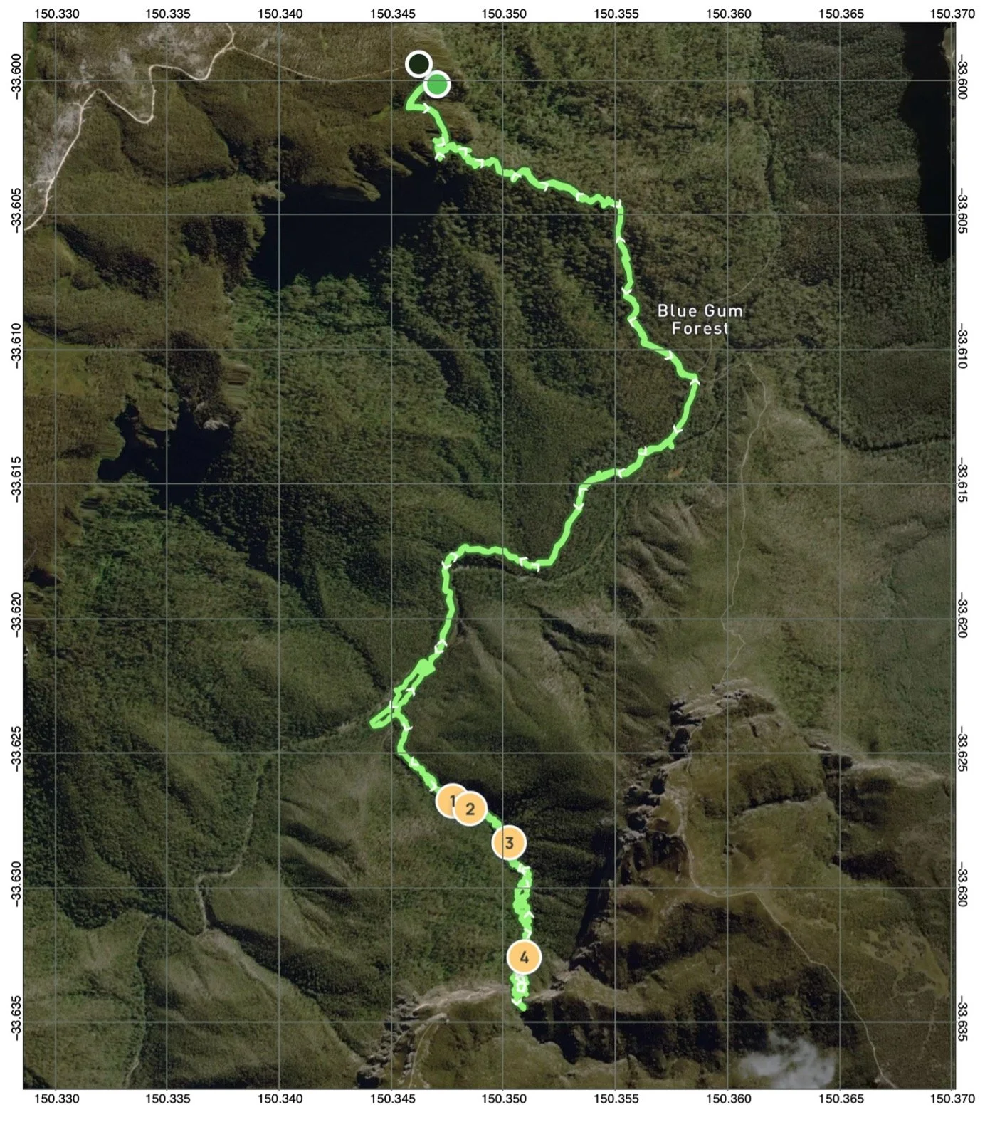
Location: Grose Valley, Blue Mountains National Park
Date walked: June 2024
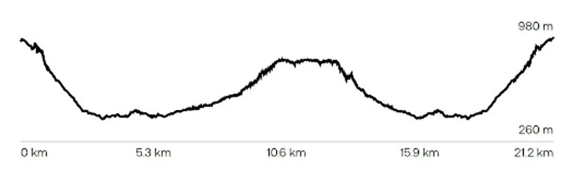
Duration: 13 hours
Distance: 21.2 km
Elevation gain: 1,243 m
Route type: Return walk from Perrys Lookdown via Docker Buttress, Blue Gum Forest, Govetts Creek and Fortress Creek
Difficulty: Very hard; long distance, major descent and ascent, creek boulders, dense scrub, exposure and complex off-track travel
Maps: Katoomba and Mount Wilson 1:25,000 topographic maps
Party: Anton (leader), Susan, Helen, Federico and Nam
Notes: This is not a route guide. The walk is suitable only for fit, well-prepared bushwalkers, and conditions in Fortress Creek can change significantly.
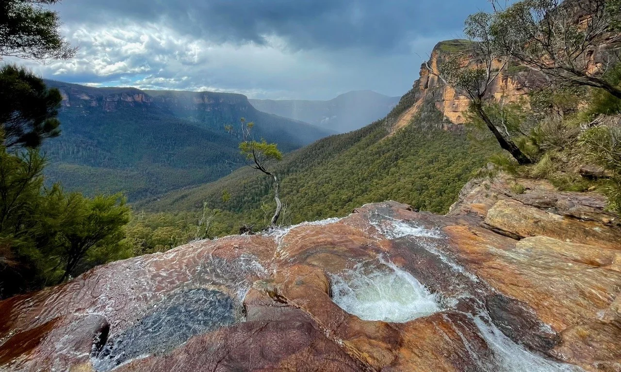
Canyoners have long been familiar with the spectacular top of Fortress Creek Falls. It marks the end of the canyon and the start of the exit trail, where the creek slides across a broad sandstone platform toward the cliff edge. Several pools sit perfectly placed like box seats above the vast sandstone theatre of the Grose Valley.
More recently, social media and several glossy books have brought new crowds to the spot. What lies at the base of the falls has proved less convenient to photograph, and therefore less famous.
That question draws us down into the valley. By bush walking means alone (no ropes and no abseiling), we deem Perry’s Lockdown to be best route into the valley to access the falls from below. The day we’ve chosen happens to be the shortest day of the year. This was either poor planning or an excellent commitment to atmosphere.
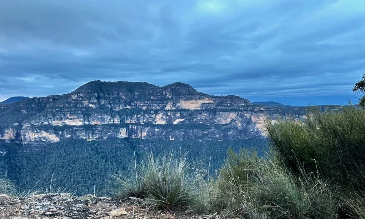
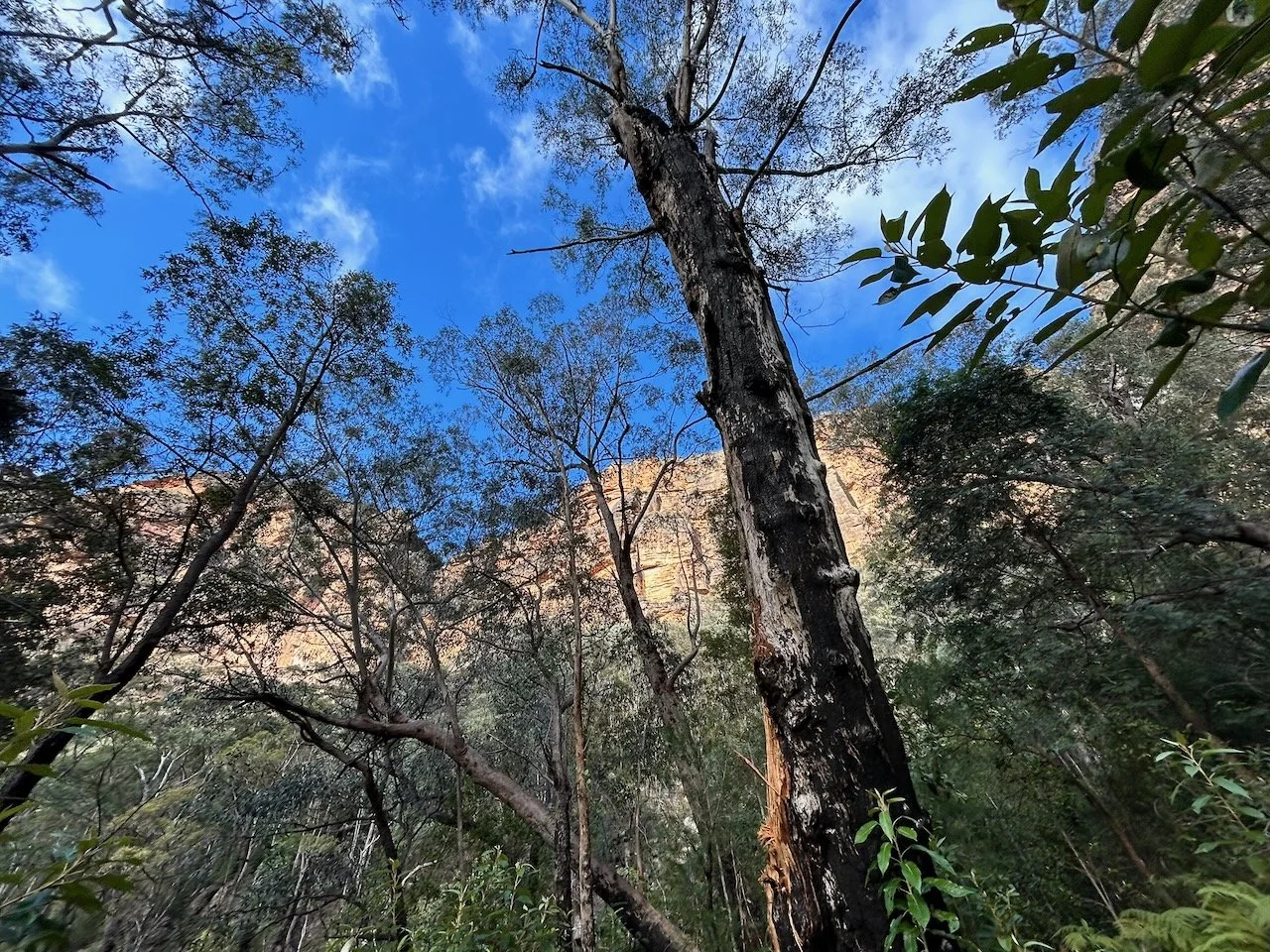
We leave Perry’s Lookdown at first light and descend the 2,200 stairs of Docker Buttress into the Grose Valley and the cold air of the Blue Gum Forest. The cliffs of Mount Banks on the other side of side of the 600 metre deep valley are majestic in the dim morning light.
Mount Banks distract us only momentarily, and we quickly reach the valley floor and glassy Govetts Creek.
Beyond Acacia Flat, we catch our first glimpse of Fortress Creek Falls — or rather, the deep gully it has carved into the talus slopes ahead. Even from here, it looks steep and uncompromising. We walk upstream along Govetts Creek until we reach its confluence with Fortress Creek. The creek begins gently, perhaps to encourage poor decisions. The encouragement is brief.
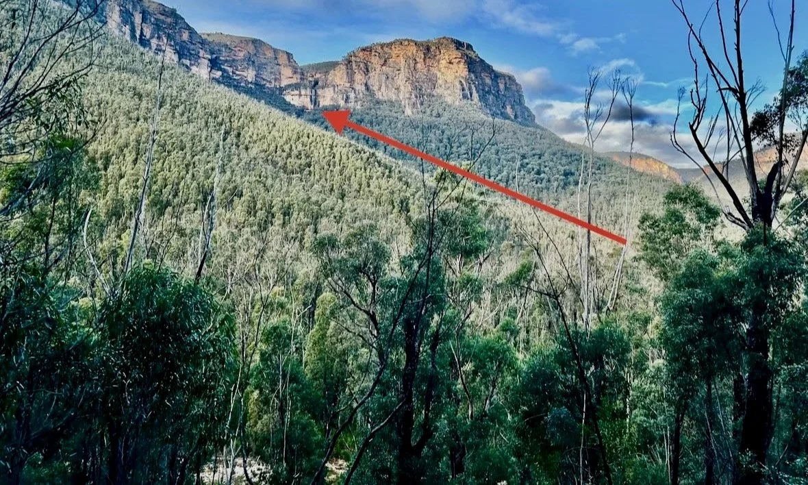
Our proposed route up Fortress Creek. The Falls can be seen above the arrow head.
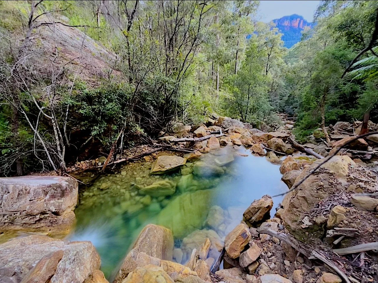
The creek narrows and steepens, and light-coloured sandstone appears underfoot, fresh and angular. We realise this is the vast volume of debris that crashed down from a partial cliff collapse near Lockley’s Pylon. The cliff scar is visible from several points around the Grose Valley including from the top of Fortress Falls, and we later learn that it is referred to as “Seahorse” due to the distinctive shape of the cliff scar. Between the rocks lie pools of startling emerald green, impossibly clear even in mid-winter.
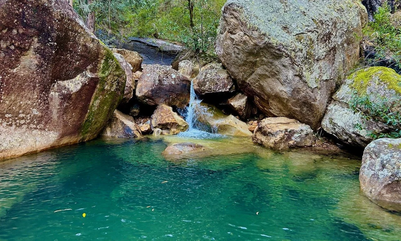
“We should come back and swim in summer,” someone says. The idea is repeated often enough to become a refrain.
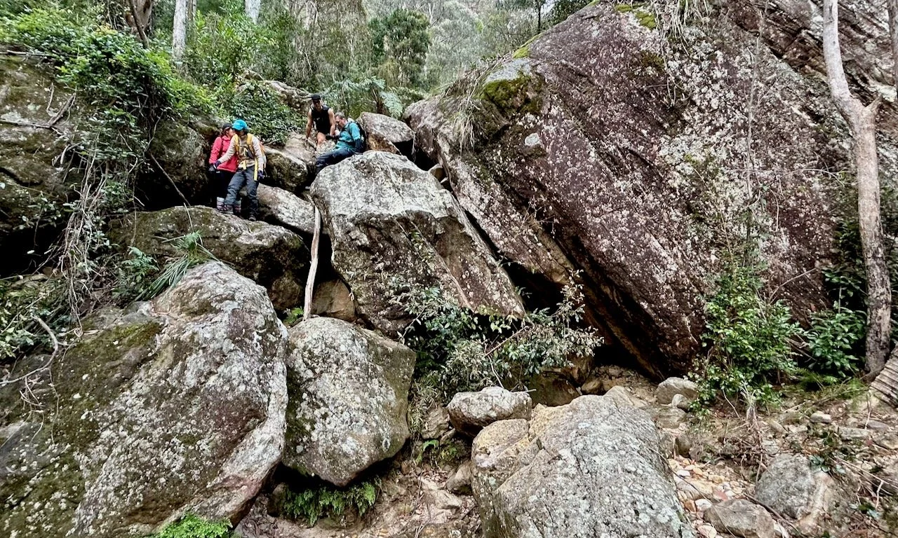
Upstream, the boulders grow larger and harder to negotiate.
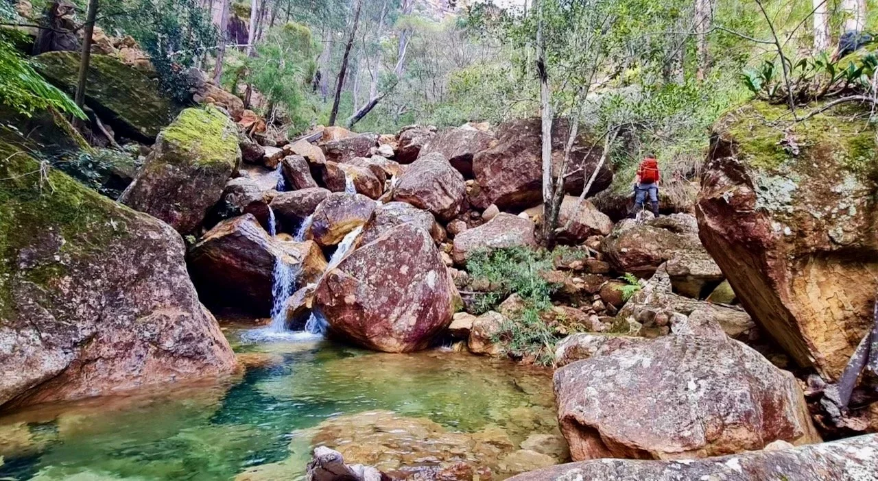
As we pass the point where the landslide crashed into the creek, the character of the rock changes abruptly. Below it, the stone is fresh, pale and jagged; above it, the boulders are darker and smooth, shaped by years of flowing water rather than a single violent collapse.
The point of landslide entry into Fortress Creek
Progress slows. We work carefully up the increasingly steep creek bed.
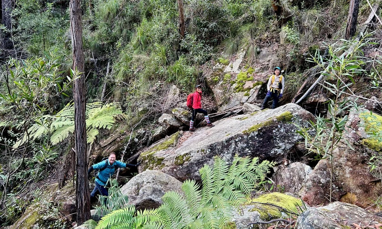
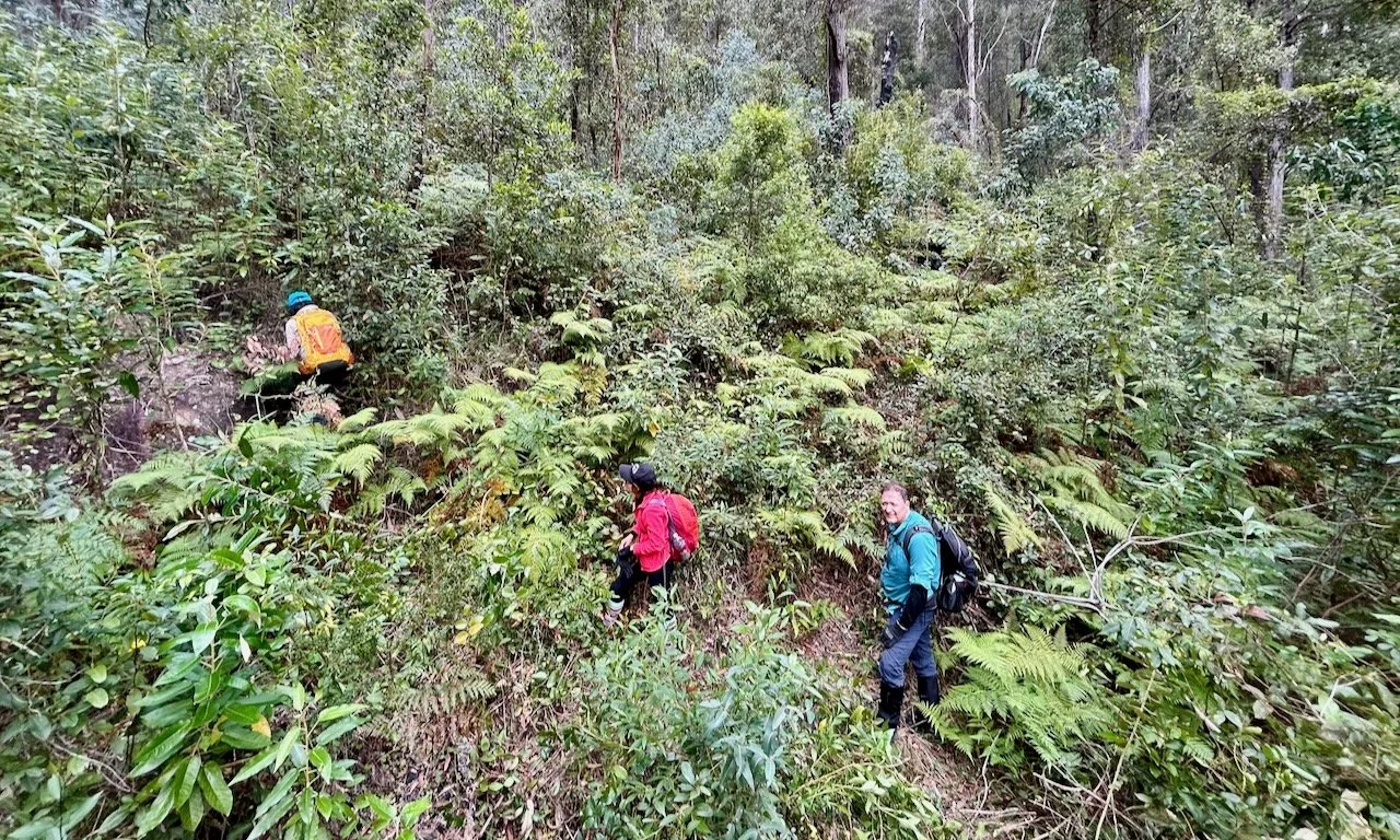
Eventually, the creek chokes on stacked boulders and small waterfalls, forcing us to abandon it and try the right bank. For a short while, progress improves. Then the slope steepens again and the vegetation closes in. Lawyer vine hooks arms and packs. The ground disappears beneath dense scrub, forcing us to feel for each step.
A suspended log offers brief respite. As we edge along it, we notice that beneath the vegetation to our left is a hidden drop of ten to fifteen metres, plunging down to the rocky creek bed.
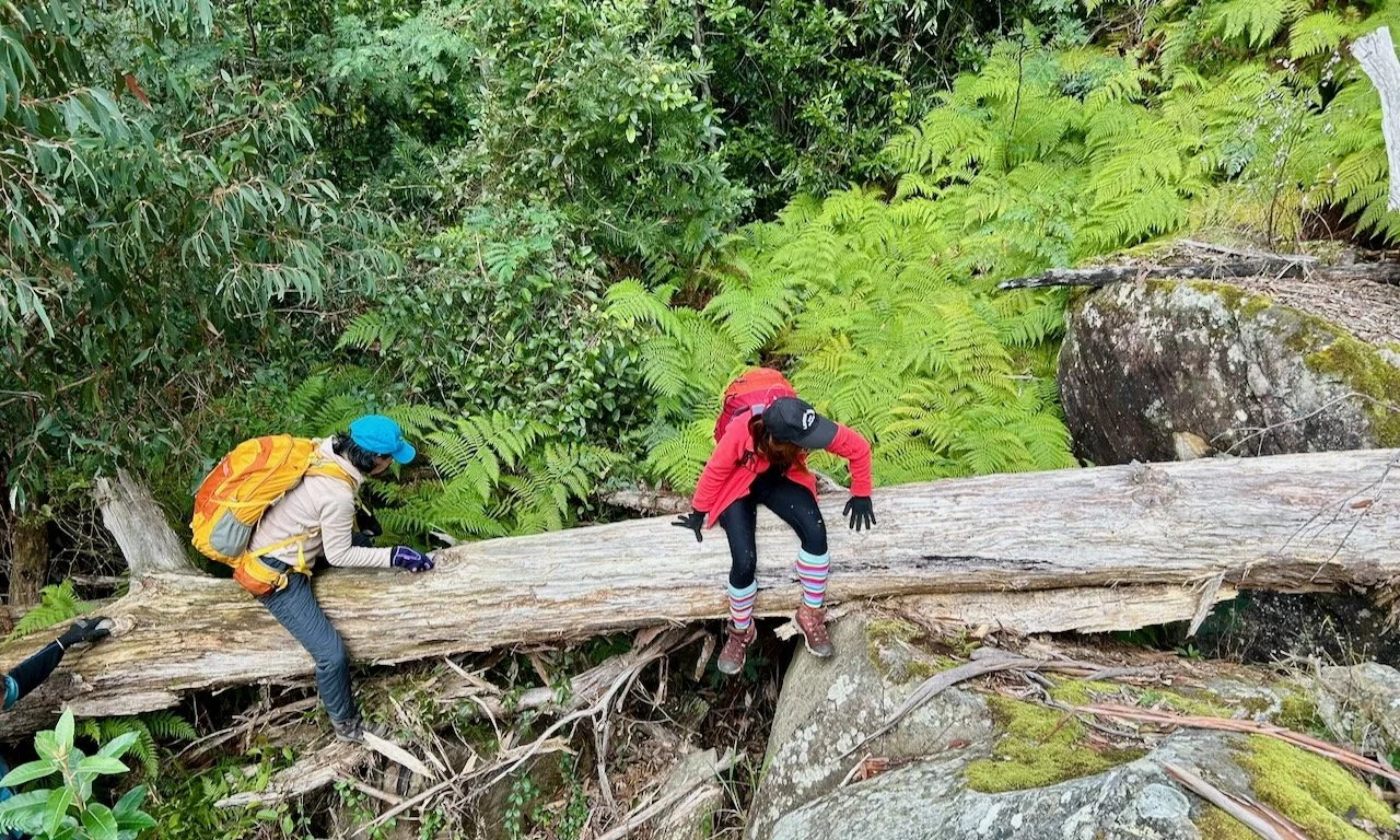
Our agreed midday turnaround time has come and gone, and at this pace we won’t make it. We float the idea of turning back. Turning back would be sensible. Descending Fortress Creek in the dark would be dangerous, and we all know it.
But Susan isn’t interested. She didn’t come this far to turn around. She takes the lead and pushes on.
Fortunately, the vegetation soon opens. Through the trees ahead, we glimpse the top of the falls.
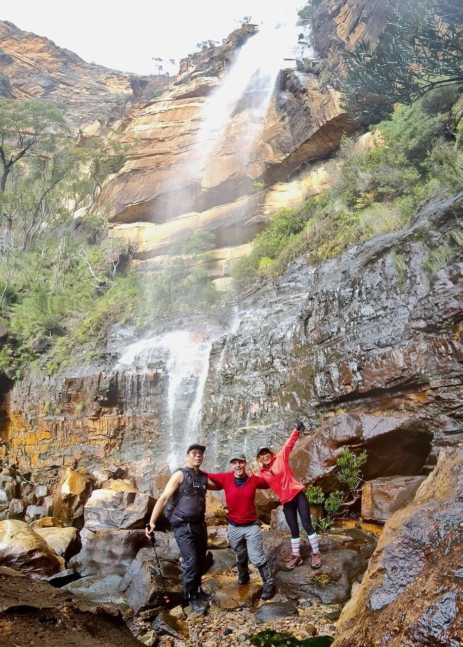
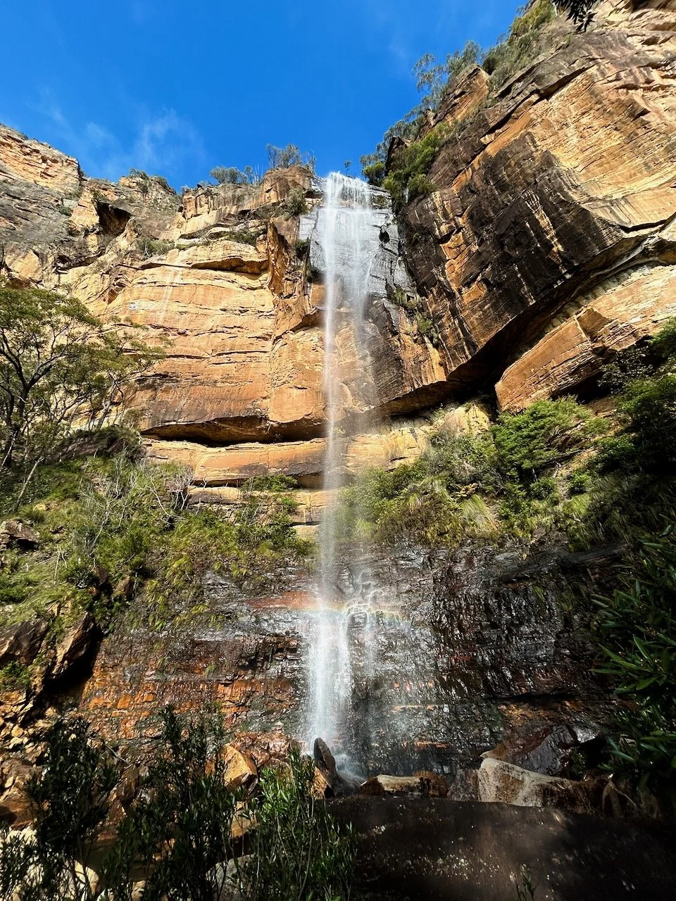
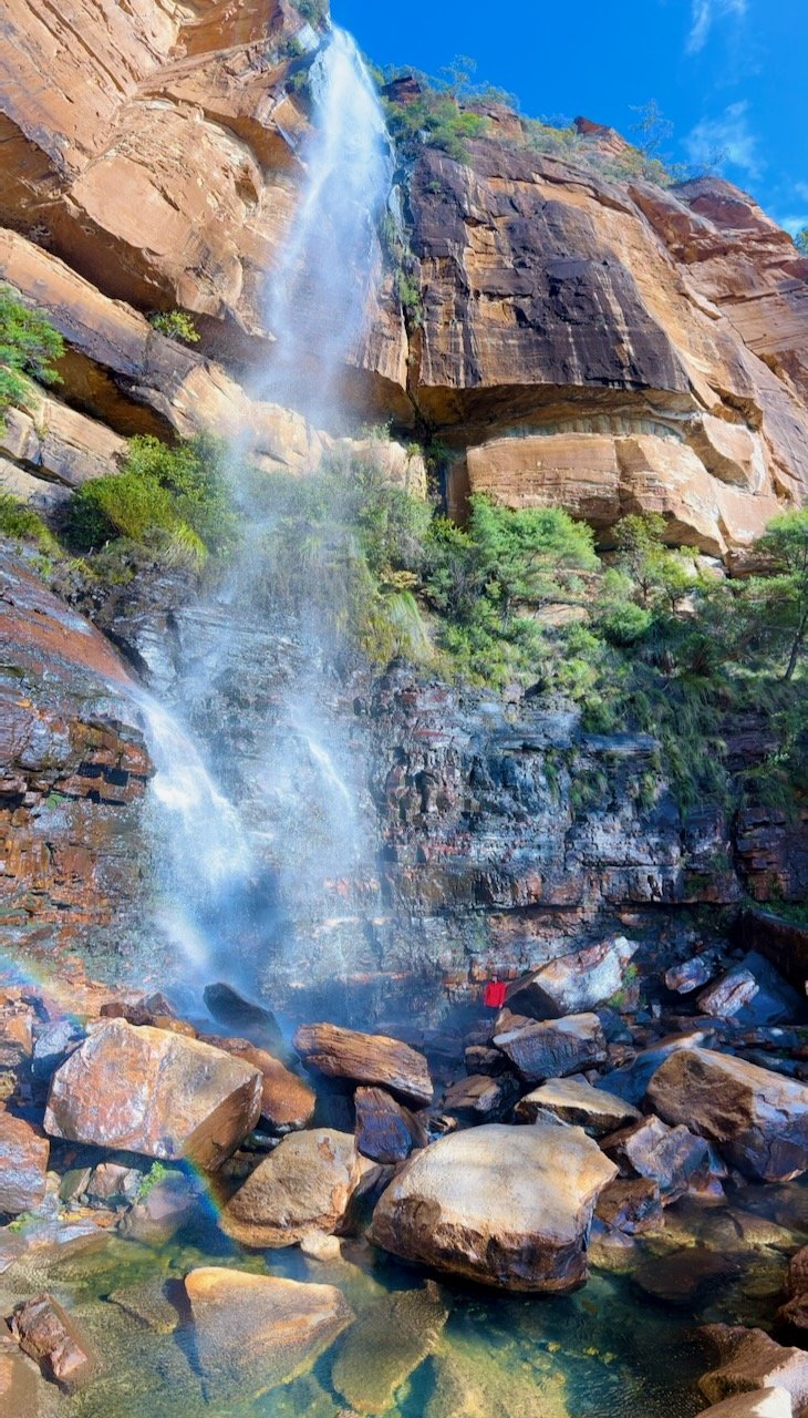
Twenty minutes later, we step out of the scrub and stand at the base of Fortress Creek Falls. Directly above us — although we cannot see them — are the famed infinity pools.
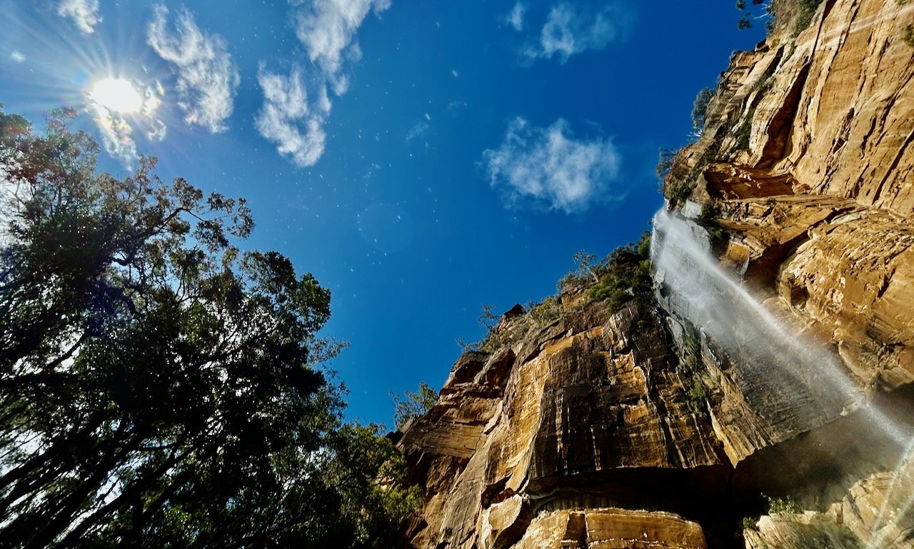
The creek drops in a single, clean 80-metre line, falling free into space. There’s a small pool a few metres from the splash zone. The roar fills the amphitheatre around us, echoing off sandstone walls. High above the Grose Valley, the place feels remote and raw.
The spray is cold enough to demand raincoats. There’s a decent flow, and after our long approach, this remote place feels thoroughly earned.
The way home is to return the way we came. That took six hours and it will be dark in five. The maths is simple. We need to leave. But now we are fatigued. The scrub seems thicker, the creek boulders larger, the vines more determined.
We miss our earlier log crossing over Govetts Creek and wade across instead, knee-deep in icy water. The mid-winter cold quickly hits our bones.
Head torches are on by Acacia Flat, and we climb Docker Buttress in the dark. The climb is steady and relentless, jackets coming off as soon as we warm up. But stopping means instant cold.
Half an hour from the top, thoughts turn to dinner at Blackheath’s New Ivanhoe Hotel.
On reflection, this is a mad walk — and one of the most satisfying I’ve done. It is suitable only for fit, well-prepared bushwalkers. Clambering for kilometres over large boulders in a steep creek is tiring and not without risk, and the return descent is arguably more dangerous as fatigue sets in.
I may not return all the way to the falls, but I’d happily come back to swim in those lower creek pools one summer. And there’s still the steep upper third of Fortress Creek we bypassed when we left the creek on the bank.
For now, it’s enough to know what lies beneath the falls.
Times, locations, elevations
| Time | Location | Elevation (estimate) |
|---|---|---|
| 07:15 | Leave Perrys Lookdown, descend Docker Buttress | 935 m |
| 07:55 | Reach base of stairs at Blue Gum Forest | 320 m |
| 08:50 | Cross Govetts Ck at junction with Fortress Creek | 340 m |
| 09:50 | First of several beautiful pools | 390 m |
| 10:40 | Landslide spoil enters creek | 440 m |
| 11:30 | Blocked by small waterfalls, climb onto right hand bank | 480 m |
| 12:10 | Cross precipitous log | 600 m |
| 12:35 - 13:30 | Base of Fortress Creek Falls, lunch | 650 m |
| 13:50 | Cross precipitous log | 600 m |
| 14:45 | Back at creek | 480 m |
| 16:30 | Reach and cross Govetts Creek | 340 m |
| 17:20 | Base of Docker Buttress (Perrys) | 320 m |
| 19:15 | Perrys Lookdown carpark | 935 m |
| 19:45 | New Ivanhoe Hotel, Blackheath | 1,066 m |
Topographic Map
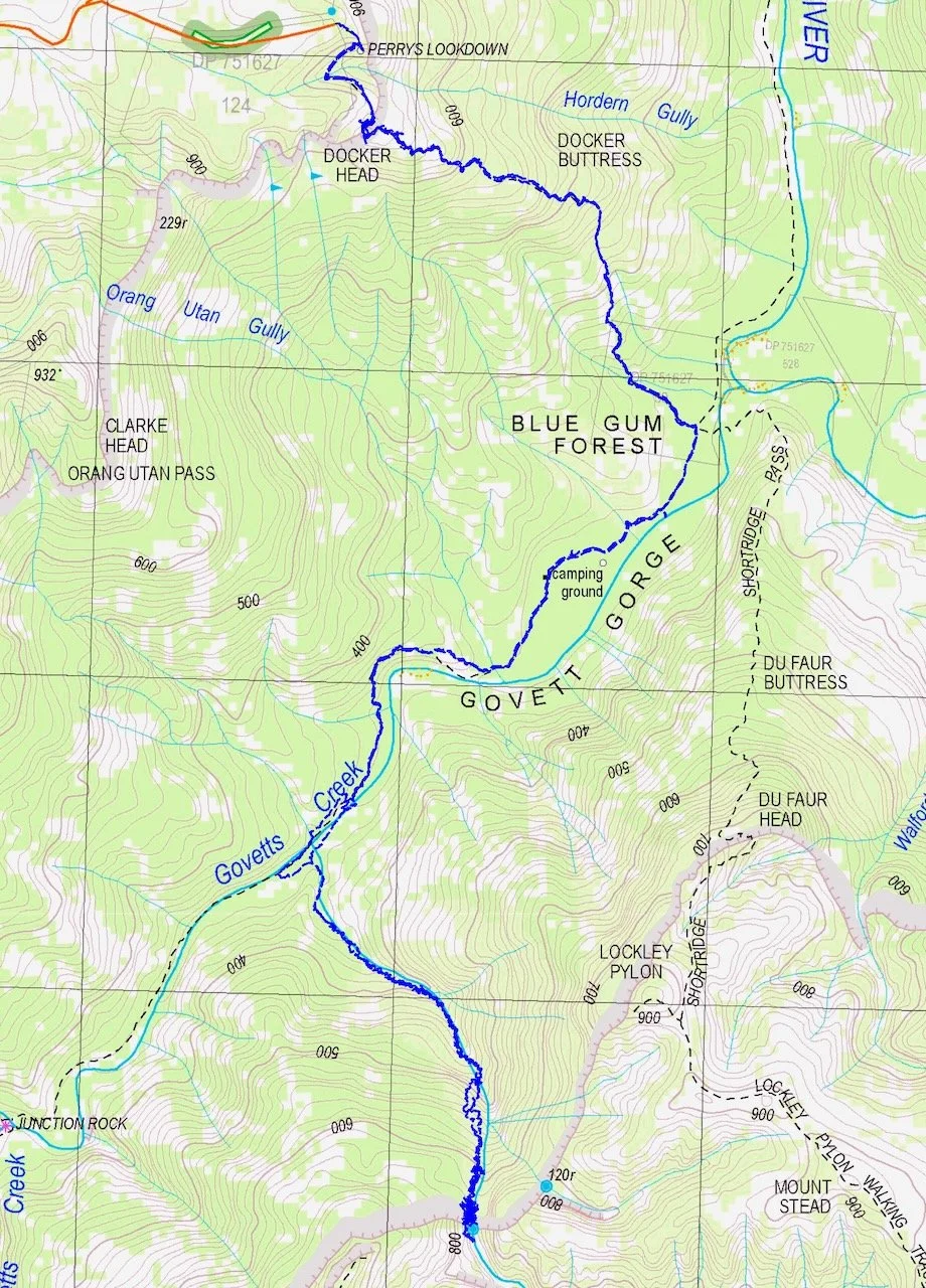
Trace recorded and prepared by Sandstone Symphony. Map source: NSW Spatial Services, Mount Wilson, 1:25,000 Topographic Map 2025. © State of New South Wales.