Monolith Valley
From first light on the Yadboro River, a long climb beneath The Castle leads through misty forest, rocky passes and hidden gullies towards Monolith Valley, with a one o’clock turnaround hanging over the day.
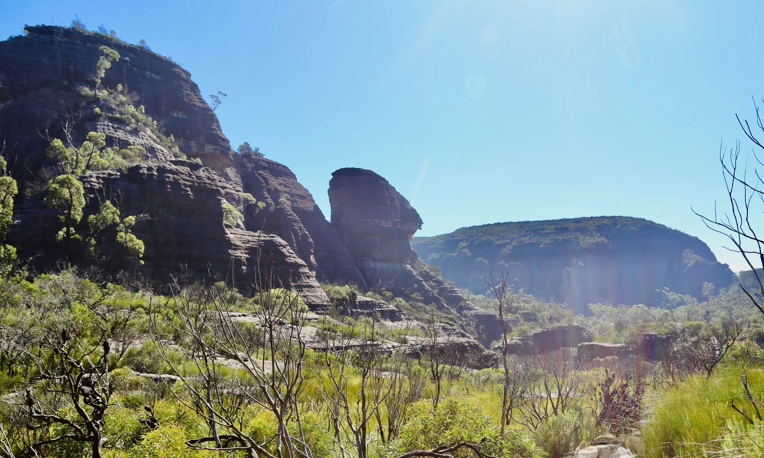
Monolith Valley, with the distinctive formation known to us as the Sphinx rising from the northern tip of Mount Nibelung.
-
Date: March 2024
Distance: 16.1 km
Elevation gain: 1,021 m
Time: 10 hours 57 mins
Grade: 5 — long distance, substantial elevation gain and sustained climbing, with a long return from Monolith Valley
Location: Monolith Valley, Morton National Park, the Budawangs, NSW
Map: NSW Topographic 1:25,000: Corang
Conditions: Warm, clear day; mist and low cloud in the valleys early, then increasing sun and heat through the afternoon
Notable features: Yadboro River, Castle Saddle, Nibelung Pass, Monolith Valley, Natural Arch, Green Room, Seven Gods Pinnacles, Shrouded Gods Mountain
Trip context: There-and-back day walk from the Yadboro River, with a 1 pm turnaround rule and a 40-minute side trip onto Shrouded Gods Mountain on the return
Photography: by Sandstone Symphony (unless otherwise noted). Mostly mobile phone, with some Canon 6D / EF 24–105mm.
We crossed the Yadboro River at seven in the morning with Monolith Valley as the objective and one firm condition: at one o’clock we would turn around, wherever we had reached. There were five of us, deliberately kept to a small group of strong walkers. We had climbed The Castle together the previous year and knew the first half of the track. Beyond Castle Saddle, the country would be new.
It was a simple plan, but not a trivial one. Between the river and our intended turnaround point lay roughly 750 metres of elevation according to the topographic map. Monolith Valley was a long way in for a day walk, and reaching it was not assumed. The question was how far six hours of solid walking would take us.
Unlike many of our walks, this one followed a track for almost the entire day. That made navigation simpler, but did little to reduce the amount of climbing.
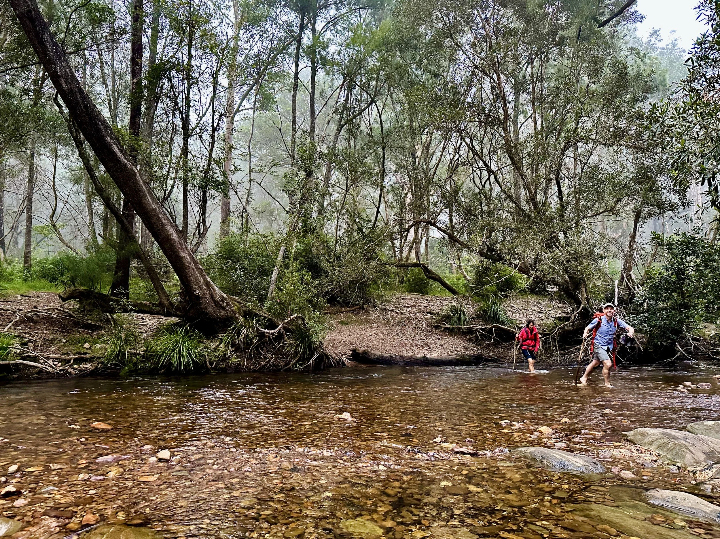
Crossing the Yadboro River at first light. Photo: Xanthe Barden
At first light the river and surrounding forest were cool, with mist hanging between the trees. The climb began almost immediately from the opposite bank, steadily gaining height through tall forest and ferny understorey.
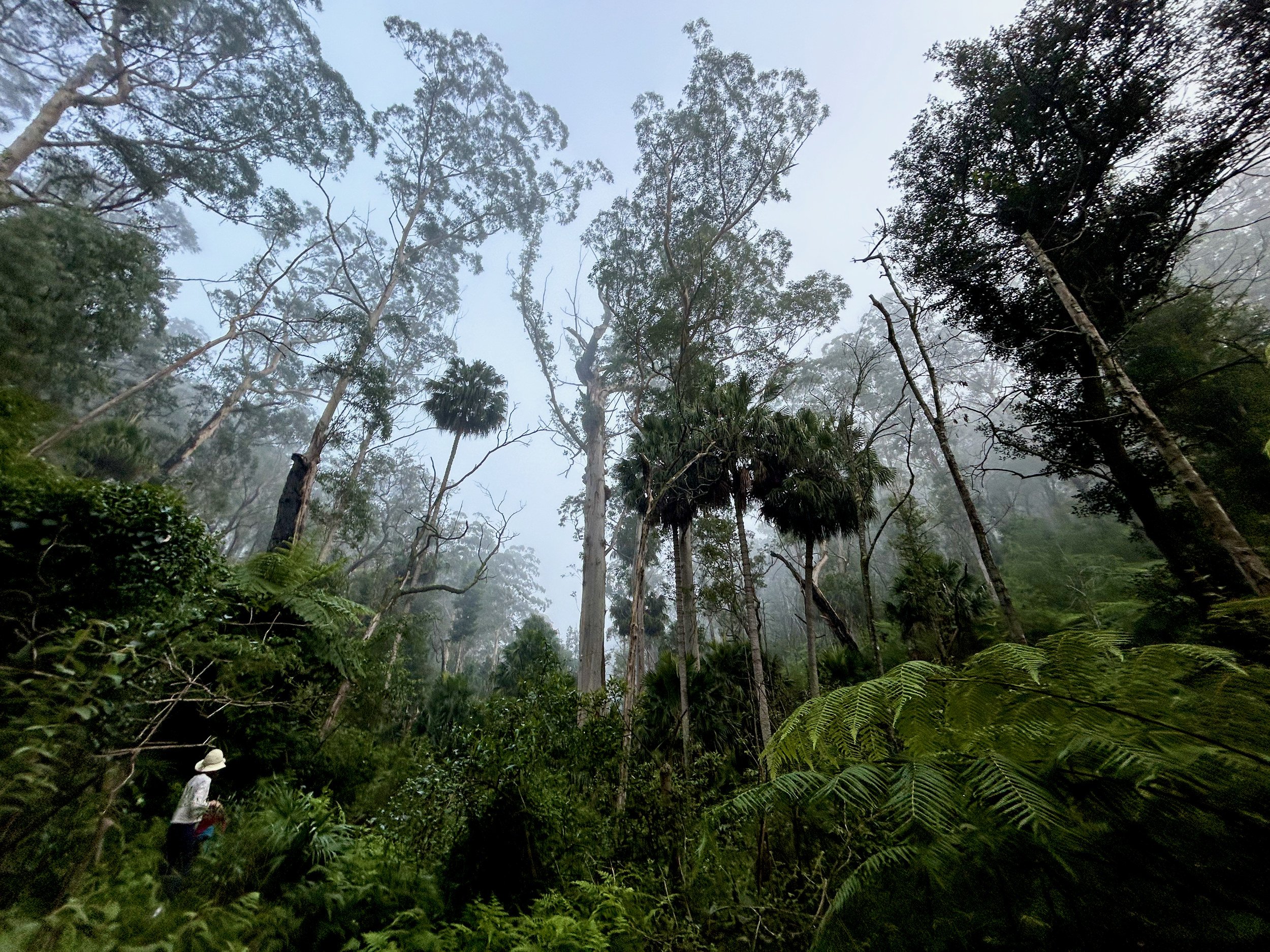
Morning mist among the forest above the Yadboro.
As the sun rose higher, low light began reaching beneath the canopy, catching trunks and leaves while much of the forest remained in shadow.
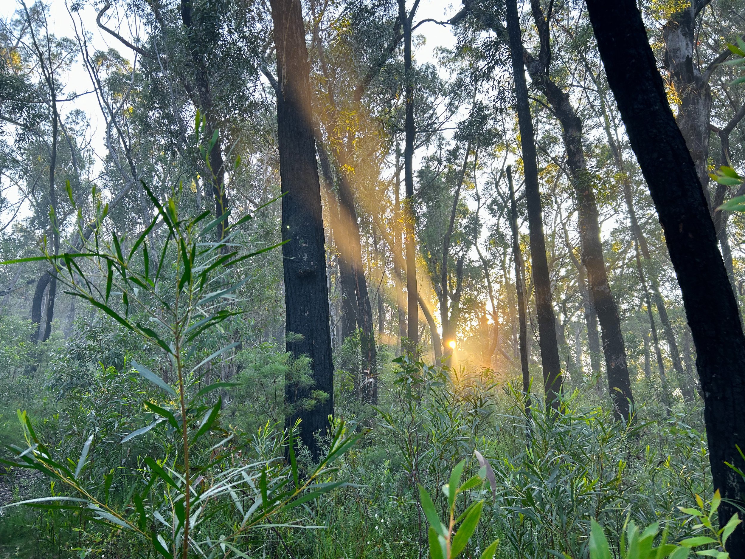
Low sunlight beginning to reach through the forest.
Higher again, gaps in the trees opened onto mist still lying in the valleys below.
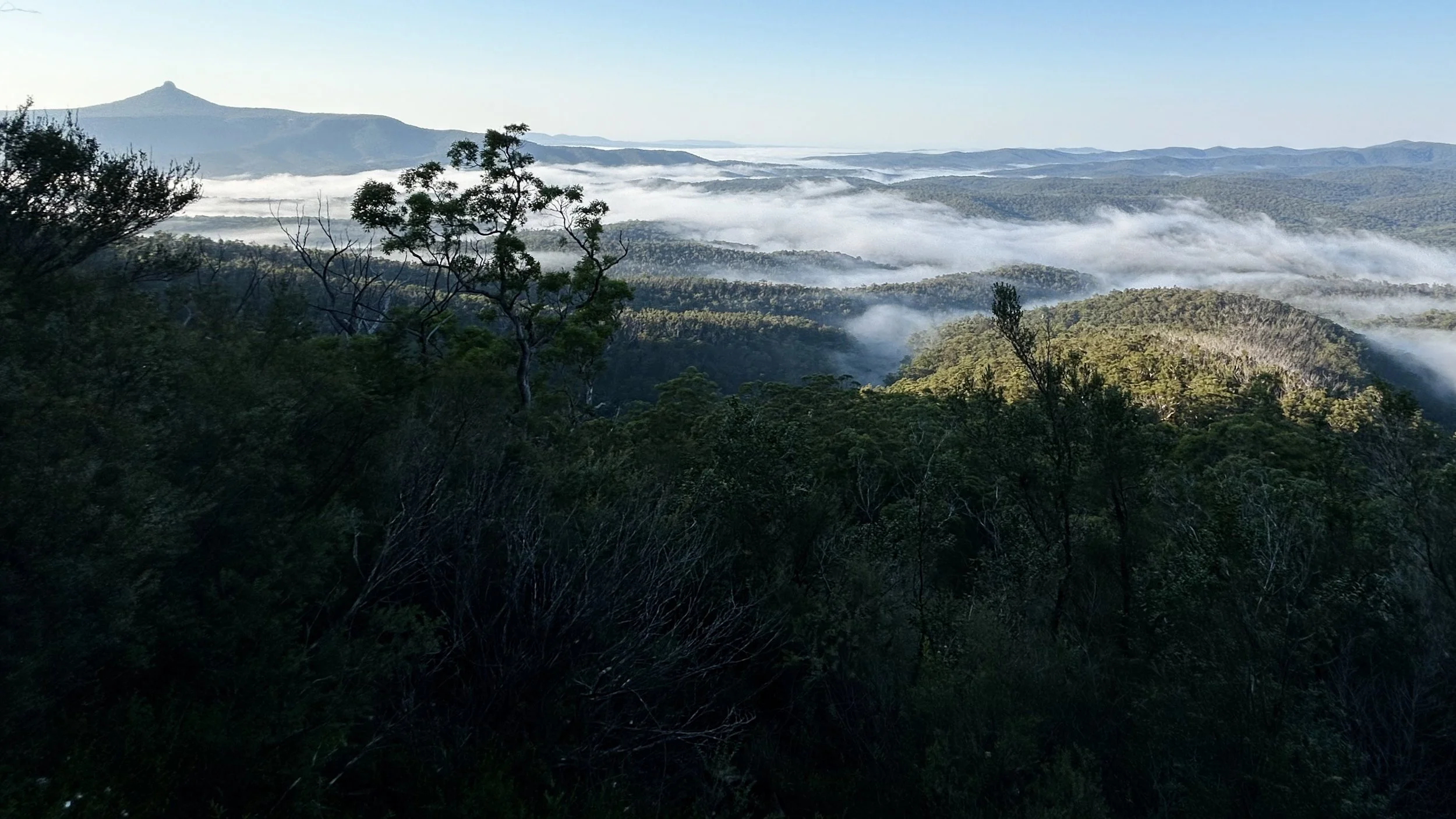
Looking back over morning mist still lying in the valleys below. Didthul (Pigeon House Mountain) on left.
Much of the morning passed with a simple rhythm: climb and climb. The country was spectacular but this was not one of those days when every promising ledge could be investigated. We had a clear objective, a warm day ahead and a fixed turnaround time.
Eventually the larger forms of the Budawangs began to appear. To the west, Mount Owen and Mount Nibelung remained in deep morning shadow, their great walls rising above the forest.
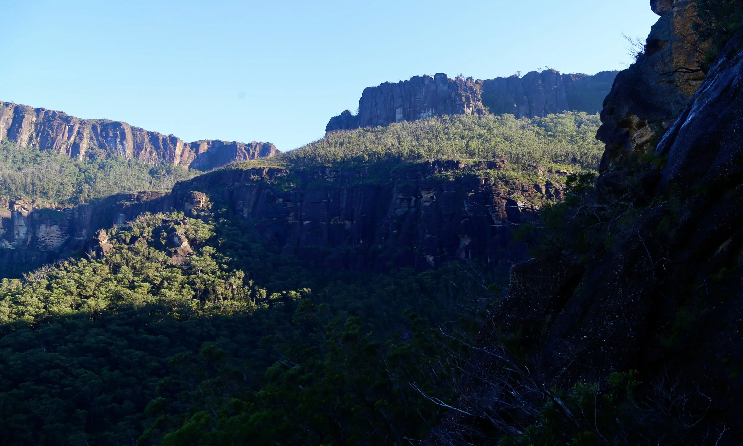
Morning shadows on Mount Nibelung (right) and Mount Owen (left).
Beneath The Castle
The approach to The Castle is not simply a matter of climbing directly towards it. The track works around the massif, sometimes through forest, sometimes beneath rock walls and between great blocks fallen from the cliffs above.
We knew this part from the previous year, when we had climbed The Castle. At Castle Saddle the familiar walk ended: the track to The Castle branched away, while we continued towards Monolith Valley.
Beyond the saddle the country closed in again. Rainforest gathered beneath the cliffs, the track winding through boulders and undercliffs in a cool green corridor.
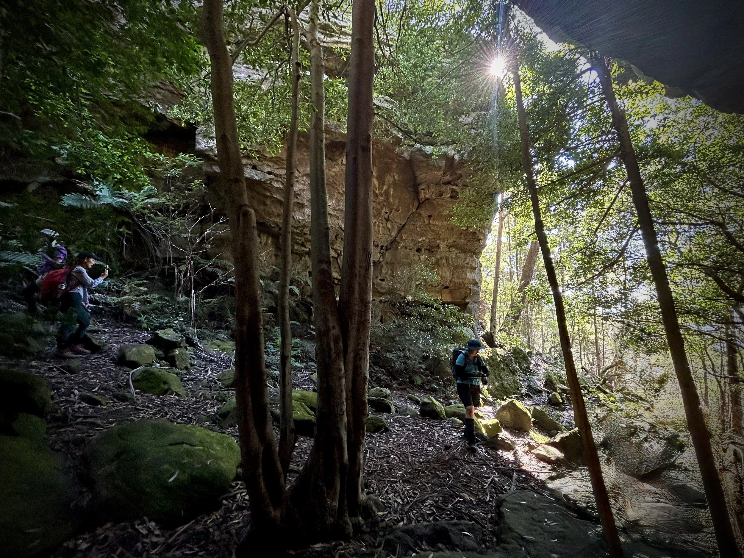
Rainforest and rock walls beyond Castle Saddle, on the approach to Nibelung Pass.
It was one of the loveliest sections of the day, though at the time we were focussed on progress through it than studying it. Somewhere ahead was Nibelung Pass and, beyond that, the first real possibility of seeing into Monolith Valley.
The track steepened into a narrow rocky climb, aided by a substantial chain.
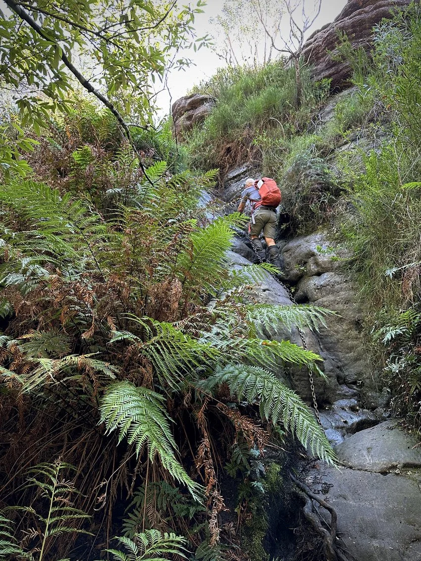
The chain-assisted climb through Nibelung Pass. Photo: Xanthe Barden
The names in this part of the Budawangs seem almost designed for the landscape: Nibelung, Seven Gods, Shrouded Gods, Monolith Valley. Yet much of the nomenclature familiar to walkers today is relatively recent. In the 1960s the group that became the Budawang Committee researched historical records, survey material and local usage as it worked to bring some order to a country where maps were still surprisingly incomplete. Many names were subsequently submitted to the Geographical Names Board and formalised.
Some came from the bushwalking culture that had grown around the range. Shrouded Gods Mountain, for example, was named after a poem by Major Jim Sturgiss, a local figure whose knowledge of the Budawangs contributed to that naming work. The mythology suggested by the map was therefore partly created surprisingly recently, by people trying to describe and navigate a landscape that seemed to demand names of some scale.
Into Monolith Valley
Above Nibelung Pass the sense of enclosure began to break. Rock formations appeared beyond the trees and there was a clear feeling that we had crossed into different country.
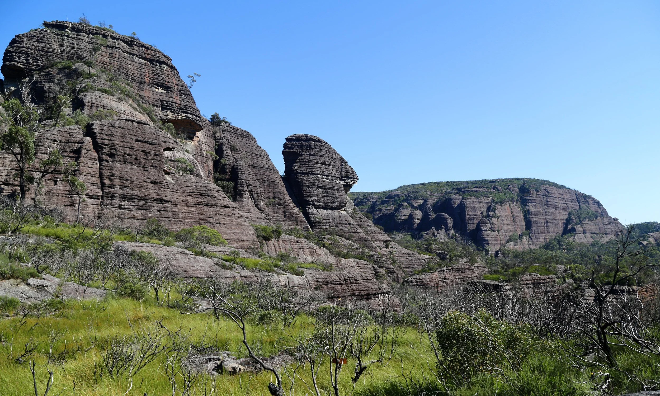
The first open sandstone country beyond Nibelung Pass.
At the northern tip of Mount Nibelung, a detached rock formation, known to us as the Sphinx, came into view.
The track now moved between open rock and pockets of vegetation, with the great rounded forms of the valley appearing and disappearing around us.
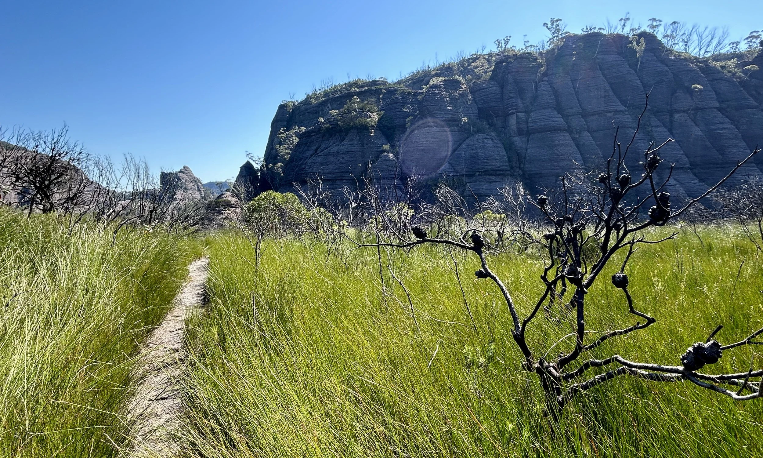
The track winding between the rock formations of Monolith Valley.
Despite its name, Monolith Valley is not simply a broad open space filled with isolated towers. Much of the experience is quite enclosed. The track slips back into rainforest, between rock walls and beneath overhangs, then returns to open heath and exposed rock.
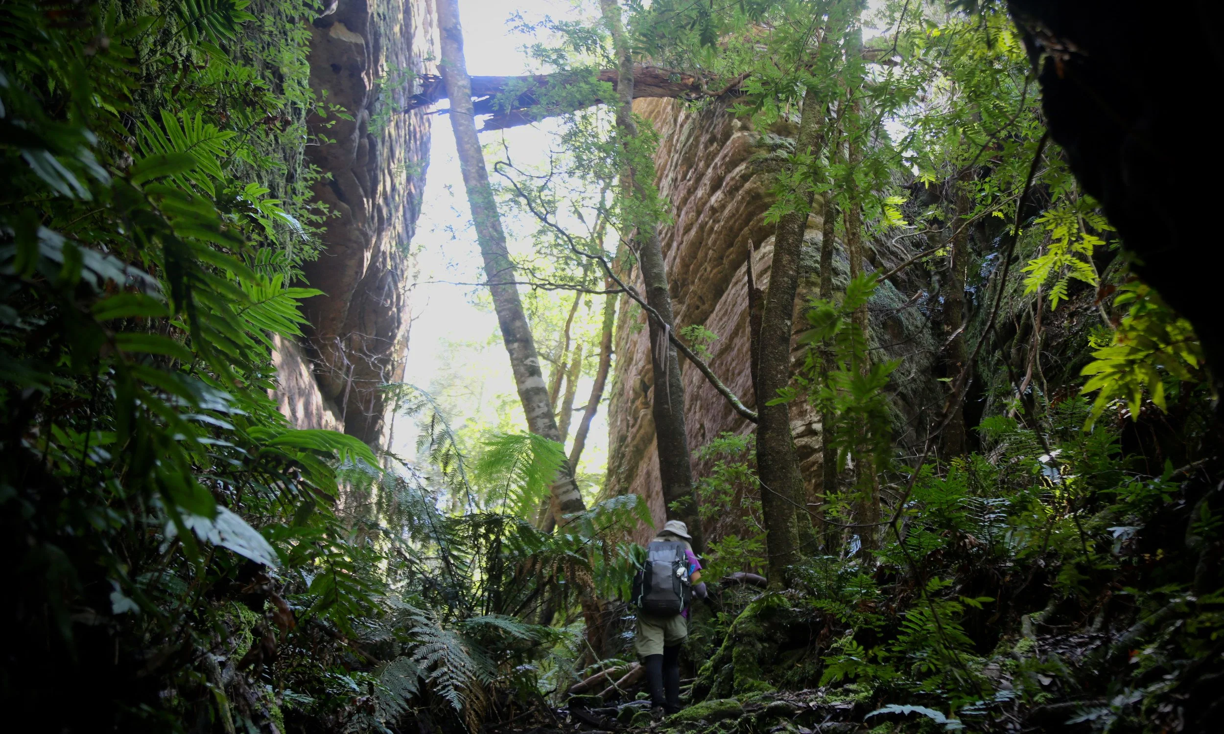
Climbing through ferns and rainforest within Monolith Valley.
The Natural Arch was one of the first places that properly slowed us down. It sits off to the side of the track at height, an enormous eroded opening beneath heavily weathered rock, surrounded by forest.
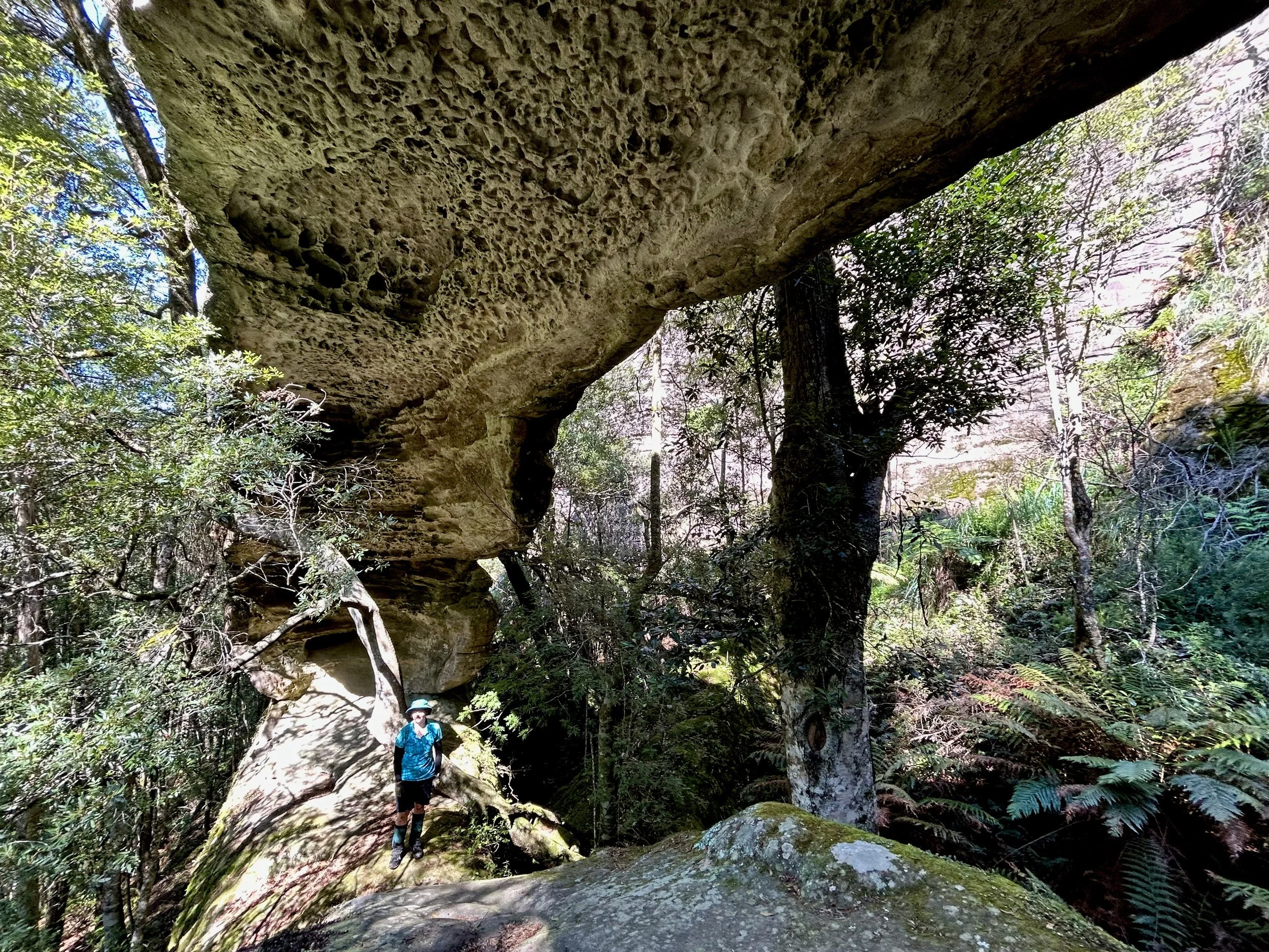
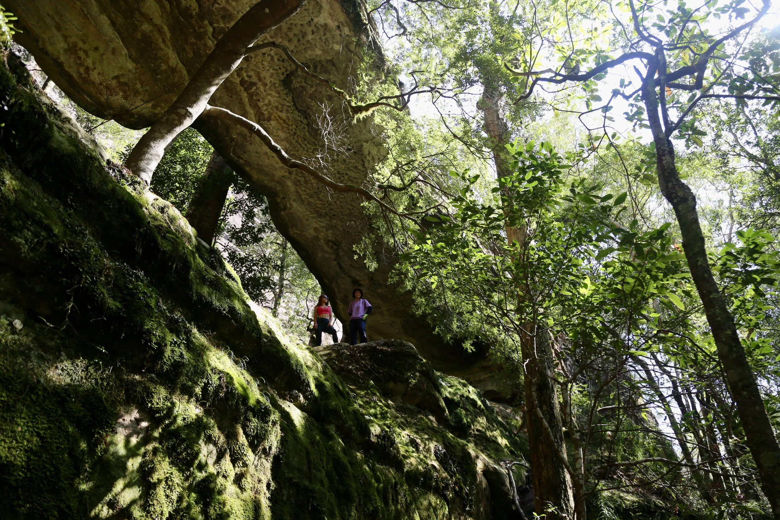
The clock was still running, but this was worth stopping for. We spent a little time taking photographs before continuing.
The Green Room received rather less attention. It was another extraordinary pocket of rainforest and sandstone, but on the outward journey it barely registered with the team. Seven Gods was still ahead, and the morning was already mostly used up.
Seven Gods Pinnacles
When we finally reached Seven Gods Pinnacles, the uncertainty that had followed us from the Yadboro was settled.
We had made it. An hour before our fixed turn-around time.
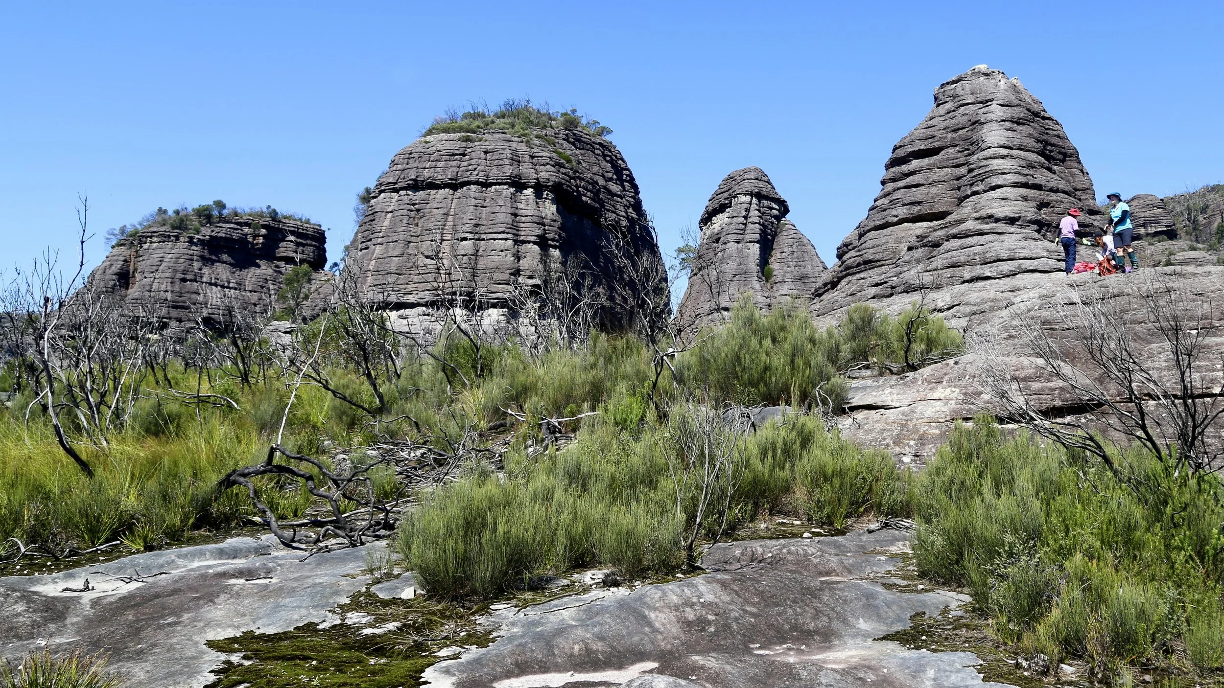
Seven Gods Pinnacles at midday — the planned objective reached with an hour to spare.
The satisfaction was considerable. There had been no guarantee when we stepped into the river five hours earlier that this would be our lunch spot, and reaching it with enough time to sit down felt like a genuine achievement.
For half an hour there was no need to keep moving.
To the north, Flying Fox Gully stretched away from Monolith Valley through a confusion of forest and sandstone.
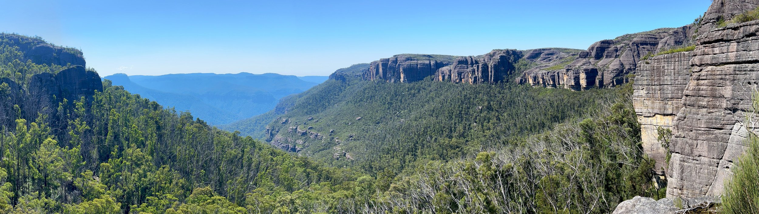
Looking north into Flying Fox Gully from Seven Gods Pinnacles.
To the east, the cliffs and pagodas of Shrouded Gods Mountain rose directly across from us. From this angle the mountain is less a single wall than a series of great rock buttresses, broken by gullies and bands of vegetation.
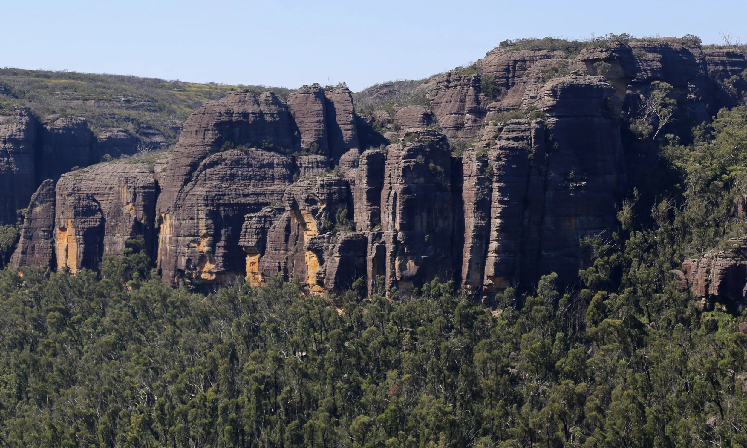
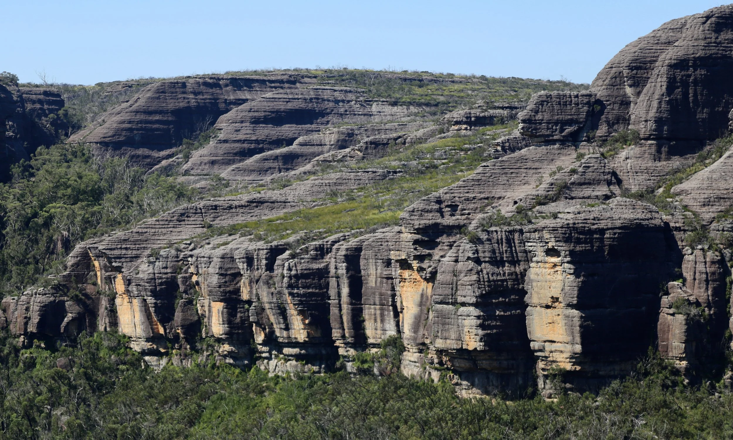
Seven Gods itself is one of the names formally assigned during the period when many Budawangs names were being regularised. Standing there, the name seemed less extravagant than the country.
Eventually lunch ended and we began the return towards Castle Saddle.
The main objective of the day had been achieved. The sensible course now was simply to retrace the track, maintain the pace and give ourselves a comfortable margin before dark.
For a while, that is what we did.
Shrouded Gods
About halfway back towards Castle Saddle, an idea I was carrying all morning came to the fore.
There is a particular view from somewhere on Shrouded Gods Mountain that I had seen several times in published photographs. One version appears on the front cover of Ron Doughton’s Bushwalking in the Budawangs. Another, photographed by Rob Jung, appeared on a striking Wilderness Society poster in the 1990s. The composition is unmistakably Budawangs: The Castle and Byangee Walls layer the middle distance, with Didthul (Pigeon House Mountain) standing farther away.
We knew the viewpoint must be somewhere above us. With the turnaround objective already achieved, curiosity won.
A slot in the sandstone offered a possible way upward. We climbed into it, followed one line until it became clear that it was not going where we wanted, retreated a short distance and tried again.
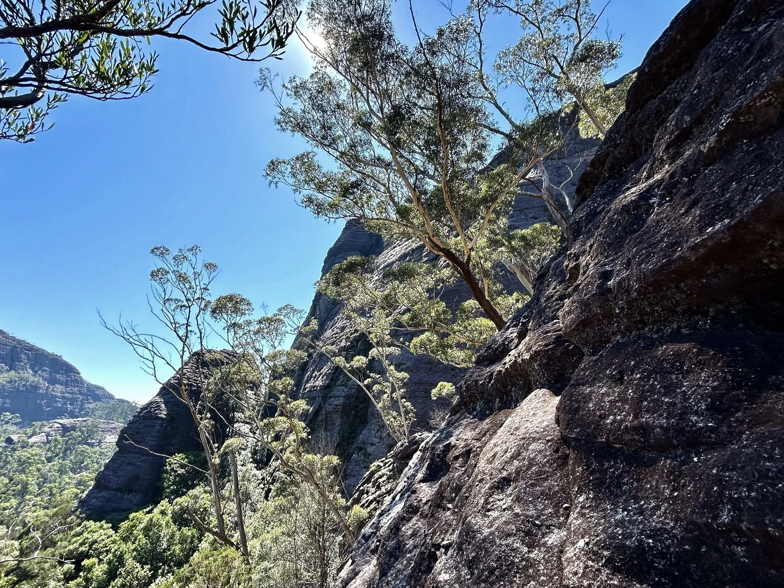
Finding a way onto Shrouded Gods Mountain took a little trial and error
Eventually we emerged onto a rock ledge.
The exact published viewpoint was still somewhere else along the mountain, but that hardly seemed to matter.
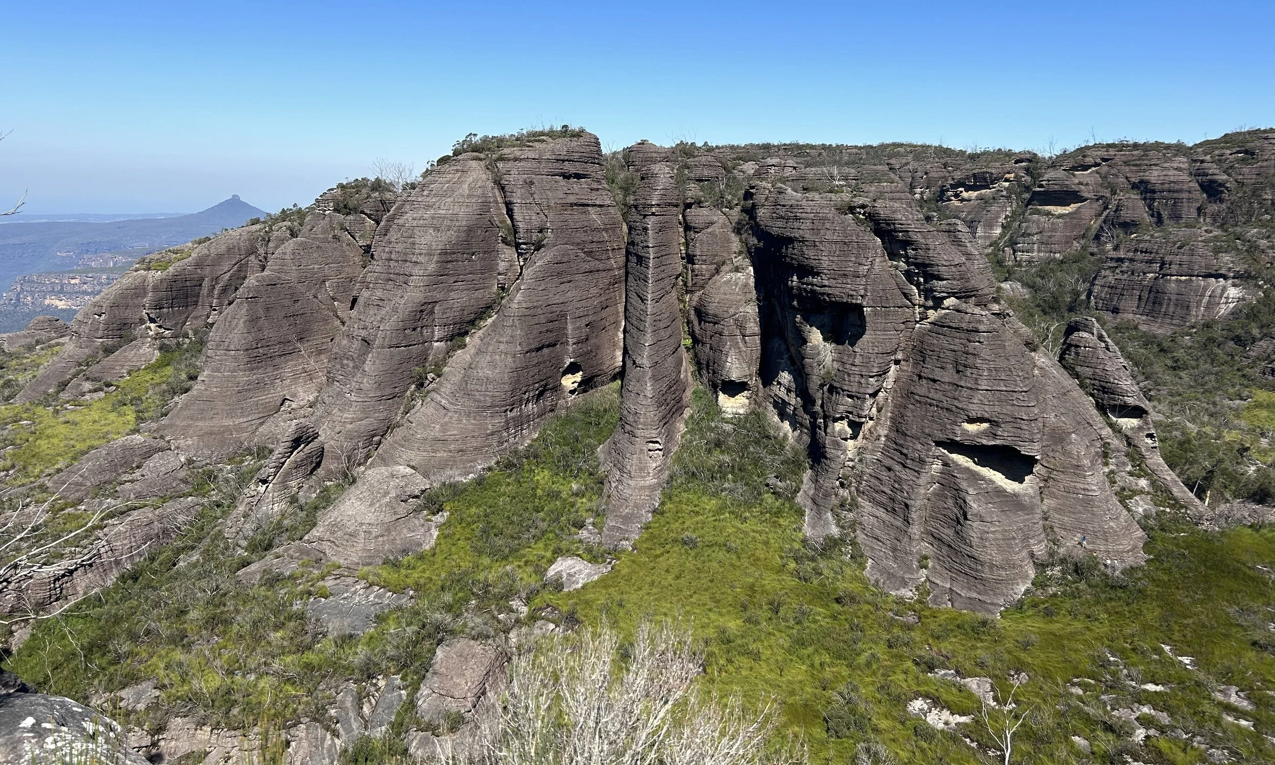
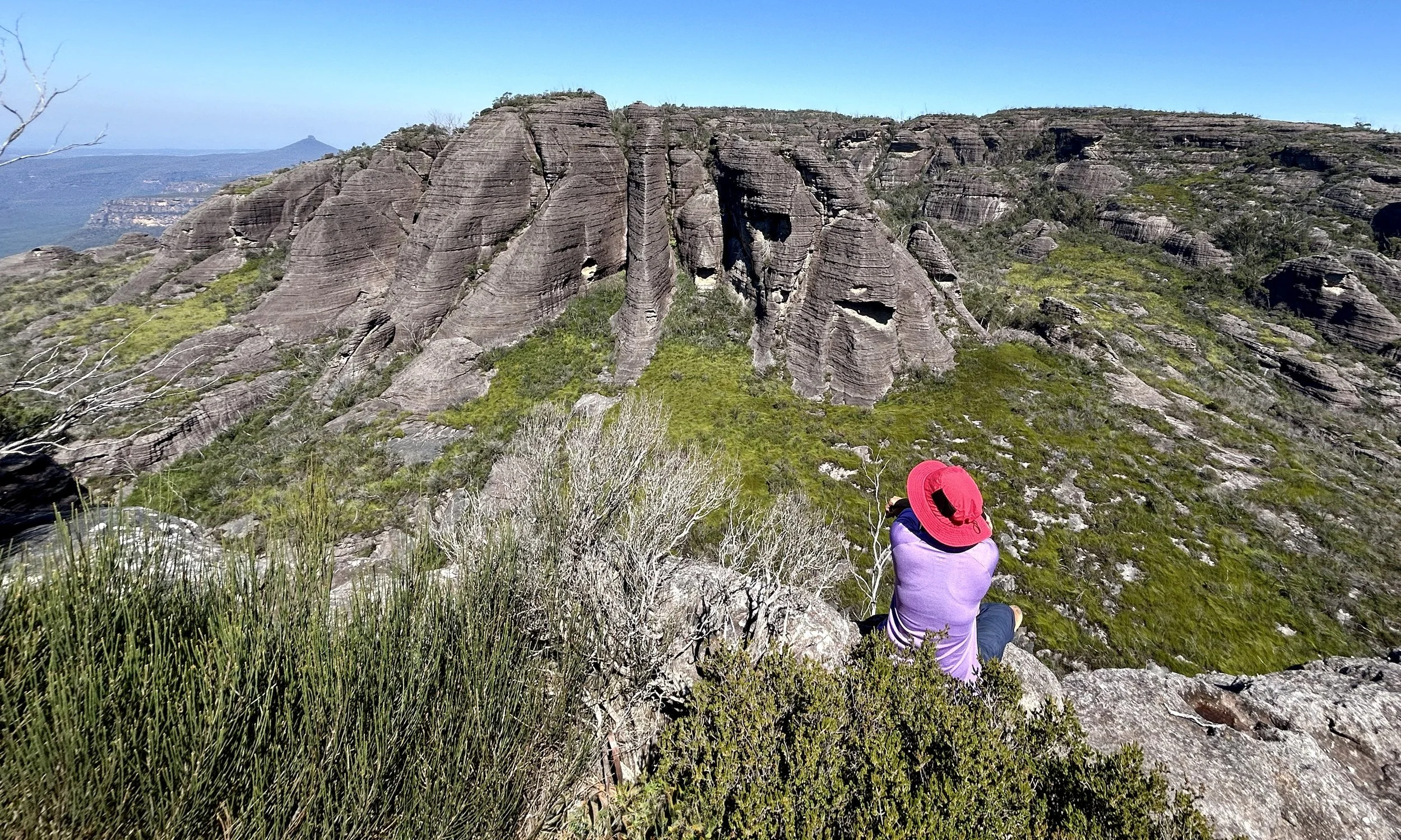
The buttressed northern face of Mount Mooryan with The Castle, Byangee Walls and distant Didthul behind.
The country seen from the ledge was extraordinary. The Castle and Byangee Walls layered away towards distant Didthul. Across the valley, the buttressed northern face of Mount Mooryan rose much closer, while Monolith Valley and the Sphinx lay below and beyond.
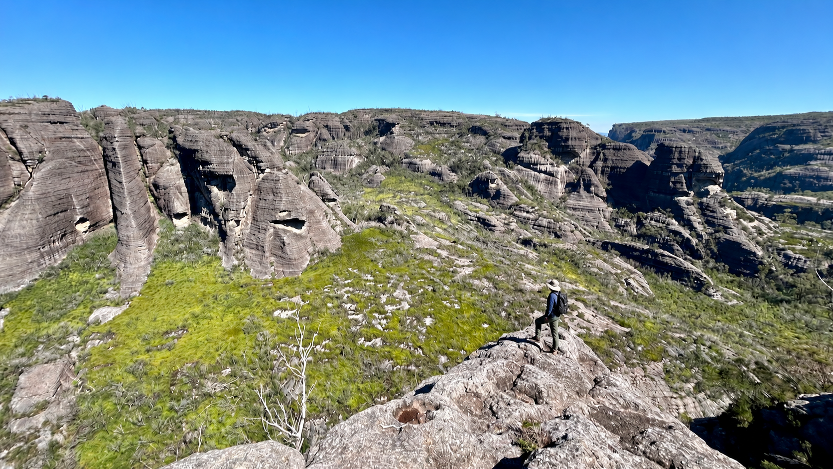
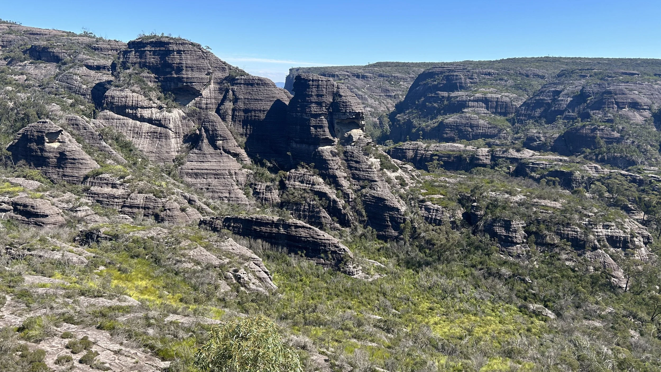
Looking one way, the landscape dissolved into layers of ridges and distance; looking the other, Mooryan rose abruptly from the forest in a wall of cliffs and deep recesses. It remains one of the finest views I have come across in recent years of walking.
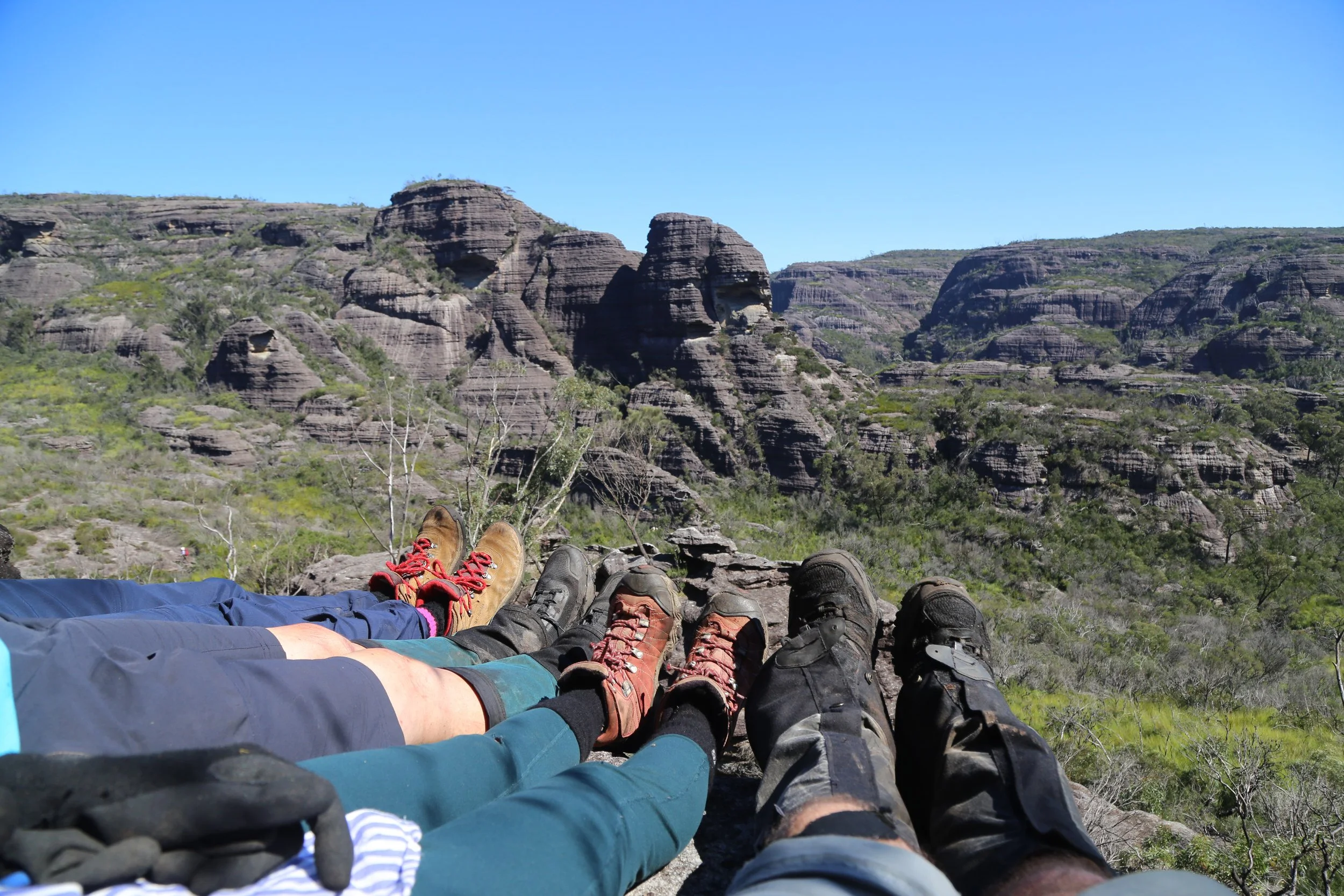
Then we remembered the arithmetic. The forty minutes spent on the side trip were forty minutes no longer available for getting back to the Yadboro.
Back on the track, we continued towards Castle Saddle. The Green Room, largely missed due to pace on the outward journey, deserved another look.
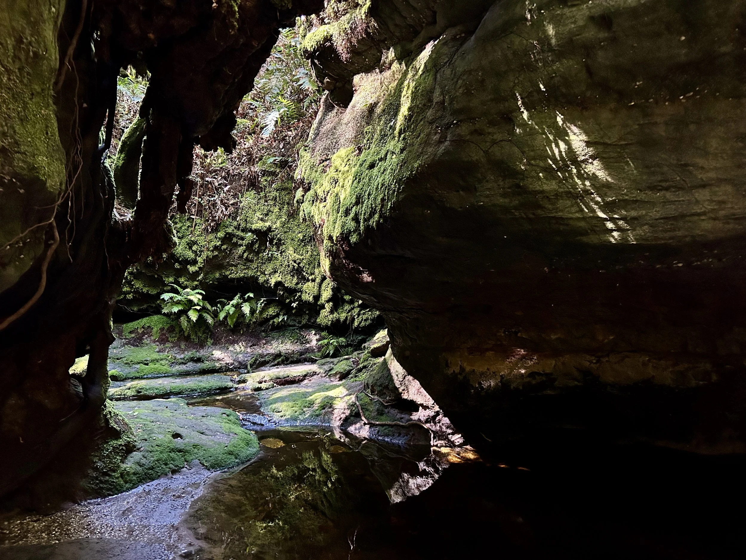
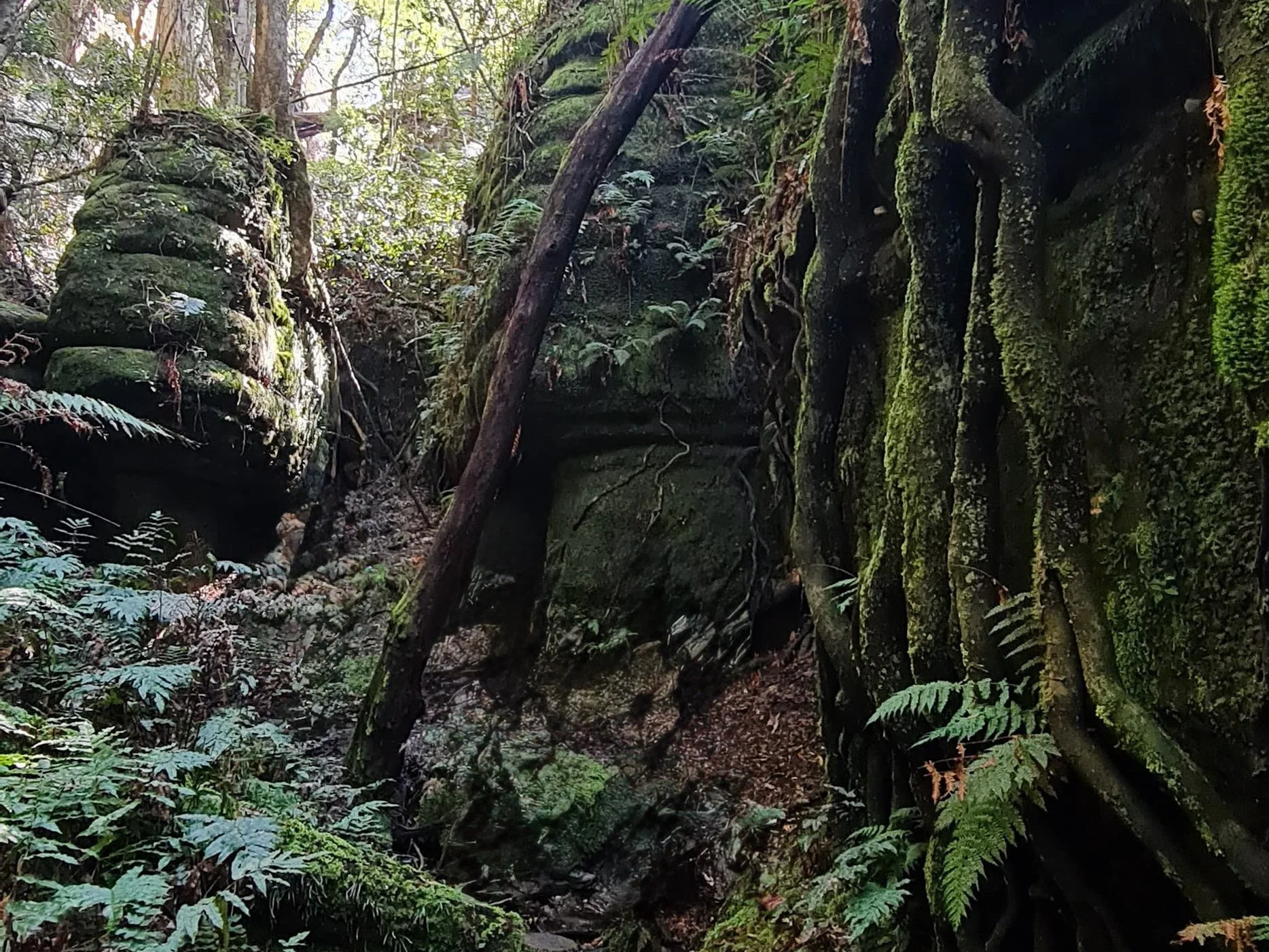
The track enters a cool enclosure of rock, moss, shallow water, ferns and tree roots descending over the rock. Light reaches the floor unevenly, catching some surfaces while leaving others in deep shadow. After the exposed rock above, it feels lush and intimate.
We were still moving with purpose, but there was now a little more room to notice the places we had hurried through earlier. Monolith Valley had been reached. The remaining task was simply to get back.
The afternoon had become hot, although there was plenty of water along the track. We descended again through Nibelung Pass, crossed Castle Saddle and began the long descent beneath The Castle.
Somewhere below the cliffs, a waterfall crossed the track.
Hot from working the descent, we stood underneath it fully clothed, laughing as the cool water came down on us. It was one of those uncomplicatedly joyous moments that sometimes arrive late in a long day.
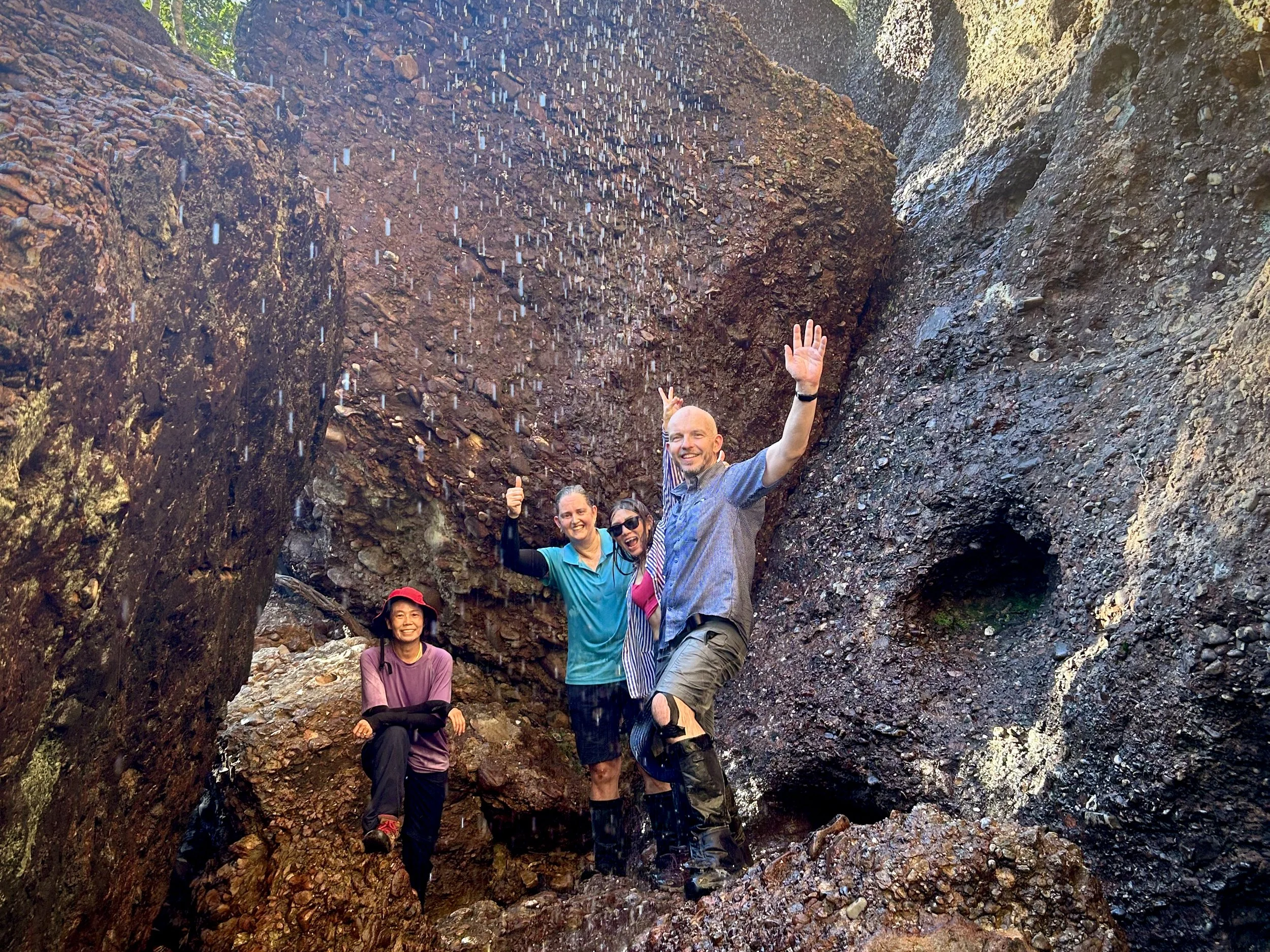
Late in a hot, tiring day, standing under the cool waterfall was a joyful relief.
From there the descent continued through the forest towards the Yadboro, steadily giving back the height gained since morning.
Last light
The final descent brought us back through the forest to the Yadboro River, just as the sun was going down.
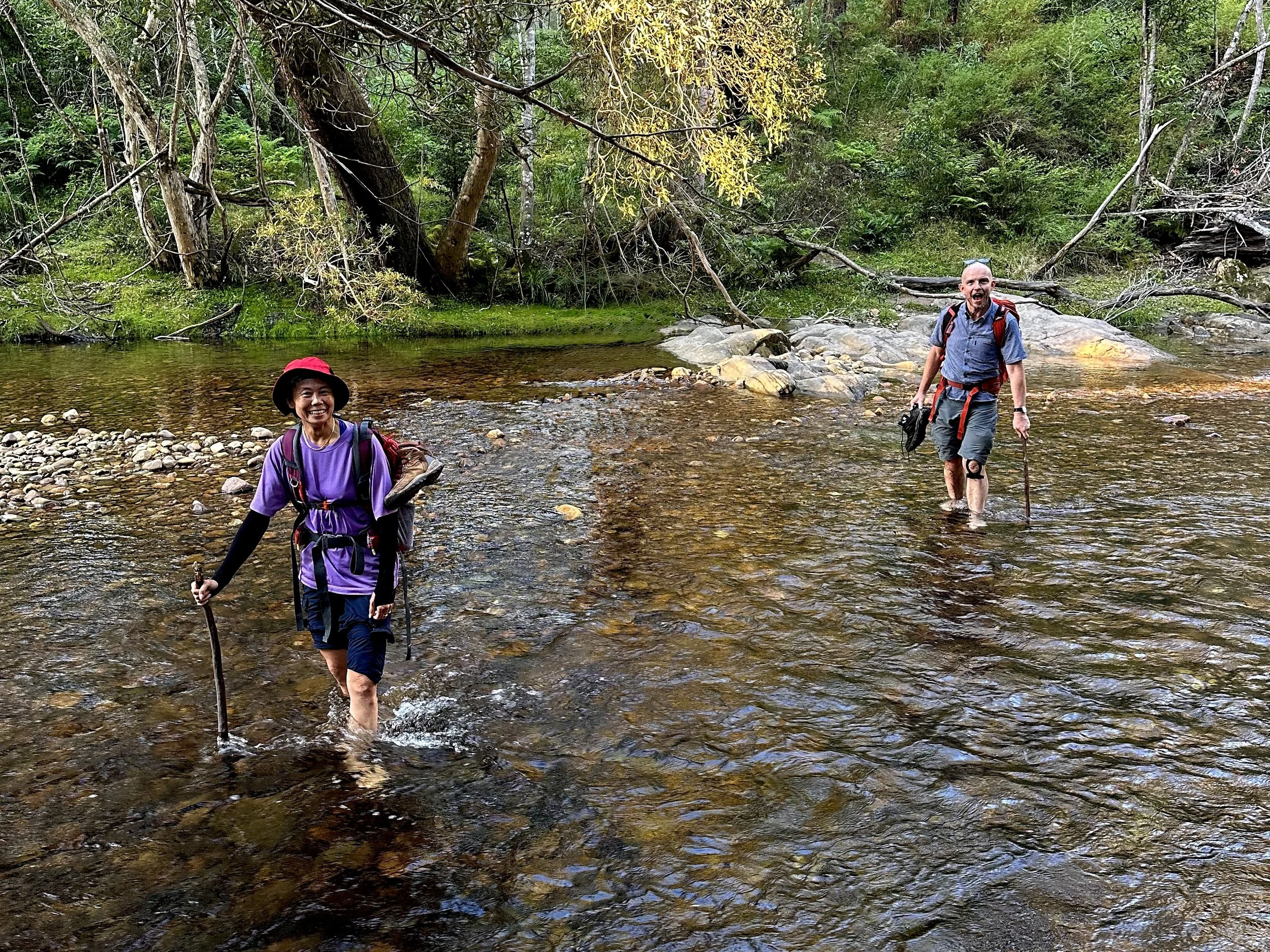
Back at the Yadboro River, the evening almost upon us. Photo: Xanthe Barden
We had crossed the Yadboro in first light with Monolith Valley a distant and uncertain goal.
Eleven hours later, we returned as the last light was leaving the valley.
Times, Locations, Elevations
| Time | Location | Elevation (estimate) |
|---|---|---|
| 07:25 | Leave Yadboro River | 60 m |
| 10:20 | Castle Saddle | 670 m |
| 11:00 | Top of Nibelung Pass | 770 m |
| 12:05 | Reach Seven Gods Pinnacles | 780 m |
| 12:50 | Leave Seven Gods Pinnacles | 780 m |
| 14:15 | Shrouded Gods Mountain side trip | 810 m |
| 16:45 | Waterfall | 530 m |
| 18:00 | Return to Yadboro River | 60 m |
Topographic Map
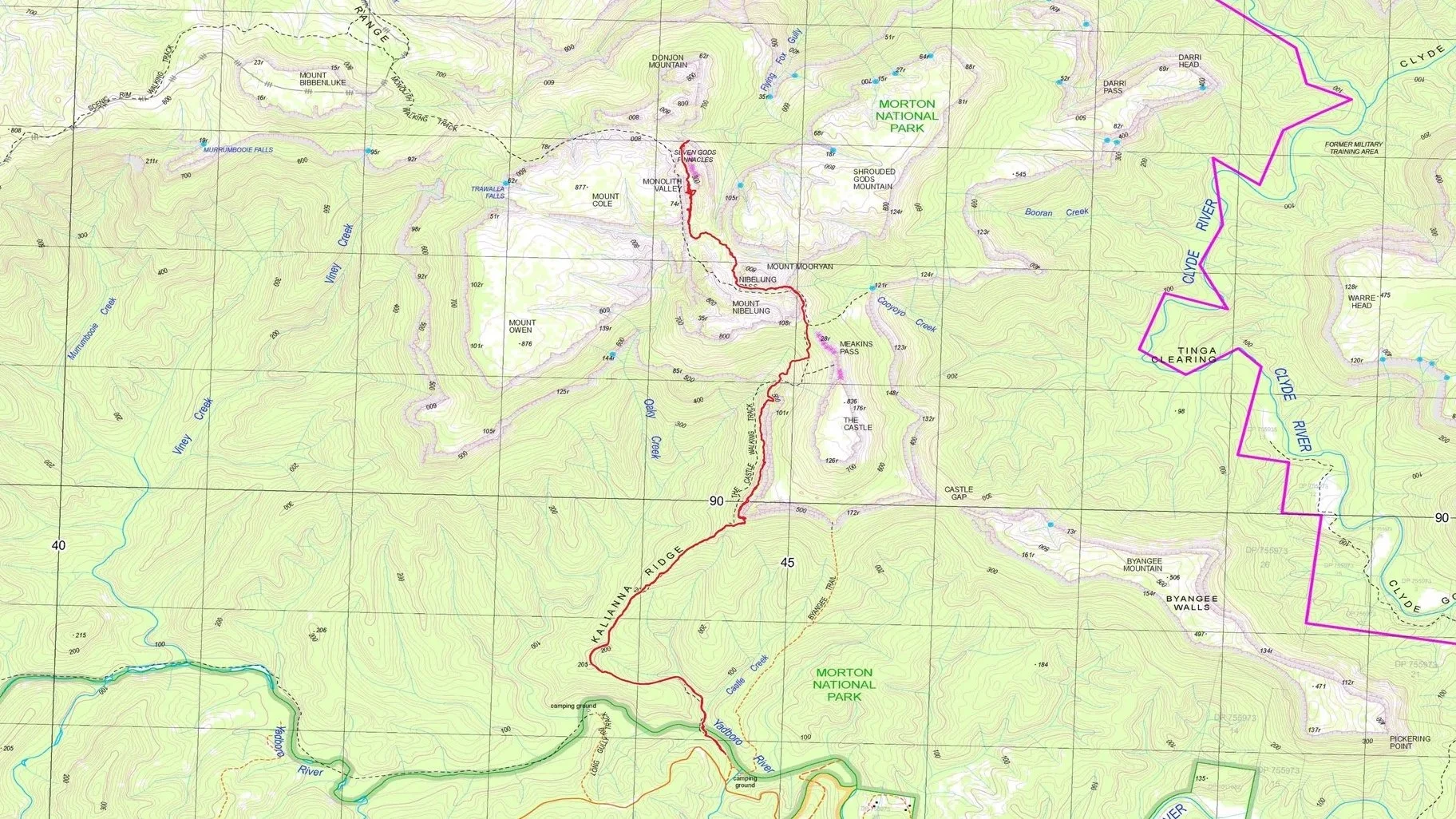
Trace (red) prepared by Sandstone Symphony. Map source: NSW Spatial Services, Corang, 1:25,000 Topographic Map 2025. © State of New South Wales.
Aerial Map
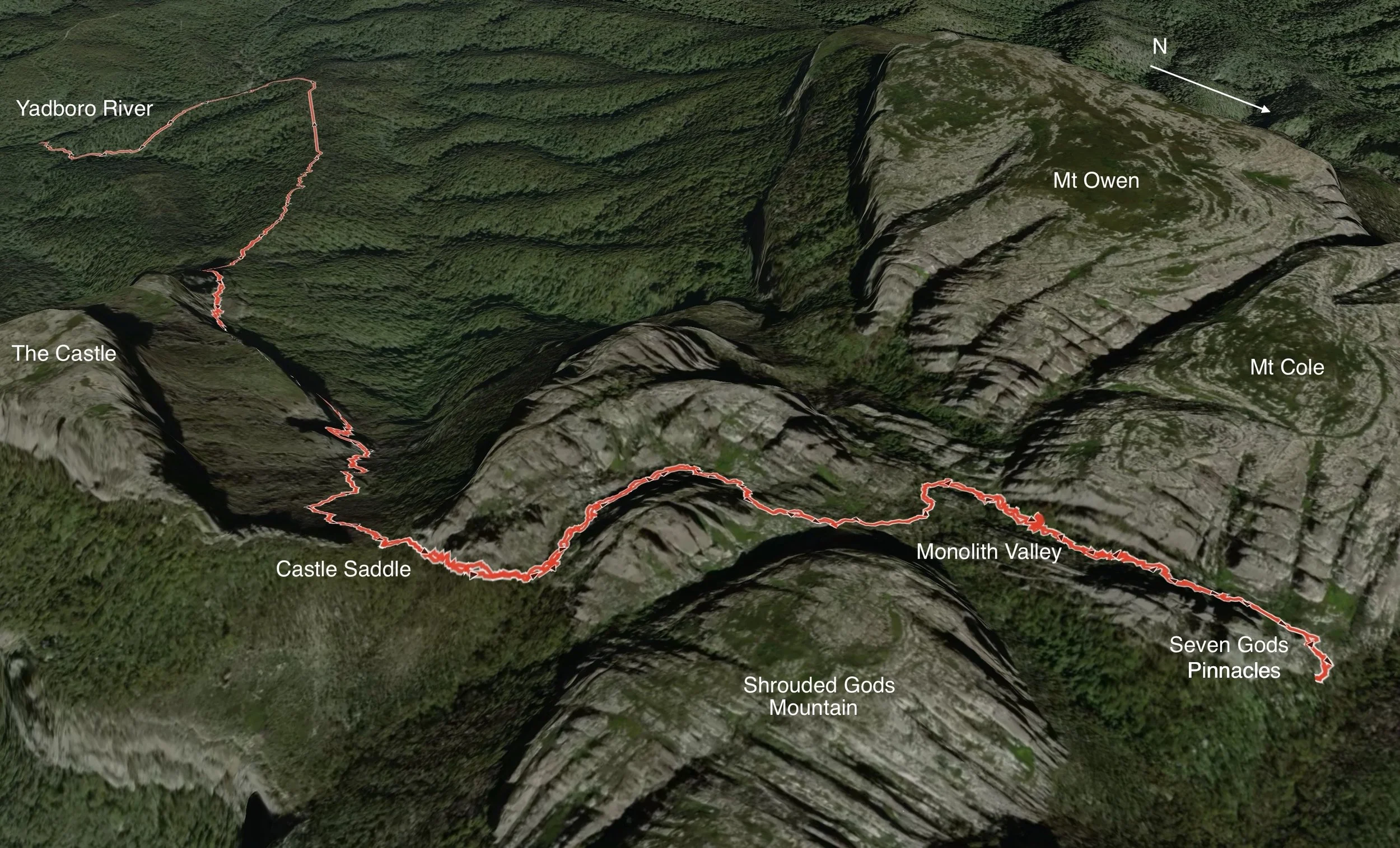
The there-and-back route from the Yadboro River to Monolith Valley, shown in oblique view. North is towards the lower right. New South Wales Topo: © Department Finance, Services & Innovation 2018. Satellite: © Mapbox. Map generated in Gaia GPS.
References and Further Reading
Doughton, Ron. Bushwalking in the Budawangs. 3rd ed. Envirobook, 2004. ISBN 9780858810723.
A long-standing guide to walking in the Budawangs, with detailed route descriptions, sketch maps and photographs; it includes the Long Gully–Monolith Valley–Mount Owen–Shrouded Gods–Mount Nibelung route.
Elliott, G. L. & Budawang Committee. The Northern Budawang Range and the Upper Clyde River Valley. 9th ed., 1998. Digitised copy: National Library of Australia / Trove.
The classic Budawangs sketch map, first compiled in 1960 and later extended, and an important part of the walking and cartographic history of the range.
View the map at the National Library of Australia / Trove
Colin Watson — “Place Names in the Budawangs”, The Sydney Bushwalker, July 1985
An account of how many Budawangs names were researched, proposed and formalised, including the roles of Ken Angel, George Elliott and the Budawang Committee.
Place Names in the Budawangs
NSW National Parks and Wildlife Service — Morton National Park, Budawang National Park Plan of Management. 2000/2001.
An official overview of the two parks’ natural and cultural values, including geology, vegetation, Aboriginal heritage, wilderness and conservation management.
Morton National Park, Budawang National Park Plan of Management
NSW National Parks — Morton National Park
An official introduction to Morton National Park’s natural and cultural values, including rainforest, geology, Aboriginal heritage and distinctive species such as the rare Pigeon House ash.
Morton National Park — Learn more
Australian Geographic — “Mighty Morton”
A broader history of Morton and the Budawangs, with material on Colin Watson, the Budawang Committee and the development of the famous sketch map.
Mighty Morton — Australian Geographic